Feeds:
Posts
Comments

Archive for September, 2022

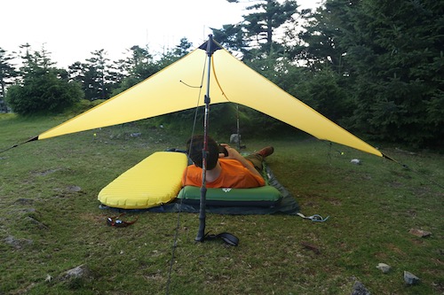
My first visit to Sasayama’s Mt Mitake and Kogane was a wintry up-and-back from Ōtawa-tōge to the northeast. The trip always haunted me, as it felt like we cheated a bit by driving most of the way up the mountain, resulting in my desire to give the peak a second chance. Cue my trusty companion Paul M. and his German neighbor Chris, who are keen for a late September hike not too far from Kobe. I suggest Mitake, and our plans are set for a beautiful Saturday morning.

Paul M. drives the car through light traffic past the sleepy village of Okuhata and to the small trailhead parking lot along route 301. It is 10am and the temperature is already in the mid 20s—so much for the cool autumn air. We shoulder the day packs and walk back down the pavement to a signpost affixed to the side of a traditional farmhouse. I’m not sure how the residents feel about their backyard sharing trailhead access, but the lack of a barking dog suggests that the owner may not mind the brief passersby.

A large adult praying mantis stares at us from the top of a plant lining the edge of the owner’s garden as the path ducks into the forest to commence the steep climb. Horizontally speaking, we only have a distance of 2.8km to cover but well over 500 vertical meters in front of us. Log steps lead us to the top of a broad spur lined with Mongolian oak and red pine. At the top of a small rise, a battered signpost informs us that there was once a resthouse for visiting Shugendō practitioners, and a bit higher up the spur we reach the ruins of Mitake-ji temple.

Mitake-ji temple was a Shugendō hotspot purportedly constructed by En no Gyōja himself but more likely by a monk in the 12th century. It flourished as an esoteric training ground until burning down in the late 14th century. Now all that stands is an explanatory signpost and a series of rock boulders strewn across the Taki Alps. The path steepens from here, and after passing by a small Buddhist statue built into an alcove, we reach a rock face affording mesmerizing views into the valley below. A weather beaten carving of En no Gyōja sits in a niche above the clearing, and while taking in the views of the rest of the mountain range, a giant Japanese hornet hovers to remind us that it is now breeding season.

We beat a hasty retreat and skirt past a few more rock formations before ducking into a dense cedar forest housing a covered picnic area with a porta-potty installed. A few steps higher and we reach the summit ridge, marked by a large rock shelter bolted shut with a gate. Peering through the gate reveals a modest altar lined with ancient stone carvings, so eroded that it is difficult to determine which deities are enshrined within. A broad rock formation sits above the shelter, but rather than rest here we turn left for the final few steps to the summit of Mitake. Unfortunately, a TV antenna and cell phone tower sit on the broad summit, marring the otherwise unobstructed vistas of northern Tamba city.

An early lunch is in order, so the three of us settle down on a circular concrete bench erected beside the triangulation point. Preciously one bite into my sandwich, a large hornet swoops in, circling around Chris and I as if holding a personal vendetta. Paul M. looks on with amusement, for the wasp wants nothing to do with him despite his red shirt. Unfortunately, Chris is dressed in black, a color for which hornets are known to love. Meanwhile, I am wearing an orange shirt and red backpack, apparently another no go color in the autumn. You see, hornets have trouble seeing color, so to them orange and red both appear as black, though I am wondering if hornets might also be attracted to the sweaty odor wafting from my stinky body.

After three rounds with the hornet, I trod off in protest and head to the rock formation above the stone shelter just below the summit. My companions soon follow suit—including the hornet! So instead of a leisurely break, we shoot down the eastern face of the steep peak, hornets in pursuit. Every 50 meters or so, a hornet would buzz by, leaving me perturbed and regretting my decision to hike in active wasp season. My only solace comes at the splendid mountain scenery, which is finally starting to show some autumn tones.

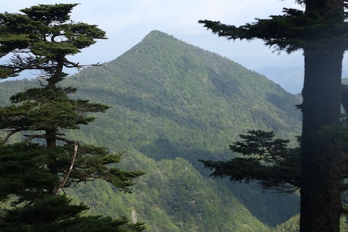
Through a gap in the trees, the craggy monolith of Kogane rises up majestically due east, with the narrow Ōtawa-tōge pass separating us from our target for the afternoon. We lose altitude abruptly, holding onto fixed ropes with one eye on the lookout for more dive bombing by the annoying Vespas. To make matters worse, at the bottom of a steep climb we encounter a trio of hikers, who inform us that the hornets haven’t been bad at all. Perhaps the creatures hold a personal grudge against foreign male hikers.

30 minutes later we reach a grassy field at the mountain pass and settle onto a bench under some cherry trees to finish off our lunch. Sure enough, another hornet makes an untimely appearance, but fortunately for us it appears after we have finished off our rations. The mountain pass is home to a modest parking lot and the recently erected Forest Adventure, a French-inspired treetop park of vertigo-including walks and adrenaline-releasing ziplines. The trailhead passes right through the park, and while the attractions do cost money to experience, we are content with just walking under and around the playground built in the dense canopy of cedar trees.

While this park was not present during my first visit, it is a welcome sight, as this depressing section of monocultural cedar plantations would otherwise be neglected and forgotten. The route follows a dry gully until reaching a series of log steps built higher up the spur. We turn left and ascend to the top of the spur at the base of a narrow crag. While the trail skirts around the rocks on our left, Paul M. drops his pack for an improvised climb to the dizzying top of the boulder. Chris and I observe from the comfort of more stable ground.

A long fixed chain dangles downward as I start the skirt around the boulder. Wouldn’t you know it, two steps into my descent a hornet flies directly up from below, engaged in a game of chicken that I want no part of. Fortunately my partners have yet to start their descent of the fixed chain as I let out a scream and embark on a makeshift retreat back up the chain. At the top I duck as the bee flies directly overhead. With the coast now clear, I restart my careful repel down the chain and reach the bottom with no other close calls.

The route up towards Kogane is draped with fixed chains along the sawtooth ridge, with a few hornets thrown in as an added obstacle. For some inexplicable reason I always seem to take the lead on our hikes, and I am convinced that all of my hiking companions are content with letting me be the first one to encounter all of the spider webs, insects, and reptiles.

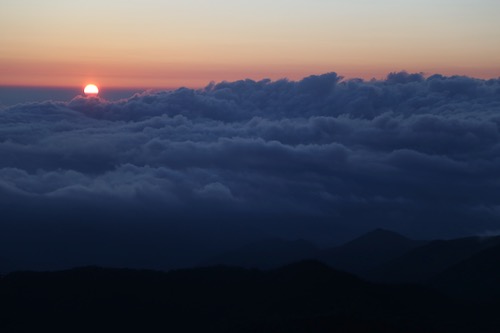
Just after 1pm we pop out on the summit of 725m Mt Kogane, covered in sweat from the tricky scramble. The panoramic views help calm our minds after the climb, with fluffy cumulus clouds floating around the surrounding peaks. On yet another rotund concrete bench we brew up some coffee while fending off yet more hornets. I swear this is the last time I will hike in September.

The caffeine and chocolate help to fight off the fatigue and we turn due south along a near-vertical rock scramble that leads back into the forest along a narrow ridge past the temple ruins of the 12th century Fukusenji temple, which is nothing more than a flat area strewn with boulders and a toppled explanatory signboard that is slowly being returned to nature. A jizō statue is the only reminder that a great sanctuary once stood in its place.

It is here that we leave behind the ridgeline and descend through a narrow valley of loose moss-covered rock which leads to a narrow mountain stream. We follow the tape marks and about half an hour after leaving the ridge we pass through a chain-link gate and reach the outskirts of Okuhata village.

Asphalt would lead us back the car in a roundabout way, but spying a shortcut on my GPS, I lead our team past a small shrine along an overgrown path that dead ends at a chain-link fence. We can see the road on the other side, so we all scale the fence and navigate through a field of solar panels to reach the road back to the car.

All in all it has been a fun excursion in the hills, hornets aside.

Read Full Post »

Late August and a promise to fulfill. Paul M. has been suggesting a climb of Kansai’s highest mountain for years, and after climbing it a second time without him, I agree to escort him up the slopes of a peak that I vowed never to climb again. It’s not that I don’t like Mt Hakkyō, it’s just with two previous climbs under great weather conditions, it’s tempting fate to climb it a third time in an area known for torrential rain. Regardless, we leave Kobe in the early morning hours for the long drive along the incredibly narrow road that hugs the aquamarine waters of the Tenkawa in central Nara Prefecture. Most of the drive involves a tricky game of letting two-way traffic through on tight squeezes that are only designed for one vehicle at best. We finally arrive at the Gyōja tunnel trailhead shortly after high noon and rest in the shade for a hastily prepared lunch.

We shoulder our heavy packs, crammed with provisions for an overnight visit, and hit the trail just after 1pm under sunny skies and calm conditions. The initial approach along the left bank of the river is gentle, with no camping signs posted along the way most likely by the hut staff above, who are eager to collect income by forcing people to pay money to stay on top. Such capitalist greed runs rampant in the mountains of Japan, with an unspoken caste system dictating preferential treatment for those shelling out the big bucks to stay in the huts with meals, while the campers are often thought of as second-class squatters.

After crossing the wooden bridge spanning the stream, the start of what I call the ‘spur from hell’ commences. While incredibly beautiful with its diverse mixture of hardwoods, verdant moss, exposed roots, and unique rock formations, the shortest and most popular route to the World Heritage Okugake Michi is little more than an agonizing slog designed to destroy the morale of even the most optimistic hiker. At least that’s how I think of it, as my string of expletives grows longer with every lunge forward.

Paul M. and I reach the ridge line preciously an hour after setting foot, with both of us collapsing in a heap of perspiration and fatigue. The long drive has taken its toll, and I feel that I can go no further without some nutritional assistance. I pull out a caffeine gel, hoping that the drug will do its trick and help will me along upward. A five-minute pause to let the effects kick in and we start our walk on the historic route connecting Yoshino with Kumano, turning due west along a well-used track blanketed by a bamboo grass carpet, with a mixed deciduous and conifer ceiling providing an ample amount of shade from the piercing heat of the sun.

Past groves of purple monkshood flowers the trail continues, through an area of trees toppled by the the fierce winds of Typhoon Jebi back in 2018. We maneuver over and around the labyrinth before arriving at Benten no Mori, named for the Buddhist goddess of literature and music. As if on cue, the distant sounds of a conch shell reverberate through the valley from an unseen location high above: a weekend Shugendō warrior has made his presence known.

Benten no Mori sits at an elevation of 1600 meters, and a short descent on the far side of the rotund peak affords us our first views of Mt Misen and Mt Hakkyō, which sit high on a parallel ridge like a impenetrable feudal citadel. The route involves a direct ascent of Misen before swinging due south to the adjacent 1915m summit of Hakkyō, the highest point in the Kansai region. Luckily for us, we are in no rush and keep a slow yet steady pace, simply placing one foot in front of the other while relishing in the incredible beauty surrounding us.

After dropping to a narrow col, our rocky path continues along the ridge past towering beech, oak and hemlock trees casting a patchwork of brilliant shadows on the moss-covered floor. The piercing sound of a conch shell at close range startles us, and a glance up ahead reveals the Shungendō practitioner in full white garb directly in front of us. He belts out a few more sonic notes from his horagai shell while we look on with intrigue.

A short climb later we pay homage to En no Gyōja by bowing silently in front of the bronze statue overlooking the ruins of the Shōbō no Shuku resthouse that once stood here centuries earlier. Currently it is just a flat spot that would serve a tent adequately if the need arises. This is the start of the long slog up Misen’s formidable headwall, as the pitch steepens through long switchbacks along a carpet of verdant ferns. My last two autumn trips to this mountain never revealed the lush foliage that the warmer seasons afford, so I take in the sights and smells as a lucky observer. Clouds drift by overhead as Misen struggles to ward off the encroaching fog.

Through a gap in the foliage we catch glimpses of both Daifugen and Ōdaigahara sitting comfortably free of cloud as our route now enters a long promenade of wooden steps built directly into the hillside. I take a deep breath and place my first footfall on the weather-beaten timber and focus on my breathing while telling myself that every step forward is one step closer to our goal.

At the top of the spur, a clearing on our left beckons us over. We drop the packs for one final recess before the final push to Misen’s nearly 1900-meter plateau. The encroaching cloud brings a refreshing chill to the air as we shake our shirts to remove excess sweat accumulating on the wicking polyester fibers. Our pace slows considerably, mostly due to the return of those dreaded wooden steps: while they do provide assistance in gaining altitude, they do so at the expense of energy reserves for which we are desperately running low.

The watch reads preciously 4:30pm as we deposit our gear at a picnic bench beside the hut and rest our throbbing legs. This has been the toughest ascent of Misen thus far, and I mostly attribute that to the heat and our overstuffed packs. I head over to the hut to register, pay the modest fee, and purchase enough drinking water to sustain us for the evening. The campsite lies in a glen just out of earshot of the hut and we soon find a flat place to pitch the tarp next to a jovial solo elderly hiker. The sun plays a cat and mouse game as we finally inflate our air mattresses for a quick test of our barebones set up. Even though I have brought along a mosquito net, the chilly temperatures and altitude are enough to keep the blood suckers at bay, so we opt for a more open bedroom.

A lookout point just east of our campsite draws us, as our elderly camp neighbor recommends the unobstructed views across a steep valley toward the Ōdaigahara plateau. Paul M. and I sit at the top of the cliff face and take in the spellbinding vistas which do their best to restore vigor to our weary minds. The clouds continue to dazzle in their struggle to gain dominance over the sinking sun. We retreat to the picnic table to go over our dinner plans. “Should we cook now,” asks Paul, “or head to the summit for sunset?”. The decision is easy.

Mt Hakkyō sits as a neighborly peak, with a broad col separating it from Misen. Most Hyakumeizan climbers simply leave their packs at Misen for an up-and-back ascent of the mountain, which usually takes an hour roundtrip. Since it is my third time up to the peak and I am no longer checking off a list of mountains, I climb with no sense of urgency other than to make it to the summit before dusk.

Dropping to the col, we pass through the gates erected to keep foraging deer away from the Siebold’s magnolia groves and slowly pull our way up to the top. The summit itself is free of cloud, but a drifting fog bank blots off most of the views as the sun struggles to take hold. We wait patiently and can feel a turn of the momentum.

Suddenly, like the rising of a curtain, the clouds drop, revealing the Kinki Peninsula in all her splendor.

We take turns snapping summit photos and at one point while standing on a pile of stacked boulders, my shoelaces become intertwined and I trip while trying to stabilize myself—in my attempt to help cushion the fall I let go of my camera just in time before falling chest-first off of the meter-high cairn. My ribs are the first to take the impact, but luckily there aren’t any major puncture wounds to speak of. Regardless, each breath sends throbbing pain through the left side of my rib cage.

I try not to panic while switching to a shallower breathing rhythm to help ease the discomfort. The setting sun takes my mind off of the pain as we both stare in awe as the sun reaches the horizon. We are the very last people to witness the sinking of the sun from our rooftop perch on Kansai’s highest point. Never in my life have I laid witness to such mesmerizing light displays. Pink hues of alpenglow replace the grey horizon on the east as I put the pain aside and simply let my true excitement show.

We depart the summit at 6:45pm and retrace our steps by headlamp, arriving back at the picnic table after most of the other hikers have already gone to bed. We cook dinner and proceed to devour all of the curry we had brought for our meal. We followed that up with nuts and cookies we were planning to save for tomorrow.

Post-dinner we stow away our dinner gear under the tarp, turn off our headlamps and gaze upward at a dazzling celestial light show. The moon has yet to rise, giving us a clear view of what must surely be the best place for stargazing in the entire Kansai region.

Bedtime eventually beckons, but neither of us are really looking forward to the fitful rest. In my younger days I could sleep anywhere and anytime, but I’ve become such a light sleeper recently that I tend to wake up at even the slightest of sound. In the outdoors, it often means laying awake with my eyes closed for most of the night while struggling to fall into a deep slumber. Paul M. also struggles with the same issue, so camping adventures together often result in next-day grogginess.

I wriggle out of my sleeping bag shortly before 5am and scan the horizon to the east, which has already started to glow. I signal over to my partner, who is already awake and eager for coffee. We grab the breakfast kit and head to the lookout point to usher in the new day. The hot water boils just as the sun pierces the horizon and we welcome the warmth, for it has been a chilly night of temperatures hovering around 12 degrees.

Ōdaigahara sits in a thick cloud bank but it is a cloud-free morning that greets us up on Misen. After breakfast we leave camp and head back up to Hakkyō to take in the brilliant sunshine.

Instead of heading back to Misen, we continue on the Okugake Michi southwest to the adjacent peak of 1894m Myōjō or Mt Venus. The path follows the undulating ridge until reaching a junction for a loop trail that will take us back to Misen. The true summit of Myōjō lies just off the main path, so we follow a faint trail to the summit to take in the outstanding view of Mt Shaka.

We retreat back to the junction and leave the Okugake in favor of the loop. Thick groves of Veitch’s silver fir and spruce dominate these highlands, reminding me of parts of the Yatsugatake mountains. We meander among the hardwoods for an hour before taking a shortcut path to Ōkamidaira (狼平), which involves a direct descent on the treacherous eastern slopes of Mt Hinoura. We somehow manage to avoid falling to our deaths and celebrate by washing our faces in the cool soothing headwaters of the Misen river.

Crossing this stream leads us to the emergency hut at Ōkamidaira and a well-deserved bar of chocolate. From here is it an agonizing climb up a series of log steps to a false summit before a short descent and even longer traverse back up to Misen. The only upside to the slog are the pleasant vistas of the knuckle-shaped Mt Chōsen directly behind.

By the time we return to camp is it already 9:30 in the morning and we are already beat. Paul M. and I hastily break down camp and eat the remainder of our rations before retracing our steps back to the car, which we reach shortly before 12:30pm. It has been a hectic 24-hour trip, and apart from some bruised ribs, it has been a success. With such perfect weather this time around, I would surely be foolish to return a fourth time, or would it?

Read Full Post »