Feeds:
Posts
Comments

Archive for the ‘Minami Alps hikes’ Category

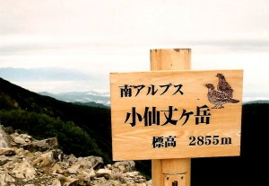
Two peaks stood between myself and the completion of the hallowed 100. The remaining duo are actually on the same ridge line, a mere two-day walk that I could easily tie together on a three-day weekend. Timing doesn’t always work out how you plan, however, and if there was any chance of finishing off the peaks before the arrival of the winter snows then I’d have to grab every available opportunity. So, preciously two weeks after coming down the jagged spires of Tsurugi-dake I was at the southern end of the alpine spectrum, attempting to knock off Tekari as a day trip.

This mission called for back-up, and my trusty companion Fumito came to the rescue. After running my plan by him he agreed to not only shuttle me to the trailhead but also to tag along on the agonizing climb. Instead of the drive from Shiojiri, I met Fumito at Toyohashi station in Aichi Prefecture, where he had been transferred to earlier in the year. Despite its proximity to the Minami Alps, it still took us several hours to navigate the rural roads leading to the trailhead at Irōdo. One we arrived it was a simply of matter of pitching the tent by the side of the gravel road and catching a few hours of shuteye before the early dawn would signal our departure for the formidable challenge.

We embarked on our expedition shortly after dawn under a thickening sky. The route weaved through an army of cedar trees lined up in marching formation. Each step brought modest gains in altitude, as the views started to open up the higher the path forged through the woodlands. Shortly before noon the cedar gave way to trees of the more deciduous variety, and the cool autumn air brought a tightening to my lungs that threatened to bring a premature end to our operation. I stopped briefly, sucking in large pockets of air deep into the lungs until the bronchial spasms subsided. I’d never had a problem with asthma before, so I needed to hurry up and finish these last two peaks before they finished me.

The lungs somehow returned to proper working order just as we reached the junction at Mt. Irōdo. We were now officially on the ridge that ran along the entire spine of the mountain range. The altimeter read 2500 meters: preciously 1700 vertical meters higher than our Toyota parked in the valley below. The two of us were absolutely spent from the exertion of energy, but the battle was far from over. Though the majority of the steeper bits were behind us, we still needed to tramp along a ridge laden with more ups-and-downs than most roller coasters. We each downed an carb-laced energy gel and a bag of mixed nuts and slowly glided through a wooded plateau affording views of Mt. Hijiri across the valley. The cloud had yet to invade my last remaining Hyakumeizan, but the barometer warned us that menacing weather was just around the corner.

The pace slowed to a crawl as we followed a dry creek bed through an area ablaze with the yellows and reds of an early autumn. Just below the terminus of Mt. Izaru a small mountain spring brought refreshment to our dehydrated bodies, and by sheer luck the grade eased up just as the eaves of Tekari hut came into view. Peering over the edge of the southern ridge, the conical massif of Mt. Fuji punctuated a rolling torrent of boiling cloud, presenting a spectacle that surely would have had Hokusai glowing with delight. After chatting with the hut owner briefly, we topped out on Tekari’s tree-lined summit shortly before 3 in the afternoon. It had been one gargantuan effort to get there, and the majority of climbers would simply settle into the padded comforts of the cozy hut, but we both had work the following morning.

Clouds swept in from the east, providing a much-needed catalyst to get us moving back towards the junction. I tucked the camera away snugly in my pack, knowing that photo ops would only slow us down. We hit the junction at Irōdo a little past 4 and trudged back down into the dominion of evergreens just as the skies opened up. The canopy above kept most of the larger drops from soaking our gear as we limped through a network of downed, moss covered cedars and lumps of weathered granite. By the time we reached our automobile the first signs of dusk flickered through the forest. It was a monumental climb of nearly 12 hours that both of us vowed never to repeat. One thing was certain: the final peak would be knocked off at a much more leisurely pace.

Read Full Post »

The rain came down in rhythmic sheets for most of the night, pushed on by the autumn gusts whipping through Ina valley on their way to Kofu city and the outer reaches of the Kanto plain. I rustled back and forth in the warm futon, trying to drown out the drum-like drone of the pellets bouncing off the hut roof. Fatigue eventually took over, and the next thing I remember was the sound of  shifting nylon, as groups of eager hikers donned their matching rain suits before heading out into the murk.

kai3-2

I got a more leisurely start, cooking up a light meal of warm noodles near the hut entrance, where I had a good look at the nasty conditions. Despite the uninviting weweather, I knew a mountain with my name on it lay hidden above the dreary mist. Sure I could have turned my back and called it a day, but it’s an awful long way from Osaka to Kitazawa pass.

kai3-6

After putting on my fire-engine red full body rain suit, I stepped out on the trail towards Mt. Senjo, a thousand vertical meters above me. The rain continued steadily but fortunately the wind remained relatively calm. The lofty alpine fields of the Japan Alps are a magnet for cloud cover, as any full-bodied mountaineer can attest. I accepted my fate with relative serenity, knowing that the views from Mt. Houou made the trip a resounding success. Today, however, I experienced a bizarre phenomenon that has yet to be repeated: though the rain made the journey from the stratosphere, the accompanying cloud did not. Once above the tree line, visibility were comparable to a cloudless, sunny day. The spiny crags of Mt. Nokogiri ran westward from the rocky spires of Kai-koma, as Yatsu-ga-take looked on from across the deep valley.

kai3-3

Once I hit Mt. Ko-Senjo, I got my first glimpse of the massive col that surrounds the summit plateau. Kita-dake was visible to my immediate left, all but the tip of the summit below the cloud line. Beyond, even Mt. Fuji remained clear up until the 8th stagepoint, appearing on the horizon as a perfect volcanic trapezoid. I savored the views, knowing the clouds could roll in at any moment to spoil the fun.

kai3-4

The final push to the top was along the outer edge of the col. The rain was reduced to a fine mist, so I unzipped the jacket to help air out my sweat-laden armpits. Step by slippery step I marched, reaching the highest point just after midday. The views to the north, hidden by the linear line of Senjo’s flowing ridge, were finally released from their tight grip, as I had breached the 3000 meter mark for the first time on the trip. To my utter disbelief, not only did the Minami Alps remain free from fog, but every peak in the Minami Alps stood clear.  In addition, Kiso-koma in the Chuo Alps soared up above the Ina valley, while Ontake and Norikura sat on the edge of the dark wall of cloud. The rest of the Kita Alps was swallowed by the low-pressure leviathan. I was glad to have made the decision to stay south this trip, as I still had plenty of peaks to climb that lay victim to this evil storm system.

kai3-5

As I rested on the saturated rock outcroppings, a trio of young climbers reached the summit. They were part of a university mountaineering club in Nagoya. I asked them if they had been to the Aichi Expo, since it was currently in full swing. On cue, they pulled two stuffed toys from their packs: Kiccoro and Morizo, the two mascots from the World Exposition! What a better way to add variety to the usually summit shot, I thought, handing my camera over to the more competent of the photographers.

kai3-1

The chance encounter, along with the stellar views and the retreating storm system, kept my spirits soaring, and I flew back to Kitazawa in a fraction of the time it took me to ascend. Once at the pass, I boarded a shuttle bus bound for Hirogawara, followed by a bus back to Kofu and a long train ride back to Osaka. The Minami Alps were almost completely conquered: I only had the southernmost peaks of Tekari and Hijiri remaining. As fate would have it, they ended up being peaks #99 and #100, which probably says something about my affinity for this area of Japan.

kai3-7

There is a bit of a lesson to be learned from this soggy climb: even if the forecast calls for rain, don’t be fooled into thinking that nimbostratus clouds will blot out the view. With a little perseverance, you just might surprise yourself.

Read Full Post »

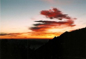
The horizon burned a fiery crimson when I finally hit the trail just before 5am. Breakfast consisted of a hurried bowl of warm oatmeal: the race against the rising sun was on. The maps said it would take around a hour to reach the ridge, but such time was not an option: if I had any chance of getting good shots of Mt. Fuji I would need to be sitting on the ridge now, before the first rays of the dawning day drew near. A brisk pace carried me through the sleepy stands of hardwood and conifers, which stood guard over the great heights of the rolling phoenix. The higher I climbed the brighter the horizon glowed. I knew I wasn’t going to make it but managed to get high enough to get a glimpse of color.

kai2-1

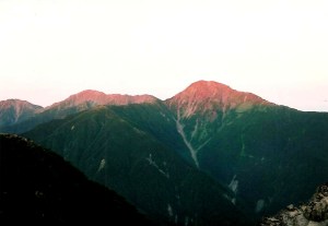
The scarlet clouds of a new day could only mean one thing: a low pressure system was on the move. While not always the case, a red sun in the morning is usually a warning of approaching storms, but would they hold out until I safely cleared the alpine danger zone? The final 50 meters to the junction was unbearably steep, as I spend the final efforts on all fours literally slithering my way back above the tree line. Gazing due west, the triplet peaks of Shirane sanzan glowed like the embers of a fire fit for giants. Perhaps I wasn’t too late after all.

kai2-3

By the time I reached the summit of my first target peak (Mt. Kanon, peak # 34) the sun had made a welcome appearance, casting strong shadows across the deep valley I had trudged up less than 24 hours earlier. In complete solitude, with a deep reverence of the wilderness spread out before me, I marched back towards the obelisk, which finally stood tall, unobscured by clouds.

kai2-5

The ridge undulated through an eternal array of deep folds, but with visibility so vast, I skipped daintily as if on an early morning stroll through an enormous park. After an hour or so I reached Hirogawara pass, and gazed down the long gully that took an eternity the previous day. After that I spend the rest of the day marching west, towards the rocky spires of Kai-komagatake, a peak which I had hoped to summit before nightfall.

kai2-2

At Miyoshino I took a well-deserved lunch break, staring out over the mighty Kita-dake and the rest of the spires of the Minami Alps. Sunrise was precise in her prediction of a change in the weather, as a layer of altocumulus clouds rolled in from the southwest. By now it was approaching 3pm, so with haste I jogged on to Asayo pass, which sat on a strategic perch nearly 2800 meters in elevation. It was here that I met my first hikers of the day, a retired couple from Saitama, just outside of Tokyo. I reached down to grab my camera, seizing the opportunity to get a self-portrait snapped as a memento for the epic hike. To my complete and utter astonishment, the camera was nowhere in sight. My best guess is that is was sitting on a rock at Miyoshino, a 20-minute walk away.

kai2-4

With daylight now starting to come into play and a weather system that would likely release precipitation before nightfall, I was left with a crucial decision: turn back and grab the equipment, or trudge on to the summit of Kai-koma. I had less that 500 ml of water remaining, and in the afternoon heat I knew I would need more liquids for the remainder of the climb. Explaining my predicament to the elderly couple, the wife immediately pulled out a bottle of unopened tea, explaining that they had no need of it since Asayo was as far as they were heading today. Thanking them profusely, I turned my back on my target peak and rushed back to Miyoshino, finding my camera sitting quietly on a rock.

kai2-6

Now that I was reunited with my gear, I retraced my steps back to Asayo and descended steeply down the other side, to Sensui pass, where a water source lie in the valley below. It was an hour round-trip, but what other choice did I have? I could have easily checked into Sensui hut and climbed Kai-koma the following day, but with the approaching weather front I knew my best window lie just before me. After filling up on liquids, I ascended back to the main ridge, reaching Sensui pass shortly before 5pm. According to the map, it was a 3-hour trudge up to the summit, followed by a 2-1/2 drop of 1000 vertical meters to the hut at Kitazawa pass. Things were starting to become interesting.

kai2-7

In a true race against the clock, I pushed up to the junction just below the peak in only 25 minutes. I was truly heading at a marathon runner’s pace now, but the fatigue and altitude were starting to affect my decision making. There are two route up to the summit once you hit Roppo rock: skirt up to the right and around the edge of the flank, or head straight up a near vertical rock scramble. I’m pretty sure you can guess which route I chose.

kai2-8

The route is marked by a dotted line on the map and for good reason. Though not technical, one slip here would send you bouncing off the boulders to an almost certain death. I held on with all my strength, following the yellow paint marks with all of my mental energy focused on my footholds. The X marks painted on the boulders showed which areas to avoid, and though the skies were dark, the low altitude clouds had held off. I can only imagine how tricky this route must be in less-than-ideal conditions.

kai2-9

It was after 6pm by the time I topped out. As I looked across the valley towards Mt. Senjo, I noticed the top had been swallowed by a curtain of white, with a thick layer of gray fanning out across the open sky towards my current position. I really had to get a move on if I wanted to make it off this mountain as a dry man.

kai2-10

I took the ‘easier’ route back down to the pass, which proved tricky in the loose scree that blankets Kai-koma’s sandy mound. The layers of stone have the look and consistency of snow when viewed from afar. Snow, however, would prove much easier to navigate than this pebbly playground.

kai2-11

Once back in the treeline, I rolled along the ridge to Mt. Futago, where I dropped my back and rearranged my gear. Rain would soon be falling, and I needed protection other than what the woods would provide. I stuffed a handful of mixed nuts into my mouth and finished off the remaining supplies of water, knowing that my next stop would be at the hut in the valley far below. Just before setting out I donned my rain jacked and fastened my torch securely to my forehead. I made it about 50 meters down the southern face of Futago before the skies erupted in a loud roar.

kai2-12

Thunder rumbled from an unseen source as I stumbled through the dark forest. Using the headlamp to guide me, I pushed on just like Michael Douglas and Kathleen Turner, reaching Chouei hut around 7:30pm. The caretaker, though startled as he was, gladly showed me to my awaiting room as other guests looked on with disbelief. I had a dry place to stay, and after firing up the stove, had a full belly to boot. Things were starting to look up, but the trek was far from over.

Read Full Post »

Three peaks in the northern section of the Minami Alps remained on my list. Rather than tackling them individually, I seized the opportunity to scale all 3 at once, though the route would not be easy: 3500 vertical meters of elevation gain spread out over a 30km area. Finding a window of holidays in late September, I boarded the overnight bus to Kofu, followed by the early morning shuttle to Hirogawara, the starting point for my unprecedented traverse.

hou1-1

During initial route planning, I mulled over the idea of starting at Yashajin touge, which would allow me to traverse the entire Houou mountain range. While tempting, it would add an extra 10km to an already long traverse, so the shorter approach from Hirogawara won out. The route involved a bit of backtracking, but I knew it would be the least popular of the 4 approaches to the peak. Solitude was something I longingly craved, for the previous month’s ascent of Yatsu-ga-take was anything but: scores of Kanto adventure seekers armed with entire families of unwilling under-aged mountaineers. I wanted a place that screamed wilderness, and knew taking the path less traveled would provide that remedy.

hou1-2

From the massive bus parking lot of Kita-dake’s extremely overcrowded entrance, I trudged past Hirogawara’s namesake mountain hut and ventured to the northwest, along the paved road to Kitazawa Pass, where I would eventually end my trek. Off limits to private vehicles, the deserted pavement was a welcome sight after the jubilant atmosphere of the nearby bus terminal. After 10 minutes of gentle climbing, I spotted the trailhead on the right bank of the shoulder and disappeared into the dark forest. According to the map time, I had a 6-hour slog ahead of me, but I knew  I could easily half that pace with my small pack and fit body. I decided to travel as light as possible: the tent and sleeping bag were traded for a few extra paper layers in the wallet that would cover hut accommodation. This was my first experience relying solely on the comfy lifestyle that the hut provides: a dangerous and costly addiction when compared to the bodily torture of carrying half of your body weight on your shoulders.

hou1-3

The route, though a little overgrown, was fairly well-marked despite the lack of foot traffic. After gently gaining altitude through the groves of oak, beech, and birch, I hit a massive boulder field which stretched all the way up to the horizon far above my head. Perhaps I had found the reason why this was the road less taken. Luckily visibility was good and it was a breeze keeping pace with the paint marks and arrows scattered through the steep alpine couloir. I hit the ridge after only 2 hours of steady climbing. The map said to allow at least 3-1/2 hours with their “middle-aged” allocations. The following day, I would need to backtrack to this point and continue to the west, but for now I headed east, up above the tree line to an unmarked crest just shy of 2800 meters above the sea. Shortly after descending the other side, I hit thick cloud and lost the views I had very much looked forward to: the rest of the Minami Alps spread before me while Mt. Fuji floated about them all. There was always a chance of capturing the scene the following morning if I could rouse myself out of bed in time.

hou1-4

The path soon turned to a slick sandy grime, courtesy of the vast deposits of sandstone lining the entire Houou range. These fields of crumbly scree are one of the trademarks of the area, whose name translates at the Phoenix range. Perhaps these mounds of sand are remnants of the mythological birds, who must’ve have come here to die and reawaken from their own grit-like ashes. A little further along the glazed path, I reached the base of the obelisk rock formations of Mt. Jizo, the first of Houou’s three sacred peaks. I could just barely make out the phallic shapes of the rocks in the thick mist. Giving it a miss, I scrambled back down to the tree line and reached Houou hut shortly before dusk. After checking in, I headed outside to prepare dinner. Though I was staying in the hut, I opted to save a bit of money by providing my own meals: a savings of roughly 3000 yen when compared to being fully catered. The hut owners generally have a hierarchy when it comes to customers. Those paying for 2 meals generally get treated like kings, while those who are paying for bedding only are usually quarantined to a different part of the hut, where they must prepare their meals in isolation. Finally come the campers, who the hut owners want no part of, since they aren’t making a profit from the DIY crowds. There are exceptions at different huts, of course, but generally in the Japan Alps you can generally expect the level of hospitality to rise in accordance with the amount of money you are forking over.

hou1-5

Sometime around 8pm I settled into my futon and drifted off to sleep. I had a marathon day ahead of me and needed as much rest as I could spare.

Read Full Post »

Heavy rain thrashed outside the cozy hut most of the night, while the wind picked up several knots with each passing gust. The storm forecast was right on the money, but unfortunately we were a literal no-man’s land, sandwiched between two of Japan’s higher peaks. Breakfast turned into an impromptu strategic meeting of the minds: myself and one other hiker had our sights set on Hijiri, while the 5 other men were studying routes off the peak. One trio opted for  the 8-hour descent to Shirabiso-toge, where a taxi would be waiting to whisk them back to reality. The other two chose to re-climb Akaishi and head down to Sawarajima via Akaishi hut. The challenge was on.

My new-found companion was named Koji, a 40-something Tokyo businessman on a weekend outing in the Alps. After gearing up, both of us stepped outside, facing the brunt force of the typhoon head-on. We took one look up at the nasty ridge heading to Hijiri, turned to each other, and did what any other sensible climber would have done: we joined the duo bound for Akaishi. For one, we’d both taken the path the previous day and knew in addition to being somewhat sheltered from the wind, it was technically non-challenging. Hijiri would have to wait for another day. The 4 of us marched in unison, leaning close to the ground when the wind gusts blasted us. The rain was close to horizontal as we pushed on unfazed. Once we reached the emergency hut just below Akaishi’s exposed summit, the caretaker ushered us in. Without saying a word, the saintly gentlemen boiled some water on the kerosene heater and plied us with warm tea. He knew the severity of the predicament we were in. After all, temperatures were hovering around zero at 3100 meters above the earth. Remember that this emergency hut has no water source, so the man was giving from his own rations and didn’t expect anything in return. My respect for the hut operators in the Southern Alps reached new heights.

Up and over Akaishi we marched, dropping down into the tree line for a much needed respite from the wind. The rest of the hike down to Sawarajima was a bit of a blur. I don’t recall any distinguishing features other than the well-groomed grounds of Akaishi hut. Once reaching the valley, the news of cancelled bus service set in, as I raced around frantically trying to figure out how to get back to Osaka. Tokai forest was running shuttle buses to the parking lot, but from there I was basically on my own, miles from the nearest town. Luckily, Koji offered me a ride to Shizuoka station without hesitation. The rain continued to pour down as the shuttle bus made repeated stops to remove debris and landslides from the forest road. I had the feeling we were getting out in the nick of time. If we’d climbed Hijiri and stayed an extra night on the mountain there’d likely be no road left to leave on.

Disaster was once again safely diverted. Hijiri remained on the ‘to climb’ list, and little did I know that it would end up being #100 for me. Such is the way things panned out in my Hyakumeizan adventure.

Read Full Post »

I woke before dawn, boiling water for oatmeal in the early morning mist that enveloped the vestibule of Takayama hut. I needed every calorie at my disposal for the mammoth climb that lie ahead. Shortly after leaving the warm confines of my accommodation, I found a stream flowing past the trail, gushing clean, crystal-clear mountain water down into the valley below. Make no mistake about it: reliable water sources are in fresh abundance in the Minami Alps, a stark contrast to the huts of the Kita Alps, which sell rain runoff for exorbitant prices. I carried an extra liter in the rucksack, which I hoped would last until the next stream up and over the rocky spires of Mt. Warusawa.

The crawl up to Mae-dake, the first of the triple peaks of Warusawa, took what seemed like an eternity. Fortunately, the light mist gradually evaporated, revealing clear blue skies and hints of a sunny day ahead. The problem lie in the fact that I was heading up the western face of the peak, away from the warm rays that would make the wet, rocky col much easier to navigate. At least I wasn’t descending this route, I thought, as I picked my way through the boulder fields. Alas the ridge grew near, and one last sweaty push later, I sat on the cusp of my target peak, surveying Mt. Akaishi shimmering blissfully in the soft golden sunlight.

I turned left, dropping my gear at the emergency hut at Naka-dake before dropping to the saddle far below. Here a family of ptarmigan crossed the path, oblivious to my close presence. Warusawa’s eastern spire towered menacingly above, swirling in and out of the rapidly flowing clouds. Taking a deep breath, I marched in silence, hoping for an unobstructed view before the mist swallowed the peak for good. I got a quick summit shot off before white enveloped everything around me. Using the paint marks to guide me, I carefully retraced my steps back to my waiting pack, and marked another Hyakumeizan off the list. “Only one more to go today”, I quietly thought, knowing I’d have a huge drop and ascent before reaching it.

A few hundred vertical meters later, I popped out of the clouds and into warm sunshine. Groups of climbers made their way past me, towards the lofty peak I’d just climbed. For once I was happy I wasn’t joining them. Arakawa hut soon came into view, and I found myself sitting on the picnic tables absorbing morsels of vitamin D, when the hut manager came out for a chat. “Here, Japanese sweets”, offered the elderly caretaker. I grabbed a mochi-filled manju and talked about life in the mountains. “Yes, you can see Mt. Fuji from here, but not today”, explained my informative guide. A thick layer of cloud lie between us and Japan’s signature peak. He wished me luck for my rather intimidating afternoon climb. “You’re lucky. Winds are calm today, but a typhoon is on the way.” It’d been a while since I’d seen a weather forecast, but September in the mountains is always a gamble.

Soon enough I rose back into the cloud, counting my steps until even that became a bore. I tried singing my favorite tunes, but nothing could shake this feeling of regret. Sure I was out in nature, but wasn’t this the same scenery I’d seen time and time and time again? A multitude of mountains in the fog, yet all with the same alpine blur. As I was pondering  these thoughts, I’d reached the crest of a hill and realized I was sitting on top of Ko-Akaishi, which was nearly a stones throw away from the summit. Dropping my things, I double checked the map times, and my watch. “Hmm, 2 hours from Arakawa”, read the suggested pace, but here I was 70 minutes after my mochi break. I’d definitely had no trouble acclimatizing to the altitude. My doldrums suddenly vanished as quickly as they appeared and I pushed on with renewed vigor.

After reaching the top, I coasted along the ridge down to Hyakkenbora Yama-no-ie, my home for the night. This time around I’d booked a place with two hot meals. After the incredibly long day, I needed the extra protein to see me through the rest of the traverse.

The majority of climbers take at least 2 days to cover the same distance I’d managed in 1. All in all about a dozen people shared the floor space that night, with all eyes glued on the post-dinner weather report. The prognosis was not good, as the Minami Alps lie directly in the path of the advancing typhoon. What could we do but hope, pray, and wait?

Day 3

Read Full Post »

The train pulled into Ina-Oshima station shortly before midnight, as I searched for a dark corner to catch some shut-eye before the early morning bus to Shiokawa trailhead. My eyes immediately caught sight of a long bench in the covered bus shelter directly across the street from the station. The bus I needed to catch would leave from here, so at least I wouldn’t have to worry about oversleeping if I bedded down there. I unrolled the sleeping bag, crawled in, and spent the next 6 hours or so in an uneasy fit. As soon I drifted off, a car would come swooshing by, splashing rain water perilously close to my partially-exposed figure. Once the bus finally arrived, I sighed with relief and fell into a deep slumber, awaking only after the driver tapped me on the shoulder. Good thing the trailhead was the last stop.

The path towards Sanpuku-toge was just as I’d remembered it: lush, overgrown, and completely deserted. The rain had eased overnight but the cloud hung heavy on the ridge far above, threatening to turn my first day into a foggy mush of misery. Somehow I managed to not lose sight of the tape dangling intermittently from the surrounding trees, as I crossed the river one last time before starting the infinite switchbacks towards the highest mountain pass in the Minami Alps.

Shortly before noon I popped out in front of the hut I’d stay in during my last tramp into these mountains. The jovial staff gently filled my water bottles while inquiring about my plans. Usually hikers need to pay for water here, but since I was the only one around for miles, he quickly waved off my offers of cash. “Where to today?,” the middle-aged man queried. Thinking I was headed towards Shiomi-dake, my information source let out a rather audible gasp when I pointed in the direction of Arakawa. “You’d best stay at the emergency hut at Kogochi”, he added before ducking back inside. “Here, take this”, shoving a ripe Fuji apple into my left hand, “you’ll need this.”

After bidding farewell to the caretaker, I started the long, slow climb towards Mt. Kogochi through the thick cloud and strong winds. Robbed of a view, I marched to the beat of an imaginary drummer, humming myself into a trance with obscure tunes from my childhood. Flowers bloomed all around but I was in no mood for snapping photos. I knew I had a long way to go before reaching the next Hyakumeizan on my list, and all I could think of was how many kilometers I could knock off of that approach during the slowly fading daylight. Perhaps that was the main reason I opted not to follow the apple giver’s advice and pushed on well beyond the summit of Kogochi to the next hut along the ridge, a good 8km away from my current position. I don’t remember much about that trail except for the white monotony of the misty veil. Shortly before dusk, I stumbled into Takayama emergency hut, startling the manager who’d given up hope of having any additional visitors for the evening. As I handed over the modest accommodation fee, the elderly worker nearly fell off his chair when I told him I’d come from the station earlier that morning. Apparently most people take at least 2 days to cover the same distance I’d knocked off in the better part of one. After a quick meal, I slipped into a deep coma, preparing my body and soul for the even longer day that lie ahead.

Day 2

Read Full Post »

I can think of at least a few hundred things I’d rather be doing than breaking down a tent in the rain, but after waiting half the morning for a break in the weather, our patience wore thin. I must say that the job becomes a lot less messy with two people on the job: I simply stuffed the tent in my pack in the blink of an eye while leaving the ground sheet,rain fly, and poles exposed to the elements on the outside of my pack.

John and I meandered through the pristine forest towards the tree line and our impending assault on Mt. Shiomi. We should’ve seen the warning signs from a mile away. It wasn’t until I got my pictures developed weeks after the trip that I noticed the approaching low pressure system. Once above the tree line, things took a sudden turn for the worse, as we hit the full blunt force of the whipping winds. Wet clothing and strong gales are a definite recipe for disaster. “I’m going to push ahead and find a hiding place out of the wind”, screamed John, who was losing body heat much faster than he could replenish it. You might remember the lack of winter clothing from the first two days of the traverse. He was paying for it dearly now, and I watched his tall, stately figure vanish quickly into the mist.

I was shivering from the cold as well, and pushed on as quickly as I could, crouching close to the ground to avoid being blown into oblivion. I was walking as if in a trance, my camera secured deep within my pack. This was not a time to be snapping photos. The official high point of Shiomi, the east peak, was reached after an hour of fighting for my life. There was no escape from the torrent and no reason for respite. Down to the saddle and over the west summit I flew, reaching an incredibly steep wall of rock similar to the buttress I’d seen on Kita-dake just one day prior. It was here that I found a trekking pole, snapped cleanly in two. It wasn’t supposed to happen this way.

John was nowhere in sight, so I gave him the benefit of the doubt and continued gliding down to Shiomi hut. Our eyes met just outside of the entrance. My hiking partner looked much worse for the wear, as our request to come into the reception area to warm in front of the kerosene heater was rebuffed. This was getting ridiculous, and if my friend succumbed to the elements then we’d definitely have a lawsuit on our hands. We took the proactive approach, escaping into the lobby of the adjacent hut and grabbing anything we could find to raise John’s body temperature. He was shivering intensely, with 3 layers of blankets wrapped snugly around his body, when the hut staff barged in. “No, no! No blankets. Get out of here!”, gruffed the men, clearly enraged with our lack of etiquette. “Chotto, teitaion ..”, mumbled my fearless friend. The hut ruffians had been sitting in the comfort of the warm hut all morning, oblivious to the raging storm on the summit. “Please, we’ll pay you to use your heater. My friend is in serious danger”, I pleaded. The hut workers talked quietly amongst themselves before finally agreeing to let us stand in front of the heater for 1000 yen a piece. Now if they’d only been that cooperative from the beginning….

The color eventually came back to John’s skin as we beat a hasty retreat to Sanpuku-toge, the highest mountain pass in Japan. After our ordeal, we decided to indulge ourselves by checking into the hut. There’d be no more unnecessary danger on this trip! The hut staff couldn’t have been friendlier, a stark contrast to the loonies an hour to the north. We slept like babies and feasted like never before, while the foul weather continued unabated outside. The next morning we descended to Shiokawa in a light drizzle and heavy cloud cover. At the bus stop, we met a group of university students preparing to depart on a multi-day trek. I really hope they were better prepared then the two of us. Never underestimate the power of nature. We went from the best trekking weather ever to the worst in less than 24 hours, and that snapped trekking pole did indeed belong to John!

Read Full Post »

I drifted off to sleep immediately after crawling into my sleeping bag, and John’s consciousness soon gave out under the increased comfort of the wool blankets. We didn’t bother setting an alarm, as the ruckus of the neighboring tents would surely be enough to wake the dead. Dawn came much sooner than welcomed, but the warmth of the tent took precedence over scrambling up to the summit of Japan’s 2nd highest peak to watch the sunrise. We’d do just fine watching from the vestibule.

A leisurely start to the day it was, as breakfast was cooked, gear stowed, and linens returned to their rightful owner. The walk from the hut to the summit took barely 20 minutes, where we found a completely deserted signpost. Another advantage to the “late” start (late meaning 7:30am, in our case).

After crossing the peak, the path took a turn for the worse, through a steep gully with plenty of life-ending drops and precarious footholds. While the chains did help, adjusting to the awkward center of gravity created by an enormous pack took a bit getting used to. I have the utmost respect for those few brave souls who’ve attempted this tough wall of granite in the winter.

Once out of the death zone, the trail became a breeze, skirting past the front door of Kita-dake hut before rising gently to the flattened heights of Ai-no-dake. The weather continued to be absolutely stunning, the perfect companion for a leisurely day in the Alps. After lunch, it was time to do a bit more fooling around before descending to our chosen campsite for the night at Kuma-no-daira.

John and I rolled into the wooded confines of our camp around 4pm, pitching in a secluded area away from the bigger university mountaineering clubs. Our requests for extra blankets, however, were vehemently denied by the stern staff at the hut. Pay 8000 yen to stay in the hut, and we could have all the extra bedding we wanted. Campers in Japan really need to take care. In most places you’re treated like a vagrant and not allowed to use any of the luxuries of the hut, but such is the life in a country where alpine huts are private property!

Fortunately, our campsite was 500 vertical meters lower than the previous night’s accomodation, and somewhat sheltered from the winds, so after a quick distribution of extra clothing from my gear, John was in relative comfort (if you consider comfort maintaining your body temperature just slightly above the border of hypothermia). We dozed off to sleep by the titter-tatter of a light rain falling on the tent fly above our heads. So much for the dry weather…

Day 3

Read Full Post »

Sleep deprivation can cause some careless decisions to be made at times. Hence, our current predicament. The overnight bus rolled into Kofu station shortly after 5am, where John and I realized, to our chagrin, that the first bus to Hirogawara (広河原), the start of the hike for Kita-dake, did not depart until after 9am. After studying the map for about 10 minutes, I spotted an alternative approach to the trailhead that seemed much more interesting than sitting in a smoky coffee shop for half the morning.

We rode a few stations north to Nirasaki, exiting the station towards the west amidst strong winds and a light rain. We trudged along towards the mountain road, hopeful that someone would come along to give us a ride. After all, if this indeed was the gateway to the Minami Alps, there should be a fair amount of vehicular opportunities. Higher and higher we climbed on the deserted pavement, passing by a troupe of wild monkeys foraging for food in the dense undergrowth of the forest. Finally, after nearly 2 hours of rising above the valley, a car came to a halt. The middle aged women, a bit startled by our early morning adventure, broke the news to us as gently as she could. “Yes, this road does indeed go to Hirogawara, but it’s not the Hirogawara you’re looking for.” Turning the map over, she showed us that our current location would indeed take us to the true Hirogawara, if we could add an extra day by traversing up and over Mt. Houou. As luck would have it, the woman happened to run Hakuhou-so (白鳳荘) at the base of the hike to Mt. Amari (甘利山), which is where we spotted the other Hirogawara on our map. “Don’t worry,” she asserted, “my husband will give you a ride to the real Hirogawara!” Only in Japan would two places in close proximity have exactly the same name with precisely the same Chinese characters.

So, after a plate of curry and rice and a generous helping of coffee, we hopped into the passenger’s seat for a whirlwind ride to Yashajintouge, where we boarded a bus to the true start of the Kita-dake hike. Instead of our anticipated start time of 10:30am, we were now poring over the maps, wondering how far we could make it on a 3-hour delay. We set off in high hopes, trying to make up for lost time with a full set of gear: tent, sleeping bags, 3 days worth of food.

One obvious advantage to our late start time was that we had the trail entirely to ourselves. Another perk was that the clouds and rain of our ill-fated morning were starting to break up. Scarcely an hour after leaving the massive parking lot at Hirogawara, John and I strolled into the campsite and hut at Shirane-oike for a quick break and replenishing of fluids. The map said it’d take 3 hours, but we were definitely powered by pure adrenaline by this stage, completely oblivious to the small home that both of us carried on our backs. Turtles we were not on this mid-August afternoon. “I bet we can make it to Kata-no-goya before dusk,” I quipped. John was up for the challenge as much as I was, and we powered through the tough switchbacks like wild horses trotting through the meadows. Even though our pace slowed somewhat, we’d been rewarded for our endeavors. The views were opening up.

Rolling into camp around a quarter to 7pm, the tent was erected just in time to admire the magnificent light show. There are few campsites in Japan that match the unobstructed views of Kata-no-goya. Where else can you stare at Mt. Fuji from the vestibule of your own abode? The temperatures plummeted after sundown, as we realized a pressing problem. John, accustomed to the extreme heat of Osaka, failed to pack any warm weather gear. No winter coat and absolutely no trousers to cover his lower extremities. His sleeping bag was rated at 15 degrees celsius, which would be useless in the sub-arctic conditions. “I wonder if the hut has any extra blankets?” John mused. 5-minutes later, my hiking companion returns with half a dozen warm linens. The staff at Kata-no-goya hut couldn’t have been nicer.

As we drifted off to sleep, I wondered what the scenery would be like for our first full day in the Minami Alps, a place that both of us were visiting for the first time. Would the approaching high pressure system continue to hold?

Day 2

Read Full Post »