Climbing the highest peak in every prefecture wouldn’t be easy, but with a little help from my friends it could be a little less intimidating. The previous day, in less than desire downpours, I had knocked off the highest mountain in Okinawa along a trail slippery with runoff and heavy with erosion. While hardly a monstrosity, the mountain did throw up some surprising challenges that took the form of habu snakes lurking in the shadows of the dense jungle floor. As I recovered in the common room of a guesthouse in Kabira bay on Ishigaki island, a young, brightly attired guest entered through the vestibule, dropping her sky blue Millet pack next to the other luggage tucked away in the far corner of the cozy space. She took a seat around the low, rectangular dining table and settled into our lively conversation. She appeared quite different from the other half a dozen beach-bumming guests of the penny-penching accommodation, her dark wavy locks tucked neatly under a red and beige Outdoor Research sun hat.

She introduced herself as Megumi from Kumamoto city, and the conversation quickly shifted to the mountains, a subject that both of us shared with equal passion. We spent the rest of the afternoon and evening engrossed in conversation about past hiking trips and future endeavors. After explaining my dream of climbing Japan’s prefectural summits, she invited me along to climb with a few of her other outdoor enthusiasts to Mt. Kunimi, the highest mountain in her prefecture and included on the list of Japan’s 300 Famous mountains. A chance to knock off another peak in Kyushu was too much to pass up, so a few months after our fateful encounter I cruised through the rice fields on the newly-christened Kyushu Shinkansen en route to the old, hilly castle town. I had been to Kumamoto once before for a brief stopover between the mountains of Unzen and Aso, but here way my first chance to see the historical town through the eyes of a local.
After checking into a cheap guesthouse that doubled as a gourmet coffee shop, Megumi dropped by to shuttle me to a local restaurant to get acquainted with our climbing team. We squeezed into a cozy table in the corner of the bustling establishment while my host fired off food orders to the sure-footed staff. Megumi settled in beside a dark-haired guy with thick eyebrows and a million dollar smile that would surely make even the thickest girl swoon. He introduced himself as Tsubasa, a pharmaceutical researcher turned part-time mountaineer and photographer. He knowledge of alpine routes was stunning for someone dwelling so far from the loftier heights of Honshu. It turns out he was born and raised in Shiga Prefecture near the shores of Lake Biwa, a fellow Kansai partner with a thirst for adventure as satiated as my own. On my right sat a cute, bubbly girl by the name of Keiko, whose small face, dark complexion, and straight brown hair seemed more southeast Asian than the ghostly complexion of typical citizens of the rising sun. Due to the warm climate and ample sunshine, the women of Kyushu take on an exotic air and vibe that are enough to drive a grown man crazy. Despite the pheromones permeating from our companions, Tsubasa and I stayed on our best behavior, lest we draw the ire of our significant others.
I had a difficult time sleeping that evening, a combination of the hormones released in our lively dinner and the remnants of the strong cappuccino still flowing through my throbbing blood vessels. Tossing and turning on the firm mattress in the deserted guesthouse, I focused on the impending climb of the 1739-meter mountain, a peak I knew next-to-nothing about. At least it appeared in Tsubasa’s Kyushu hiking guidebook. Thoughts of weather conditions dominated, as most of my summer ascents on Japan’s southerly island have been anything but cooperative. Eventually I drifted off into a deep, drooling, comatose state but was jerked out of my slumber by 6am morning call.

Tsubasa’s red hatchback rolled up around 7am and I settled into the backseat alongside Keiko. Megumi helped Tsubasa navigate through the rural hamlets of the Kumamoto countryside. The rural route followed the narrow valleys of the southern part of Mashiki village, an area dominated by ancient tile-roofed structures still clinging to their feudal past. The road nudged just past the vestibules of these rustic buildings, the road built directly atop the old horse trails that once linked these secluded hamlets to their pre-Meiji daimyo lords. Occasionally we’d grind to a halt as a hunchbacked octogenarian crossed the road with the speed and agility of a box turtle.

Out of the valleys we rose, along windy mountain roads barely wide enough to accommodate one-way traffic. Whenever a vehicle approached from the opposite direction we’d put the car in reverse, searching for the slightest shoulder that would give us a few extra inches of leeway. Luckily the traffic was few and far between and once over the mountain pass the byway widened to a more respectable span. Speaking of spans, a bit further up the valley we reached an immense suspension bridge crossing a nauseating drop down to a river covered in thick, green foliage. We vowed to cross this pedestrian walkway after our hike, as we needed to head back this way upon our return to Kumamoto city.

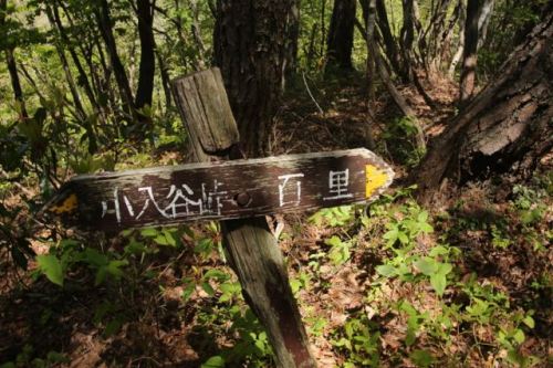
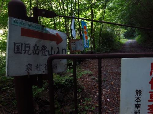
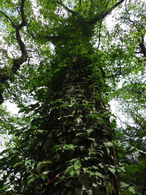
Just past the bridge we left the comforts of the prefectural highway and inched up a gravel forest road in a sorry state of disrepair until reaching a large gate permanently bolted shut. A gnarled metal signpost pointed the way to the trailhead of Mt. Kunimi, so we shouldered the packs and I led the way, using my GPS for guidance. We soon passed the old trailhead with a hand-painted sign indicating hikers to use the newer path a further ten minutes up the shuttered road. It was after 11am when we our first footfall hit the soil of the overgrown trail. but we pushed on with determined drive through a forgotten thicket of planted cedar that rose straight up the spur without a single switchback. Using both our hands and feet for purchase, we literally crawled up the mountain like lions on the hunt for antelopes.

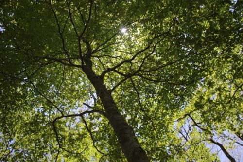
Fortunately we soon reached a junction where the old trail met up with the main trail up the mountain, and the angle eased somewhat, the evergreen army yielding to a healthier and more diverse forest of aged hardwoods and beech. We picked our way over, under, and sometimes around a collection of felled trees blocking the path at regular intervals. No one had come along to do trail maintenance in quite some time, but despite the physical hindrances we made remarkably good time up the spur towards the ridge.

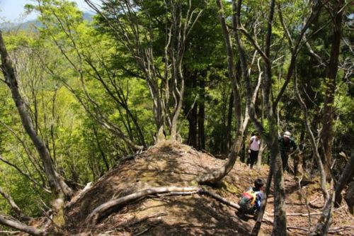
The forest thinned out once we breached the 1500 vertical-meter mark, replaced by patches of wild grass punctuated by shards of granite rock anchored in place by towering columns of beech and hemlock. We climbed in a unison of smiles and delight, spellbound with the stark beauty of an island otherwise dominated by active volcanoes. Indeed, this mountain range seemed out of place, as if transplanted here from Shikoku by Izanagi in a fit of jealous rage.
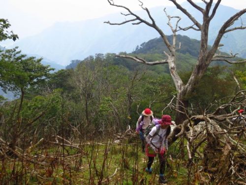
The spur eventually converged with the north-south ridge trail, marked by a sign indicating that the summit was only a five minute stroll away. So much for a leisurely walk along the ridge. A full traverse of the range is a preferred alternative to our rapid up-and-down assault on the mountain. The vistas towards neighboring Mt. Eboshi were blotted out by a bank of cloud, but through gaps in the mist to the north we could catch sight of the peaks of Miyazaki Prefecture. In fact, we were sitting directly on the border of the two prefectures, though Mt. Sobo, just twenty meters higher, lays claim to the highest point in Miyazaki.

Under a cool, refreshing breeze we enjoyed our boxed lunch and shared our love of Japan’s mountains. My companions were all surprised to hear that I had finished scaling all of the Hyakumeizan and that I was attempting to touch down on the highest point of every prefecture. Their faces beamed with delight upon the news that the highest mountains of Saga and Fukuoka were still on my to-do list. “Let’s do them for sure,” claimed Tsubasa. It was here that I realized with the proper support and encouragement, these 47 mountains could indeed become a reality.

Keiko spotted something out of the corner of her eye, injecting a single word into our jubilant conversation that had us craning our necks for a view. “Mogura“, she shouted, pointing in the direction of a nearby rock formation. We turned around just in time to see the elusive Japanese shrew-mole poke its head out of its hiding place before ducking back down for cover. It was my first and only time to see the primarily noctural animal up close and personal.

Only when the clouds moved in and completely blotted out the views did we reluctantly retreat back to the warmth of the forest canopy. Instead of heading directly back down the way we came, we opted for the left fork along the old trail that was marked as “dangerous”. True to form, the path petered out at the top of a rocky precipice with no clear way down. Backtracking a bit, we dropped off the ridge and opted for the cedar plantation. We carefully picked our way through the maze of toppled trees, trying to halt the pull of gravity against our fatigued bodies and minds. It was sweaty, exhausting work, but eventually we did pick up the remnants of the path at the bottom of the cliffs and dropped back down to the forest road. Future hikers would be best served by heeding the warnings and sticking to the safety of the newer path.

As promised, on the drive back we stopped off at the suspension bridge to stretch the muscles and to test our acrophobia. The bridge swayed under our weight as we bounced uneasily along the concrete footbridge. It was all in good fun, but we definitely knew that it would not be a good place to loiter in an earthquake. Fortunately, such seismic events were still a few years away from becoming a horrifying reality. As news of the powerful temblors reached the masses, the first people I contacted were my trusty trio of Kumamoto companions to make sure they are ok. With such devastating destruction, I fear that it may be quite some time before another hiker is allowed the privilege of setting foot on the roof of Kumamoto, and for that I feel both lucky by our timing and heartbroken by this new reality.