Feeds:
Posts
Comments

Archive for the ‘Nagano hikes’ Category

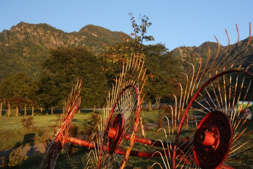
Snow country. The land that gets up to 20 meters of snow in a single season. So why is the ground bare, looking closer to late April than the height of winter? Could this be the new norm? The ski resort owners sure hope not. Visitors to Hakuba are a fraction of what they normally are, and the locals cannot recall a time when there was such a scarcity of snow in late January.  What am I going to do with these snowshoes?

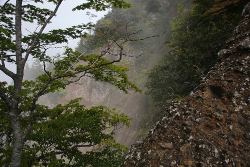
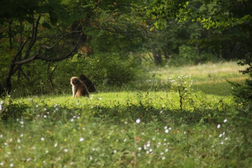
So are the questions I am left with upon my latest inquest into Minami Otari village in northern Nagano. My last trip here was during the brilliance of the autumn foliage, but now everything is a tepid hue of brown, fallow fields just calling out in desperation for a warm coating of fresh snow. Paul D. lives high up in an isolated tract of land just steps away from the mountain wilderness. Bears are a frequent sight, especially in the unusually warm autumn, when the persimmon tree directly in front of his house played host to a bear feasting on the mother lode. The woven net of the ursine feeding platform is all that remain in the upper branches, while a series of claw marks down the main trunk of the tree give further proof that this is prime black bear habitat.

An evening of festive revelry ensues over the steam of the spicy hotpot, with fellow mountaineers engaged in a fierce match of name-that-tune that spans decades of sonic wisdom. We all retreat to our sleeping quarters shortly after midnight, grasping extra wool blankets to stave off the chill. Morning comes much too quickly in these parts, and after a quick breakfast of hot sandwiches we pile into Naresh’s car for a short hike into the backcountry. Paul informs us that it is a steady hike of 2 hours to reach the ridge line, where panoramic views await all that put in the effort.

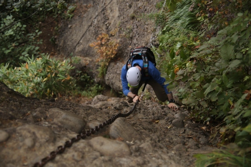
A modest base of 50 centimeters covers the shoulder of the road as we strap on the snowshoes, following a set of backcountry ski tracks as they wind their way up a lonely forest road. The Kita Alps are draped in early morning cloud in an otherwise brilliant dome of crystal blue skies. With hardly a breeze to be felt, we strip down to our base layers as the sweat begins to trickle down our temples. We each settle into our own pace, some chatting while others fixated on the soft light filtering through the bare canopy above. Often times I tune out everything all together, reaching what I call a ‘tozan trance’ and focus only on the synchronization of my footfalls and trekking poles working in unison. I can cover a lot of ground if left to my own devices, but with 5 others in tow I snap out of my zone and soon allow the others to catch up.

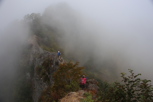
We eventually catch up to the group of skiers, who are indulging in a leisurely break about halfway up the peak. A local group led by the village soba shop owner, we chat briefly before pushing on further up the ever-steepening spur towards the ridgeline. Hisao informs us in the morning that he would like to be on the road by 2pm, but it is lunchtime by the time we do breach the ridge, where panoramic views from the summit plateau of Mt Ōnagi send us screaming for joy. Hisao abandos his plan for an early start on the highway in favor of taking in the incredible scenery set out before us.

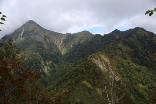
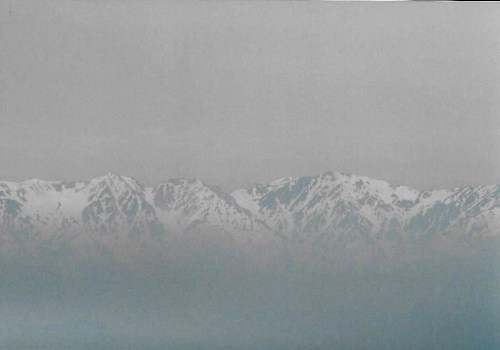
Mt Amakazari rises abruptly from a valley just below us, looking absolutely breathtaking when cloaked in wintry white. To her right, Mt Tenguhara’s broad flank dominates the ridge, blocking out the rotund forms of Yakeyama and Hiuchi beyond. Continuing clockwise, the unmistakable bulbous knuckle of Mt Myōko pokes it head out to say hello, while further along the unobstructed view both Takazuma and Togakushi dominate the eastern horizon directly opposite our vantage point. And these are just the meizan in the immediate vicinity, for to the west lie the mighty peaks of the North Alps, with Yari looking truly in-spire-ing from our unobstructed perch. Although Kashimayari and Goryū are playing hard-to-get, Shirouma, Yukikura, and Asahi stand proudly, flexing their snow-capped muscles in the bluebird mid-winter skies. Up here, away from the mild temperatures of the valleys below, we walk on a 2-meter base of snow, mesmerized by the shimming waters of the Sea of Japan coastline due north.

The summit is home to a modest emergency hut with an observation deck on the roof. We take turns jumping off the roof into the deep powder, feeding off the adrenaline rush of free falling briefly before sinking into our soft cushion of snow. The structure takes on a much different feel from the summer season, appearing at just a fraction of the height due to the snow accumulation. We easily loiter on the summit for an hour, basking in the sun and truly appreciating such weather that only comes a few times a winter. The walk back down to the car is most exciting, for the snowshoes allow us to create our own paths through the deep snow while crisscrossing the various ski and snowboard tracks down the softened southern face. We reach the car shortly after 3pm and are still on a high from the enthralling scenery above.

Mt Ōnagi may not appear on any list of venerable mountains, but it has won a place in our hearts. It just goes to show you that you need not be bound by compilations of famous mountains and ‘must climb’ peaks dictated by others. Simply look at a map, find a knowledgable local, and hit the trails in search of Japan’s hidden beauty.


Read Full Post »

At 6am on a bright sunny Saturday in mid-September, the planets aligned and the stars converged on Togakushi kogen for a meeting of the mountaineering minds. Rie and Paul set up camp next to my alien-green spaceship as Yuta and his companion dropped off their intergalactic hovercraft in a vacant docking station. Excess gear was safely stowed as the explorers donned their space helmets and jetpacks for the journey of a lifetime.

tog11

Yuta’s party started out ahead of us, since they were teleporting themselves up the impossibly steep slopes of Mt. Takazuma. Rie, Paul and I  ducked into the forest just behind our camp for a gentle 3 kilometer warm-up through untouched forests of beech, fir, larch, and other hardwoods. At one point, around 10 minutes into our mission, we spotted an ancient tree towering high above the forest floor, the branches spreading in all directions like a natural manifestation of Avalokiteshvara. Something about that tree really struck me, but I couldn’t put my finger on it. All of us commented on the sheer size and beauty of the tree, wondering how long it took such a structure to reach maturity. We continued on a couple of meters before hearing the unmistakable sound of breaking tree branches, followed by a dull thud. Apparently, a black bear had been enjoying a quiet breakfast in that very tree until our voices startled it enough to flee. Though neither of us had seen the creature, we were all sure of exactly what it was. From that point on, we needed to be a bit more receptive to our earthly surroundings.

tog1

Our unexpected encounter did have one advantage: the adrenaline surging through our blood had suppressed the fatigue and drowsiness, two things we did not need interfering with the concentration required on the impending climb. The forest gave way to a plantation of larch before spitting us out in front of a thatched temple gate marking the entrance to Togakushi shrine. This area used to be home to a large temple in the Tendai sect of Buddhism until Shinbutsu bunri put an end to that. Mt. Togakushi was, for centuries, one of the biggest training grounds for Tendai monks outside of Hieizan. Unlike the marathon walkers of Mt. Hiei, the monks sought enlightenment by scaling the near vertical walls and meditating in hidden caves dotted throughout the area. Nowadays you’d be hard-pressed to find even a monk, let alone a white-clad yamabushi. A row of giant cryptomeria line either side of the gravel approach to the main shrine building. Imagine the Daimonzaka trail at the Kumano Kodo on steroids.

tog2

Just before the main shrine building, the trail to Togakushi split off to the left. We entered the forest and immediately started the steep climb up a spur to the ridge. The first 30 minutes were fairly easy to manage, until the path reached the base of an enormous cliff face. From here, the route turned west, skirting the edge of the igneous wall with nice views across the forest canopy to the slopes of Mt. Iizuna. The path disappeared into the cloud dangling directly above, and once around the largest of the rock formations, the real climb commenced. A chain dangled from the top of a stone tower hidden by the cloud as Rie grabbed on and heaved herself up. The network of chains increased as we literally pulled ourselves up from the forest clinging tightly to the rocky terrain. Fortunately the chains weren’t in a continuous strand: after a long chain section there was usually a relatively flat area to traverse through before reaching the next rock formation.

tog5

Higher up the boulder maze, we reached a long section of nearly vertical rock face, pockmarked from the ancient volcanic forces that thrust the entire mountain range towards the sky. Rie led the way, shouting from above that the section was ‘taihen‘. Once she safely topped out, I lunged forward, grabbing the chain in my right hand while grasping the left onto any cankerous protrusions of crusted rock. The legs did their best impression of the Harlem Shake during the 40-meter scramble. Once on top I collapsed in a heap of perspiration and fatigue. I turned around just in time to see Paul standing perched on a precarious ledge, left hand outstretched in an improvised attempt at a selfie. His confidence with heights had Rie and I salivating with envy. At the top of the next scramble the path flattened out, narrowing to a scrawny backbone of a ridge that was marked on the maps with a danger symbol. The ridge, if you could call it that, was crumbly and barely the width of a balance beam in spots. The best approach was straddling the beast like a bucking bronco:  a time when form definitely followed function.

tog3

Paul walked gallantly on some of the more exposed sections, a true testimonial to those long hours on the slackline put to practical use. Rie and I scooted along behind our acrobatic master like two ducklings following their brave mother across the Hoover Dam. Fortunately the knife-edge eventually gave way to solid, tree-covered soil and it was simply a matter of hoisting ourselves over a duo of chains before popping out on the meter-wide catwalk of the true ridge itself. We used the extra space to sprawl out and catch our breath, hoping the fog would lift enough to actually see our approach route clearly. After ten minutes we gave up and turned east along the rolling contours of the high ridge. There were plenty of ups and downs on the jagged spine of the mountain, but eventually we topped out on the official high point, congratulating ourselves with a well-earned summit snap.

tog7

The further east we traversed, the better the visibility, as the fog lifted completely and afforded unobstructed views into the forests we had trudged through earlier in the morning. To the north, the pyramidal mastiff of Mt. Takazuma poked its head out of the condensation bank to offer a jovial greeting. Paul and I snapped away, trying to capture the scenery with our lenses while Rie trudged along ahead at her own brisk pace. Cliff faces tinged with autumn hues rose triumphantly towards the azure sky like soldiers saluting their major general.

tog8

Though fatigue was slowly taking hold, the warm sunshine brightened our spirits during the ramble along the undulating ebbs and flows of the uplands. An hour after breaching the ridge, we passed our first hikers of the day: a husband and wife team that had started out nearly an hour before us. A bit further along, a middle-aged Japanese hiker drenched in sweat approached us, offering a greeting that took us a bit aback. “Are you with Hiking in Japan?”, the mountaineer inquired. It turned out to be Toshi, one of the members of the Facebook community who had driven up from Matsumoto in order to join us for dinner at the campsite that evening.

tog9

The track lost altitude quickly, bottoming out at a saddle marked by an emergency hut whose construction was fit for a bomb shelter. It was here that we found Rie chatting with Yuta’s party who had just successfully descended from Mt. Takazuma. I remember this emergency hut with fond memories during my own snow-capped, adrenaline-laced summit of Takazuma during my Hyakumeizan quest.

tog4

With five people now in our party, we descended the steep gully which wound its way past a couple of waterfalls before eventually spitting us out into the cow pastures of Togakushi farm. Again, Paul and I found ourselves captivated by a troupe of wild monkeys as the others pushed ahead, anxious for a hot spring bath to wash away the volcanic filth. We couldn’t pass up an opportunity to hone our wildlife photography skills, even if they were on some very uncooperative subjects.

tog12

Once back into civilization, we spied a cafe serving pizza made from buckwheat flour. We plopped ourselves at one of the outdoor tables and split a pizza while each ordering a dish of yaki curry, a dish that can only be described as an improvised version of gratin, but instead of baking a pot of potatoes and cheese, the basin was filled with curry and rice. When those steaming ceramic bowls of furnace-temperature curry were delivered to the table our eyes nearly bulged out of their sockets.

Perhaps we overdid it a bit on the carbs, but an epic climb deserved an epic reward. Once back at camp we met up with the rest of the Hiking in Japan members (a full report can be read here) and round two of the festivities commenced. Togakushi was a mountain definitely worthy of our attention, and I could finally check that mountain off the list despite two earlier aborted missions. Now it was time to turn my attention to the rest of the peaks surrounding the idyllic crater basin of the Togashushi Highlands.

tog10

Read Full Post »

The overnight bus from Osaka to Nagano may be convenient, but the cost savings are offset by the lack of comfort and relaxation that the train provide. I arrived at 6:45am with heavy eyes and a heavier set of gear. Fumito was waiting patiently, having driven up from Shiojiri in the pre-dawn hours of a clear June morning. We turned the car southeast, past the quiet streets of Ueda and into the pasture-lined highlands of Sugadaira, the starting point of our goal of Mt. Azumaya, a gentle twin-peaked summit straddling the border of Nagano, Niigata, and Gunma Prefectures.

azumaya1

As we reached the start of the hike, an elderly lady sat in a folding chair directly in the middle of the narrow dirt lane, explaining that we needed to fork over 400 yen for the privilege of parking our cars there. Yet another local trying to cash in on the popularity of the 100 peaks. We reluctantly handed over the modest fee, knowing that it would at least protect us from slashed tires if we tried to park illegally. The path skirted the edge of a expansive pasture home to the milk-squirting bovines that made Sugadaira so renowned throughout the archipelago. After leaving the grazing grounds, we ducked into the forest briefly before reaching the summit plateau dotted with igneous boulders. Snaking through this pumice maze towards Mt. Neko, the views behind us opened up to reveal an unobstructed stretch of the entire Hida mountain range. It was as if the Kita Alps were strung out on a gigantic clothesline to dry in the soft light of early summer.

azumaya2

Though the views were enthralling, they were diminished somewhat by the aeolian haze hanging heavily over the Shinshu lowlands, making it appear like a smudged Bob Ross painting. Regardless, we could just make out Yari’s spearlike point still lathed in a cloak of wintry white. Fumito and I reached the summit of Neko a short time later, which offered our first vistas across a narrow depression to the taller pinnacle of Mt. Azumaya. We followed a thin snow-veiled spine before dropping through a meadow and back into a vast forest rising dramatically up the other side. As the grade increased, we grabbed tree branches, roots, foliage, and anything else we could find to assist in our anti-gravitational swim through the rotting snow.

azumaya3

Thirty minutes into our sweaty effort we reached the summit ridge, turning left for another quarter of an hour until topping out on Azumaya. Mt. Asama rose dramatically across a valley of low-lying cloud, still spitting volcanic gas and ash from the 2004 eruption. A modest weather-beaten shrine sat directly on the constricted rock outcroppings of the high point, so after a brief lunch, we prayed to the mountain kami for safe passage back to the trailhead.

azumaya4

Descending back to the junction, we continued straight on towards the less prominent peaks of Naka-Azumaya and Ko-Azumaya through an area of rustling rhododendron and savory mountain sakura still in bloom despite the early-June humidity. The trail led us into a dense forest of oak, beech, and birch sprouting their fresh vibrant folioles. The woods once again gave way to pasture-land which we followed back to our awaiting car. Before setting off, Fumito and I partook of soft serve ice cream made from the fresh milk of the cattle next door. Azumaya was peak #49 on the list, and we joked about being able to knock out another peak before our day was done. Flipping through my guidebook, I realized that Kusatsu-shirane, a peak that we had to turn back from in the winter, was just a short drive away. When I broke the news to Fumito, his face lit up like a child opening a birthday present. “Let’s go now,” he shouted, as we raced back to the car in a passionate pursuit of revenge.

Read Full Post »

Long before the transport ministry burrowed a giant tunnel through Naka-no-yu hot spring, there was only one way in and out of Kamikochi. The path lie in the east, through the quaint village of Shimashima, along a fork in the Azusa river that led to a small gap between Mt. Kasumisawa and Mt. Chou called Tokugo pass. Walter Weston was perhaps the first foreign face to set foot upon the plateau, whose depiction is recorded in a diary entry from the summer of 1891:   “The view from near the highest point of the pass is one of the grandest in Japan, so entirely does it differ in character from the ordinary mountain landscapes with their rounded outlines and verdure-clad slopes.” One mid-September morning, I set out with several members of the Hiking in Japan Facebook community in search of Weston’s lost view.

Tokugo1

On the flat, 3km walk from Konashidaira campground to the junction at Myojin hut, I set the stage by demonstrating my regular flat-ground walking pace, which my trusty companions watched with reserved envy. On challenging hikes I opt to cover as much of the easy ground as quickly as I can. A 5 to 6 km/h average walking speed is not entirely unheard of. As I rested outside of Myojin, Michael strolled in a minute or so behind me. Out of the rest of the members, he was the only most likely to keep pace for the remainder of the hike. Miguel, Naresh, Tomomi, and Baku each filed in one after the other, eager to enjoy the scenery as much as each other’s company. I’ve done that stretch of forest nearly a dozen times over the last decade or so, and the anticipation of possibly setting foot on some of the same stones Weston left his heel-print on was too much to bear.

Tokugo2

Michael led the way along the forest road that paralleled the swift moving mountain stream. In Weston’s time, the entire route most likely darted in and out of this water source, over weather-beaten boulders and snow sculpted waterfalls. I slowed up the pace, but once in the zone I knew that fighting my momentum would only expend more energy than necessary. That’s one of the main reasons why I never hike in big groups and also why I could never become a mountain guide: patience is one virtue that never stuck with me. To my utter surprise, our pace setter Michael had disappeared into the forest, long out of reach from my regular climbing march. I soon found myself completely alone as the route rose through a conservative array of lengthy switchbacks. Every now and again the views would open up towards the valley from which we had started, only to be enveloped by the thick greenery of the lush deciduous canopy.

Tokugo4

After crossing several small streams, I reached a signpost that indicated only 800 meters of horizontal distance to the pass. I contemplated taking my first break here, but one look at the altimeter had me rubbing my eyes as if I had seen a desert mirage: 2030 meters! The pass lay only 100 vertical meters above, and it would have been futile to rest when my goal lay so close at hand. I hit the high point about 10 minutes later, where a small flat area crammed with tents beckoned me closer. To the left, a small, red-roofed hut sat nestled on the Shimashima side of the pass. Middle-aged hikers milled about, led around by a thin-skinned tour guide who barked instructions to the two dozen customers who monopolized every available rest space. If this guide ever tired of his profession, I’m sure he could easily get a job as a JR train conductor for his love of unnecessary announcements. Yes, a 1:45pm departure, you say? Please remind me thirty more times over the next two minutes. My headache is forever grateful.

Tokugo5

I found Michael seated at one of the benches, and after a quick refueling, we searched for the million dollar view that Weston had touted in his book. A small sign in the campground pointed to a lookout point only 45 seconds away. We reached a small clearing, where a young woman with a bandanna on her head stood, hand outstretched, with her cell phone searching for reception. It turns out she worked at the hut, and this lookout point was the only place on the mountain where you could actually get coverage. Turning towards the west, the towering spires of Mae-hotaka demanded our attention.

Tokugo6

From this vantage point, it appeared as if the mountain gods had thrust a giant spear into the earth, severing the landscape into a creepy craggly chaos. I now understood what Weston was talking about. Imagine laying your eyes on the Hotaka mountains for the very first time from this vantage point. Weston describes it best:

“With the broad white pebbly bed of the Azusagawa sweeping round its southern foot, the tall form of Hotakayama rises before us face to face. The highest granite peak in Japan, 10,150 feet above the sea, its towers and pinnacles, that spring from ridges seamed with snow, give it its picturesque name, ‘the mountain of the standing ears of corn.’ Northwards a great arete connects it with Yarigatake, whose monolithic peak is yet hidden by intervening wooded heights, but as we descend a little to the left a fine view greets us of the pyramid of Jonendake standing due north of our pass and separated from it by Chogadake and Nabekamuriyama.”

Tokugo7

The descent that Weston speaks of is a little mystifying, as the trail climbs towards the left from the lookout point towards the tree-covered summit of Junction Peak. Perhaps the original location of the Tokugo trail was a little higher up or a bit further to the east?

Tokugo3

As much as I had wanted to descend the other side of the ridge and out to Shimashima, our campgear and fire awaited us back at Konashidaira. One day I will embark on the full 20-km journey from Shimashima to Myojin up and over the great Tokugo divide. Until then, I’ll just have to keep chasing Weston’s faded footsteps over Japan’s long-forgotten routes.

References

Weston, Walter. Mountaineering and Exploration in the Japanese Alps. London: John Murray, 1896

Read Full Post »

With the oppressive heat of summer now in retreat, I reconnected with my new-found friend Fumito for our first overnight outing together. As you may recall, the budding mountaineer saved me from the elements on Ontake, so it was time to repay the favor by showing my new kohai some of the hiking basics on Tokyo’s most popular alpine playground, Yatsu-ga-take.

yatsu1

I boarded a late afternoon bullet train to Nagoya and jumped on the Shinano Limited Express train, which was starting to become my regular commute to Nagano’s air-deprived highlands. Fumito met me at Shiojiri station, and after a relaxing meal, he smuggled me back to his company dormitory so I could stealthily crash the floor of his room. We had set a departure time of 5am, which offered us the best chance of avoiding his managers and potential punishment for letting a regular folk into the private housing unit.

yatsu2

Fumito and I coasted down the Chuo expressway, stopping for a quick rest at Lake Suwa before navigating the vehicle to the gargantuan parking lot that marked the trailhead entrance at Minoto. I’ve seen my share of large parking lots before, but this one looked as if it was surgically transplanted directly from the Carrier Dome. Scores of hikes stood in circles, methodically stretching their muscles in synchronized unison. Do these mountaineering groups choreograph these warm-up stretches at their monthly meetings? Is Gregory Peck somehow inolved? There was a 1-hour walk on a paved road just to reach the start of the trail. Wouldn’t this suffice as a warm-up? We sure thought so, trodding up the gravel path through the shaded forest towards Akadake hut. Despite the name, the hut is nowhere near the summit of Yatsu’s highest peak, but perhaps this was the first hut built in the area, so it could choose whatever name it wanted? The hut names seem to suggest this unspoken pecking order, with the hut directly below the summit of Akadake aptly named “Mt. Aka Summit Hut”. How does that account for the hut at the end of the valley, Gyoja-hut, whose name translates as “pilgrim”. Did the shugendo practitioners of yesteryear use this as their base? A lot of questions needed to be answered, so we wasted no time in continuing our investigate traverse.

yatsu3

It took a couple of hours on a long gentle path to finally reach this pilgrim hut, which was surrounded by more people than I’d seen on any mountain sans Tateyama and Mt. Fuji. Scores of walkers milled about, polishing off their early lunch in the brilliant sunshine. Fumito and I settled on a bare patch of dirt, since all the picnic tables were occupied by chain-smoking fogies, families kitted in matching gear, and other random groups of outdoorsy types. Despite scaling over 30 of the 100 peaks, children were a first for me. Sure, I ran across a few in Tateyama, but those groups took the bus there. These elementary-aged kids had to walk in with their parents! So is this where the Tokyoite families take their kids to enjoy nature? Are these guardians going to drag their kids up Akadake as well?

yatsu4

I popped in the hut to inquire a little about the history. “Yes, there have been Esoteric Buddhists here since the Kamakura era”, noted the hut manager, a soft-spoken white-haired gentlemen who looked as if he’d seen his fair share of days above the tree line. “In fact, there used to  be a temple where we are standing.” The first mystery was solved. Now it was time to investigate the areas with thinner air and rockier profiles. After tucking our heavier camp gear behind the hut, Fumito and I hopped up the Jizo route to the start of the alpine ridge. Once we hit the spine, we turned right, following the paint marks and increasing crowds towards the crest of the rise which marked Akadake’s summit. The going was slow but steady, with a bank of cloud on our left to help keep us company. A small, weather-beaten shrine greeted us on the plateau, along with a smaller hut which would not have looked out of place on Mt. Fuji herself. The vantage point from the top is immense, or so I’m told. The cloud cluster swarmed us as soon as we topped out, cutting off the views towards Japan’s highest peak to the east.

yatsu5

Down the other side of Aka we skated, grappling the chains as if repelling into an unexplored abyss, which in our case was a thick blanket of grey condensation. Shortly above Naka-dake we broke out of the cloud line, overtaking a father-and-son team whose abseiling techniques baffled the mind and could probably be considered a form of abuse in most industrialized nations. The middle-aged father took the lead, escorting his 5-year old son along the knife edge ridge on a makeshift lead. The rope nestled the child’s waist as the man grew more and more impatient with the toddler’s ever-slowing progress. What did this failure of a father figure expect? His son to be jumping from boulder to boulder as if at the local neighborhood playground? I encouraged the young one as best I could while glaring at the irresponsible guardian. If I were the father I would have picked up my child and carried him the rest of the way off the peak, but perhaps this was one of those “toughen up” lessons for the kid. I’m pretty sure this boy will grow up with a nightmarish hatred of the outdoors in the future.

yatsu6

After hitting the col below Nakadake, Fumito and I raced up to the summit of Mt. Amida, our second peak of the Yatsu range. The cloud once again hung thick to the bald summit, as I said a silent prayer for the climbing party that had perished on the summit the previous winter. Yatsu is well-known for its winter climbing opportunities but they don’t come without a price. Every year a handful of hikers leave Tokyo for a weekend jaunt only to return home in a 90 by 230 non-porous sack.

yatsu7

Once back at Gyoja-hut, we retrieved our bulky kit and awkwardly stumbled to Akadake-kosen, our sleeping ground for the evening. Just after setting up camp, the hot spring baths of the spacious hut were joyfully explored. What relief to aching feet do such luxuries provide. I was now beginning to see why half of Tokyo come out here on the weekends. Dinner was cooked under the gently fading light as Fumito and I got to know a little more about each other. He was born and raised in Kagawa Prefecture, moving to Nagano a couple of years ago to work for Chubu Electric Co. Ontake, where we had met just a few months prior, was his very first hike. Unlike other inexperienced hikers, who opt to join costly outdoor clubs or team up with experienced mountaineers, the 24-year old male took the initiative and headed to the hills alone. That takes a lot of guts in a society that prides itself on group thinking. I could feel our friendship growing closer, especially when taking out a half-frozen chicken breast from his well-wrapped food supply !

yatsu8

That evening, I popped out of the tent at irregular intervals. The air, calm as a sleeping child, lay still while the stars put on a brilliant celestial show. The outline of the higher peaks above drew a black line across the sky, the lights of Kanto beyond. Lights flickered from neighboring tents, complementing the chitter-chatter of late-to-bed campers keeping beat with the camouflaged crickets of summer. The attraction of this tranquil valley continued to stick like an invisible magnet: this was yet another reason why the people of Kanto come in droves. Access and convenience is one thing, but beauty and serenity eclipse all else.

yatsu9

Shortly after 3am, Fumito’s alarm sounded. Breakfast consisted of a few morsels stuffed in our day packs: we had a sunrise date with Iodake, and wasted no time in our ascent. Headlamps donned, we dashed through the forest like a lost fawn in search of its mother. Shortly after leaving the hut, we spied the red tape marks on the right side of the trail, following them until they reached the base of a monster rock formation. Skirting along the right edge, a large gully presented itself and beckoned us in. Through the maze of boulders a route became apparent, though it certainly was not the main path to our destination. We had ventured off trail, but decided to go with the flow anyway. A series of near vertical cliffs awaited. This would be tricky without ropes, but the glow on the horizon provided enough of a light source to show the areas we should avoid. A climbing route this most certainly was: perhaps one of the famed ice climbing routes that attract the more dedicated ice axers. Spotting a gap in the rocks, I popped out just below the main ridge, startling a rather large kamoshika, who stood there and stared on like a caretaker discovering two fearless trespassers. It was my first encounter with the elusive Japanese mountain serow, a cross between an antelope and mountain goat, though this one had the body of a wild boar. The creature moved on while I assisted my companion with the final 50 meters to the ridge. We had topped out at the base of a candle-like projection. To our right, behind a knee-high rope, lie the real hiking path. I later found out that our torch-shaped pinnacle was no other than the Shodoshin, seen in the right part of this photo. In the dark, we had somehow avoided the Daidoshin and found the only non-technical climbing route in the area. The mountain gods were truly watching over us.

yatsu10

When we finally reached the ridge, Mt. Fuji was there to greet us on the other side, though I expected her to be much bigger. Yatsu is still a distance away from the cone when compared to the Minami Alps, and most good shots of Fuji from the Yatsu range are done with zoom lenses, which present an optical illusion. That, coupled with the smog of a rising day, ensured that everything but the tip of Fuji lay obscured in haze. Turning left, we shot up and over Yokodake, along the ridge, and down to the saddle and shrine just below Io. After reaching the summit of Io, we looped back around on the real trail back to our campsite. How we veered off this nearly two-meter wide trail I’ll never know, but I blame it on the altitude and sleep deprivation. Back at camp, we prepared a more substantial breakfast before breaking down camp and heading back to our awaiting car.

yatsu11

On the drive back to Shiojiri, I suggested we stop by Utsukushi-ga-hara so I could knock another peak off the list. Fumito slept in the car while I jogged past the cows with nothing more than a pair of sandals. In spite of initially planning to summit only Akadake, we had managed to climb 4 of Yatsu’s 8 prominent peaks. Someday I hope to return to finish off the remaining four, if I can only figure out a time to go when the crowds are at their most manageable.

Read Full Post »

The snow-capped perfection of Ontake’s curvy volcanic form was too much to pass up. Standing on the summit of Mt. Ibuki last month, my eyes were immediately drawn to the sacred peak. The snow cover was gently waning, and I’d be a fool to pass up the opportunity to scale the mountain before the onset of the rainy season. So in early June, I geared up for the train ride through Kiso Valley to Kiso-Fukushima, where I connected to the bus the popular trailhead of Ta-no-hara.

ontake7

Except for a few locals who got off along the way, the bus was completely deserted. The route wound its way through a massive ski resort, whose grass-filled runs lay dormant, waiting patiently for the snow to return for another season of abuse. Halfway up the switchback-obsessed route, the bus passed by a hill-climbing cyclist, who pushed through the incredible ascent with apparently simple ease. Either he exercises for the pure joy of it, or he must be training for a upcoming race.

ontake1

The upper half of Ontake’s majestic form sat in a thick blanket of cloud. Snow fields stretched from the concealed heights of the peak like a smudged Mondrian painting. A half a dozen elderly folks milled around the parking lot, unfastening gaiters from their early morning ascent. I guess most people are off the peak by late morning, but I knew my speed and fitness would not be a problem. It was the clouds I was worried about.

ontake2

After a quick prayer at the shrine, I passed through the flatlands and onto the steep slopes of the volcano, passing by an impressive collection of Buddhist statues standing firmly among the pumice boulders and deep red soil. These works of art were placed in regular intervals among the straightforward route, a testament to the importance of this peak for ascetic monks. On this particular overcast day, the mountain was mysteriously absent of the white-clad pilgrims, who usually fill the peak during the busy summer months. Perhaps it was because the sacred structures flanking the summit plateau were still sleeping in their deep snow drifts of a lingering winter.

ontake5

Somewhere around halfway up the long slog towards the 3000 meter mark, I heard footsteps quickly approaching from behind. As I turned around, I made eye contact with an energetic climber dressed in bicycle gear. It was the same cyclist I had seen on the bus ride up. Not only was he riding the hill to the trail start, but he was running up the mountain as well. Soon after passing me, we hit the first of many long snow fields, and it was here that the rain commenced. The athlete halted his footsteps and retreated, blurting out a quick “zannen” before vanishing back down towards the parking lot. My guess is that this climb is a weekly occurrence for him,and he wanted to hit the pavement again before the roads became too slippery. The rain didn’t stop me from advancing, however, as I forged a path up the gargantuan valley of snow until it disappeared into the mist.

ontake3

The rain only lasted about 10 minutes, letting up as quickly as it had come. I’m sure that cyclist was cursing his hasty decision, and I was half-expecting him to resume his hike, but I never saw him again. Once into deep cloud, the dirty white of the crusty snow meshed with the ghostly white of the clouds, and if it weren’t for the deep groove of footprints I never would have found my way to the ridge. Once at the summit of Otaki, the snow gave way to volcanic steam vents, which wore thick layer of sulfuric cologne. The shrine here was still buried up to the roof eves, but the final push to the summit lie on the wind-swept ridge, so navigation was a breeze except for the wafting aroma of rotten eggs attacking from all directions. The top of Ontake was home to yet more structures, which provide accommodation for arriving visitors, but only during the main climbing season. The doors were still boarded up, and the top lay deserted sans a few other hikers who had made the brave ascent in the dismal conditions. One such visitor stood out among the other elderly walkers: a young Japanese man out hiking along. Out of the two dozen Hyakumeizan I’d done so far, this was the first time (other than Mt. Fuji of course) to run into someone my age, so we immediately struck up a conversation.

ontake6.jpeg

He introduced himself as Fumito, a 24-year old originally from Kagawa Prefecture who had relocated to Shiojiri to work for Chubu Electric. I inquired about his choice of climbing routes, and it turned out he had started an hour earlier than me from the same approach: I very likely walked right past his car when disembarking the bus. Since I had no way of getting back to the station, I politely asked if he could honor my request. Gladly, he accepted, and both of us decided to descend together back down the same trail we had come up. My original intention was to traverse over to two small volcanic lakes lying just below the summit before making the long trek down to Nigorigo hot spring. There were two things inherently wrong with this idea: for one, I physically had no idea which direction the two lakes rested, since visibility in the thick fog was reduced to only a couple of meters. Second, the entire route on the northern face of the volcano was completely buried, with few hikers ever using that approach even in the summer season. I would surely get lost on the way down and even if I didn’t, I would have to negotiate some sort of ride out of the hot spring town.

ontake4

Fumito and I talked the entire way down, finally popping out of the clouds into unexpected sunshine. I told him of my quest to climb the Hyakumeizan, which he enthusiastically endorsed.  On the drive back to town, the skies opened up, dumping heavy rain that forced us to the shoulder of the road. Both of us praised our excellent timing, and I knew right then that I had made the wise decision not to do the traverse alone. Fumito dropped me off at Fukushima station, where we promised to go hiking again sometime soon.

Read Full Post »

“Don’t climb here!”, gruffed the man in charge. “There will be avalanches”, seconded his supporting officer. Fumito and I were truly busted by the ski patrol this time, climbing out-of-bounds on a 40-degree slope in mid-February. Despite our best intentions of avoiding the crowds, we were being forced back onto the ski slopes and into the path of reckless skiers and wobbly boarders. Thus was our introduction to Kiri-ga-mine, one of the easiest yet trickiest Hyakumeizan to date.

kiri1

Fumito and I unloaded gear in the parking lot of Kuramayama ski resort shortly before 10am on a cool and cloudy Saturday afternoon. We had spent most of the morning in route from Shirojiri city further north, and had plans to knock off our target peak while the hungry skiers filled the lodges for their mid-day beer fest. We kick-stepped parallel paths just to the left of the westernmost boundary of the ski resort, knowing that we were far more likely to be run over by an out-of-control skier than by an improbable snow slide. I’m sure the ski patrol meant well. Who knows? Perhaps they did save us from a frozen tomb of caked ice by huddling us onto the groomed slopes, but neither of us were thrilled at our impending obstacle course.

kiri2

“1, 2, 3 GO!”, I screamed, dashing across the open slopes in a well-timed rhythm in the narrow gaps between the meandering skiers. Fumito followed next, narrowly avoiding a shoulder clip from a goofy-footed boarder in an uncontrolled frontside tailspin. “Phew, that was close”, exhaled my companion. Too bad the ski patrol didn’t stick around to see why we were avoiding the open slopes. Fumito and I burrowed a path through a small family of birch trees between two of the busier runs, which provided just enough of a buffer from the surrounding madness. Nearing the top of the ridge, we cut toward the north, crossing another open run Frogger-style before ducking under the lifts for the final hundred meters to the highest point of the resort. From here, we slipped under the rope and into the welcomed solitude of Kiri-ga-mine’s overdeveloped summit. Dropping our gear, we fired up the stove and enjoyed the serenity that a fog-capped summit affords. The arctic gales drowned out the J-pop infused drones of the ski lifts, and if it weren’t for the gargantuan meteorological tower towering directly above us it could have easily passed for the alpine meadows of a European plateau.

kiri3

While Fumito was boiling water, I jumped around incessantly, trying to fend off the chills and keep the circulation flowing. It was easily 10 below zero without the bone-piercing gales, so the minute the water reached a boil both of us sprinted back down to the ski lift and enjoyed our lunch in the sheltered confines of a storage shed, which provided just enough warmth to make things tolerable. Refreshed and refurbished, we headed back into the elements, dropping out of the thick cloud cover around 100 meters into our smooth glissade. With gravity on our side, we had no fears of being bowled over by our standing competitors. We made incredible time sliding, hopping, and running down the slippery contours of the gentle peak and by the time we reached the car the sun had made a welcome appearance. Mt. Tateshina glowed brilliantly in the afternoon light and beckoned us to investigate. Fumito and I vowed to  each other to attempt the peak in March, a promise we later made good on. For now, however, the warm baths of Shirakaba hot springs would suffice.

Read Full Post »

Peak #40 loomed on the horizon as Andrew and I changed to the Limited Express Shinano train at Nagoya. The sun shone brightly for the 7:00am departure, a stark contrast to the cold rain of the previous day. Fumito was waiting at Nakatsugawa station with a car full of fuel and a big smile on his face, a mere 45-minute train ride from Chubu’s biggest city.

A few wrong turns on back roads had us retracing our path until we found the correct route to Misaka Pass. The narrow, windy road meandered through a large cedar forest, where we passed by a procession of yamabushi (mountain priests) marching their way to a sacred ritual. Arriving at the trailhead, our eyes nearly popped out of our head when we set foot into a layer of fresh snow, the season’s first deposit of wintry gold. “Oh, boy”, I gasped, “here we go.”

The initial climb through a few centimeters of powder wasn’t too challenging, with ever expanding views of the Minami and Chuo Alps under a crisp blue sky. We soon found ourselves enveloped in a blanket of thick cloud, however, which not only dampened our spirits, but also dampened our clothing with frozen mist. Still, the three stubborn climber pushed on. After all, we’d made so much effort just to get to the start of the hike that it’d be silly to turn back so soon. After descending to a smaller plateau, the path snaked along the ridge in a chorus of ups-and-downs, each one progressively more difficult than the last.

The snow depth was directly proportional to our gradual rise in altitude, where the lack of crampons and gaiters grounded our progress to a crawl. Somewhere around the 1900m mark, my two companions gave up. “Go ahead,” explained Fumito. “You’ve got a mountain to climb.” Alone, I forced my way up the ever steepening path, kick-stepping and grabbing onto whatever plant-life supported my weight. I’d been in such predicaments before, but never so early in the season. Alas, I reached the top of the pass and the true ridge line of Ena’s horse-like figure. Just another few meters.

The few meters of climbing morphed into what seemed like an eternity on the stunningly picturesque spine. I soon reached an emergency hut, followed quickly by the tree covered summit of Mt. Ena. After a quick proof shot, I sought shelter in the hut and forced some peanuts and water into my dry mouth. Shivers reverberated through my body as the sweat of the climb caught up to me. I was losing body heat faster than I could retain, which only meant one thing: keep moving!

Ill-equipped for the conditions at hand, I retraced my steps back to the pass and slid rather awkwardly back towards the trailhead. After 45 minutes of rushed scurrying I once again caught up with Fumito and Andrew, who were edging their way past one of the many precarious traverses. “We were beginning to worry,” confessed Andrew, who had a belly full of warm noodles thanks in part to Fumito’s brilliant decision to abandon the summit attempt. Sometimes it’s best to just count your losses, but such things never occur to stone-headed peakbaggers.

In the late afternoon light, the trail gradually became a mud field, as we were beginning to descend below the freezing point and out of the clouds. By the time we reached the car, most of the snow had either evaporated or made its way into our shoes, socks, and pant legs. Fumito fired up the stove beside the car as Andrew and I pilfered through our gear searching for something dry to change into. The three of us, having safely descended, made a vow to never be caught off-guard in October again. Promises that were surely made to be broken.

Read Full Post »

In two weeks time, the rainy season would be here……or would it? Hiking in June is always a bit of a gamble, so when fair weather presents itself, I usually stop whatever I’m doing and head to the hills. So goes my attempt at mountain #81 – a peak whose Chinese characters translate as ‘covered in rain,’

ama1

The train rolled into Minami-otari station shortly after 11pm. The station was deserted as I fiddled through my pack for the phone number of the taxi company. Fortunately, someone answered the phone and sent a taxi my way, saving me the long, monotonous stroll up to Otari-onsen. “The road’s closed beyond this point – you’ll have to walk from here”, remarked the driver upon dropping me off at a large barrier put across the road. I walked in silence for over an hour on the desolate forest road, hoping no creatures would come out in the night to size me up. Arriving at the trailhead around 1am, I scoped out a place to sleep
for the night. As luck would have it, there was an unlocked rest house with a wooden table and a clean concrete floor at the end of the parking lot. I settled in for a cozy nap.

My alarm rang much too quickly for my liking, but my eyes perked up while peeping outside for a look at the weather. Although it was still too early to tell, the calmness of the air suggested that the weather gods would be kind to me. Breakfast was leisurely devoured while poring over the map: an 800m elevation change over around 5km of hiking. Much easier than my epic ascent of Mt. Takazuma a few weeks earlier. The sound of voices broke my silent planning, as I looked up to find several minivans disgorging day hikers. “What?”, I screamed. Where they came from I had no idea, but I wasn’t about to share the trail with an enormous group of retirees, so I stuffed the map and breakfast into my sack and quickly escaped into uncharted territory.

ama3

The trail quickly dropped into a vast marshland, with endless rows of mizubasho in full bloom. Here I was, completely alone, traversing through an area of pristine beauty that gives Oze a run for its money. Seriously, if you’re turned off by the crowds in Oze, I highly recommend coming here during on any morning in early June. This was definitely bear territory, as I lauded my decision to rest at the trailhead instead of attempting a night assault. The marshlands eventually gave way to a spectacular virgin forest of fir and beech trees, with a floor still buried under a deep layer of snow. Amakazari becomes a human traffic jam in the autumn, as hikers shove elbows for a glance at the vibrant foliage, but on this sunny Sunday in early June it was mine, all mine.

ama4

Even though I had the entire mountain to myself, I kept a steady pace, constantly reminding myself that I had a very large group ascending somewhere behind me. Arriving at Arasugesawa, I caught a glimpse of the rocky summit rising high above me, to my left. All I had to do was descend down into the gully, up the other side, and climb up the massive shoulder to the ridge.

ama5

Traversing through the gully proved more challenging than expected, as each step loosened the snow enough to send trees popping out of the snow beneath me. The first tree that popped up nearly gave me a black eye, so I did my best not to set off any more ‘land mines’. I wasn’t exactly sure where the trail went, but I was pretty sure it didn’t climb directly up the cirque. Sure enough, the trail continued straight on and I was climbing up towards the summit on a snow-free ridge after a steep, nasty slog. I passed by a pair of trail junctions but still didn’t run into anyone else. It looked like I’d be the first one to summit that day.

ama6

Once on top, I said a quick hello to Mt. Asahi rising up in the distance across the valley. Mt Shirouma was slyly hiding under a gentle blanket of cloud, while Mt. Hiuchi looked on with envy. I could finally rest on the small summit and finish the breakfast I had started a few hours prior. I spent well over an hour soaking up the rays and observing nature’s gifts, while trying to make a crucial decision. Should I retrace my steps all the way back to Otari-onsen, or should I dive off down the north face of the mountain to Amakazari-onsen? Either way, I had a hot bath awaiting me.

ama7

As I retreated from the summit towards the trail junction that would decide my fate, a figure appeared in the distance. A solo hiker in his early 50s, on his way to the peak I’d just escaped from. “Which way did you come from?”, I inquired, with fingers crossed for a favorable answer. “Amakazari-onsen”, replied the man. Here was my chance, as I gathered information about trail conditions, the hot spring, and……access. “No, I don’t think there’s a bus, but I can give you a ride to Toyama station if you can wait for me to summit”, as I internally rejoiced for lucking out yet again.

ama8

I lazed about, observing the wildflowers and dreaming of the hot spring waters. My savior returned, and off we ventured to the junction. The no nonsense trail dropped straight down off the back side of the peak, through what can only be described as a ‘massive’ snowfield. I’m sure there are switchbacks during the summer hiking season, but before the rainy season it became a tricky game of kick-stepping, sliding and in some cases tumbling down the quickly rotting snow. A few hundred meters into our descent, we ran into an elderly gentleman with sweat pouring down his face. With his head wrapped in a bandanna and his body draped in flannel, he gave off a vibe of someone who’s known in the Nagano circuit. Sure enough, shortly after saying farewell to the energetic elder statesman, my hiking companion gave an explanation: “That man we just met is a very famous mountaineer. In fact, he was the one who built the trail from the Sea of Japan to Mt. Shirouma in the Kita Alps.” If only I could have remembered his name!

ama9

We spent over an hour descending through the snow until picking up the trail about 3/4 of the way down the ridge. A short time later, we were soaking in the therapeutic waters, with its mixed outdoor bath located in front of the hut about 50 meters from the indoor baths. We totally caught a few clothed visitors off guard by trampling through the courtyard with only a short towel around our waists! Mt. Amakazari treated me very well, but I soon knew the summer rains would come to wash the snows away. Could I knock off another peak before it happened? The challenge was on!

Read Full Post »

I’d climbed it before, but I couldn’t erase the image of the snow-capped 2500m volcanic mass from my daily thoughts. Fumito was keen on the idea, so one cold March morning we gave it a go: the northern face of Tateshina!

tatesnow1

We pulled into the parking lot of Shirakaba-Kogen Kokusai Ski Resort on a stunningly beautiful bluebird day, unloaded the equipment, and filed our plans with the ski patrol. At least someone would know what we were up to. Opting to save precious daylight, we shelled out the money for the gondola, which whisked us to the 5th stagepoint of the 10 stage peak. The trail was well-marked for the leisurely stroll through the fresh powder to the trailhead proper at the 7th stage. In the summer,the parking lot is packed with day hikers, but on this particular winter morning, not a single creature was in sight. It seems that no one had made it up this peak for a few weeks, as there were no tracks to follow. Good thing Fumito brought his GPS.

tatesnow2

We strapped on our 12-point crampons, gripped our ice axes firmly, and started the short, steep climb towards the towering peak. Weaving in and out of a dense forest, we spotted our initial destination in the distance: a large shoulder sitting at the base of the summit plateau. Up we traversed, through fluffy, knee-deep snow. We took turns taking the lead, frequently checking the time with each passing step. We’d set 3pm as a turnaround time, and were well ahead of schedule thanks to our sustained effort.

tatesnow3

Around 45 minutes later, we popped out on the shoulder, finding a large mountain hut almost completely engulfed in snow. “Boy”, I exclaimed, “looks like it’s been a good year!” Fumito agreed, commenting on the meter or so of accumulation on the roof. The summit lie directly in front of us: an easy 30-minute stroll in the summer, but a gargantuan task during the white season. Fumito took the lead, as I kept a great distance behind in case he triggered an avalanche. I started my ascent when he gave the thumbs up, and we did our celebratory summit dance several minutes later, in plain sight of Yatsu-ga-take. Time check: 2pm

tatesnow4

The wind was whipping on the peak, so we slithered back down to the sheltered confines in front of the hut and cook up some lunch. I opted for instant pho, while Fumito dug into the udon. Hot noodles on a cold winter day really refresh the spirit, and we arose with increased rigor. We’d beaten the beast of Tateshima at her tricky game, and trotted back through the ski resort just as the skiers were carving their final runs of the day.

tatesnow5

With my internal cravings finally calmed, I could finally get a good nights sleep, but not for long. You see, once you make the commitment to climb the Hyakumeizan, the list will haunt you like a long-lost lover, taking over your thoughts and controlling your mind.

Read Full Post »

Older Posts »