Feeds:
Posts
Comments

Archive for the ‘Gunma hikes’ Category

10 minutes. If only I had bothered to check the bus schedule before setting off from Tokyo. The next bus wasn’t until early afternoon, but I had a mountain to knock off before returning to Osaka and couldn’t waste time loitering in Maebashi. I consulted with the wallet, trying to determine if the finances could handle a taxi ride up to Lake Onuma. The door of the taxi opened: I used my best Japanese to ask about the damage. “About 7000 yen”, replied the white-gloved, immaculately groomed chauffeur. If climbing the Hyakumeizan didn’t bankrupt me, I don’t know what would.

IMG_0667

The taxi ride itself was non-eventful, but as we climbed the asphalt switchbacks up and over Hachou pass, I was shocked to discover Mt. Akagi covered in an expansive shroud of greyish fog. There was no turning back, however, as the financial investment meant I’d climb this peak – rain, cloud, or shine. Once out of the taxi, I checked the bus schedule for the return journey and scooted down the paved asphalt byway to the start of the trail to Koma-ga-take.

IMG_0666

Buzzed with the excitement of the impending climb, I marched up the steps built in the hillside trail like a long-lost samurai in search of its master. After hitting the ridge, I turned north, topping out on the horse-shaped peak just in time to see the clouds lift and Akagi’s majestic form pop into view. The weather was absolutely wonderful in the late spring sunshine. The peaks of Nikko sat gracefully to my right, while the bushy summit of Mt. Kurobi rose towards the sky, a long col between here and the top. Bare of foilage, the tree branches waited patiently for winter to release its brittle grip. A large patch of snow hung firmly on the shady reaches of the western face as if expecting frozen friends to return, but with May just around the corner, it would be a long wait.

IMG_0669

After dropping to the col, the route skirted a short knife-edge ridge before ducking into the dense thicket of trees just below the high point, which was marked by a small unassuming shrine. Resting for a brief moment, I turned towards the lake, following a path whose designers had a shortage of patience when it came time to lay out the route. Perhaps they were just following the prints of our 4-legged friends, because it was easily one of the steepest and gnarliest trails around. Step after unrelenting knee-knocking step it dropped, ignoring geographical features en route to the shoreline, where the roadway provided much-welcomed relief to my aching joints. I returned to the bus stop with plenty of time to spare until the next bus, surveying the explored pages of my guidebook in search of more of Gunma’s unclimbed treasures.

Read Full Post »

Even though it is labeled as Chapter 3, this is the first in a series of articles that chronicle my attempt to do a day hike with every single Japan-based hiking blogger. Chapter 1 involved an ascent of Mt. Ibuki with cjw, while the 2nd installation depicted the scaling of Mt. Kaya with Hanameizan.

356

Peter Skov is a Saitama-based Canadian photographer, whose wonderful blogs Tsubakuro and Project Sannmyaku archive trips throughout the Japan Alps to capture the wonderful alpine scenery of Japan’s 3000m peaks. We first met back in the summer of 2012 while doing a interview with Yama-to-keikoku magazine about hiking manners in Japan’s mountains. Both of us thought it would be a good idea if we could plan a hike together in the not-too-distant future. I mentioned my plan to climb some peaks around Lake Haruna just before the New Year’s holiday, and Peter arranged to free up his schedule for the 90-minute drive from Saitama.

365

As Kanako and I gathered our gear in our modest room of the Kokumin-shukusha, Peter chilled in the lobby lounge perusing through guidebooks about the numerous hiking trails in the area. After check-out, we traveled up route 33 to the pass, where a red wooden shrine torii marked the entrance to the ice-crusted trail. We marched in unison, admiring the lack of cedar trees on the sasa-lined path. The inline rose steadily to the base of a small shrine, where the route met the ridge. Here the three of us were greeted by the Siberian winds howling from the north. I zipped up my outer layer, turning my head to shield myself from the bone-chilling gales. The sun shone brilliantly through the navy-blue sky, with a wall of thick white cloud behind. The peaks of northwestern Gunma Prefecture were definitely getting a healthy dose of winter today.

392

The path led straight up the spine of Mt. Souma’s knobby flank, via a series of near-vertical ladders. I’ve never been a fan of these things: climbs are quite fun and challenging but I’d much rather not descend down these things. If there’s an alternative route I would definitely make use of it on the descent, but this is the only way up and down the peak, so here we were. Luckily we were shielded from the winds by the immense rock wall directly above, but once above this tricky part, the brutal winds threatened to push us off the mountain. It only took about 20 minutes of skillful rock scrambling to reach the summit, which housed a small shrine in addition to several statues placed by the Shugendō  devout.

414

Peter, Kanako, and I rested leisurely, exploring every inch of the exposed summit in search of the perfect angle to digitally capture the scenery. Bare tree branches obstructed the views to our north, but the entire Kanto plain spread out directly in front of us like margarine on a piece of toast. The toast, in our case, was Saitama Prefecture, covered with a sprawling expanse of concrete development as far as the eye could see. Posing as a turtle in a pond of curvy mountains, Japan’s highest peak poked its head about them all as if waiting to be fed by the deities above. The warmth of the solar radiation was most welcome, with the shrine providing a adequate screen from the piercing winter winds.

434

Our next challenge was getting back off the knuckle-shaped summit plateau and back onto the long route out towards Lake Haruna. We eased into position and carefully lowered our bodies over the ladders until bottoming out on a well-worn path. From here we flowed along the undulating ridge, glancing back every few minutes to take in the full scale of Mt. Souma’s impressive cliffs which happen to be Haruna’s second highest summit and main target for Ni-hyakumeizan baggers.

478

Next we hit a small gazebo before gently ascending to the base of a towering rock spire  known as Surusu rock, where we found a small grotto filled with buddhist statues and sanskrit etchings. In the old days this entire area was a stomping ground for Esoteric Buddhism but now the rocks are visited by  regular folk looking for a hawk’s eye view of Haruna’s perfect cone. The trail squeezed between an opening in the rocks before leading to a long ladder that brought us to the top of the rock formation. From here, the views were straight out of a Vittorio Storaro work.

489

As the afternoon waned on, we thought it best to make a move back towards our waiting automobile, so instead of continuing along the ridge, we spied a short-cut that would take up back to the main road, where we could simply walk up the gently-inclining asphalt back to our car. The road was filled with unevenly spaced grooves, whose pitched changed as cars filed past. This is known as a ‘melody road’ in Japanese, and the tune in question this time bore a strong resemblance to the Incy wincy spider.

It was around 3pm by the time the ignition was started in the car, so it was decided a side trip to Haruna shrine, a venerated power spot in the area, was in order. The walk through the cryptomeria-lined forest was frigid in the late afternoon light, but the mysterious rock formations more than made up for our discomfort. Peter and I raced around capturing the scenery from different angles while Kanako rested on a nearby bench, looking cold and somewhat miserable. Eventually we got out of there just in time to see the moon rising over an adjacent ridge. Peter dropped us off at our hotel while he headed back to Saitama. It was great to finally do a hike with someone whose photography I had admired for some time.

642

Putting faces behind the bloggers is a bit like unmaking a voice actor for your favorite muppet character: you never know what to expect and you’re often pleasantly surprised by what the person is really like. Peter and I vowed to do more hikes together in the future when time allows, and I definitely plan to make due on our promise.

Read Full Post »

The peaks of Gunma lay out of grasp, and with a national holiday weekend on the horizon, I seize the opportunity to push into the ‘retirement’ zone of the Hyakumeizan by knocking off three peaks in rapid succession. I board an early morning train for the resort town of Minakami, where a local bus not much larger than a minivan scooted along route 63 to Hotaka bridge, the closest bus stop to the trailhead. Close in this case meant a 2-hour slog up a hard-surfaced road that most lazy denizens utilize with 4-wheeled luxuries. I hoped to cash in on this technology, so out went the thumb and 20-minutes later I end up in the back seat of the chef of Houdaigi campground, who gladly shuttled me to the campground, which was still an hour short of the trailhead. Any progress, however, is much welcomed when you’re at the mercy of rural drivers. 15 minutes later, the same chef came out and drove me the rest of the way, having any doubt that other people would pick me up. By now it was pushing 11am, so after a chorus of prolific thanking, I entered the lush forest towards Hotaka’s modest form.

hotaka1

Trails designers are a mixed bag. While some go hog wild on the switchbacks, others just want to get the job done as quickly as possible, ignoring any geographical features in their way. Hotaka’s designer was a mutant hybrid: at first the switchbacks glided gently to the rolling ridge, where all hell broke loose. The emergency hut sitting just off the trail wouldn’t look too out of place in an abandoned prison yard. Imagine a cross between a greenhouse and a massive drainage tube. Why anyone would want to bed down here outside of a dire situation is beyond me. The path gingerly led to an awkward collection of gargantuan rock formations, where the trail stopped dead at the base of a series of vertical ladders. What the….?

hotaka3

I pulled out the map, and there squiggled in kanji were the letters 岩峰群: no kidding!  The maps were surprisingly void of those 危 symbols used to note dangerous areas of the route. If anyone from Shobunsha is reading this, then update your maps please! Once past this bone-breaking climb, the path eased somewhat, gliding gently over a series of rolling hills to the Hotaka’s broad summit, my 65th peak. High altocumulus  provided a white roof to the scenery, while an eternal blanket of fog sat a few hundred meters below, stretching as far as the eye could see. In the background, the cone of Mt, Fuji rose above all else. I didn’t even know Japan’s highest peak could be seen from here.

hotaka2

After a quick summit snap, I strolled along the ridge a little more to the top of Ken-ga-mine before looping back around the where I started the hike. I finished just as a group of 3 were packing up their gear, and after a quick inquiry, they offered to take me back to Minakami station. An added bonus to an already productive day. Shortly after starting down the road, a large goat-like animal crossed the road directly in front of our car, pausing on the shoulder to stare back at us. Even though I had never seen one before, I knew immediately it was a kamoshika. Here I was within one meter of the creature, and my camera was sitting in the back of the car!

hotaka4

At Minakami, I boarded a local train to Doai station, the deepest train station in Japan. This would be my home for the night, since it was just a short distance from the start of the steep path to Mt. Tanigawa, my target for the following morning.

Read Full Post »

Looking out across the valley towards Mt. Asama, Fumito and I dig into our lunchboxes. We’d made good time summiting Mt. Azumaya, my 49th peak. It was the 4th of June, and the rainy season was just around the corner. “I wonder if I’ll be able to reach the magic #50 before it comes” I ponder, as we run through a list of peaks still left to conquer. Suddenly, both of us remembered our botched winter attempt on Mt. Kusatsushirane, realizing that it was within earshot from the peak we were standing on. Fumito offered a humble suggestion: “we could always climb it today on our way back to Nagano.” Hmmm…..

k-shirane1

“Yeah, let’s do it,” I enthusiastically responded. Frantically, we packed up our half-eaten lunches and hurriedly descended down to Sugadaira farm, feasting on fresh ice cream as a reward for our rapid descent. Time check: 2:45pm. Fumito set the car navigation, as I checked the hiking maps. The race was on.

On the deserted approach to Manza hot spring, the car weaved back and forth through a thick layer of fog and mist. We were both starting to have second thoughts about our initial idea, and figured mother nature was punishing us for trying to bite off more than we could chew. Miraculously, just like a powerful jet airliner, we broke through the massive layer of cloud and soared above it all in the late afternoon sunshine. Perhaps our idea wasn’t so bad after all.

k-shirane3

Hastily parking the car, we grabbed our gear and started our initial approach by jogging on the paved path. My supply of energy seemed endless: after all, I was about to reach the halfway point on my 100 mountain mission. Fumito, on the other hand, was just along for the ride, so it didn’t surprise me when he shelled out the money for the chair lift! We agreed to meet on the ridgeline in 10 minutes, as I started my quick trot through a remaining snow field.

k-shirane4

I quickly caught up with my companion as we traversed one of the many ancient craters that house the remnants of the mighty volcano. We soon hit a trail junction, realizing that the high point lay directly opposite. The afternoon sun shone majestically, casting deep shadows on the adjacent ridge as we kept up our athletic pace. 5pm as we reached the official high point for Hyakumeizan baggers. The true summit stood a few hundred meters further north, through an area of deep undergrowth and toxic volcanic gases. Despite the ease of access and popularity of the route, we found ourselves completely alone on this spectacular Sunday afternoon. Who says getting a late start is such a bad idea?

k-shirane5

We retraced our steps to the parking lot, rewarding ourselves with a quick stroll to the impressive Yugama crater lake, a definite must-see for anyone with a budding interest in volcanic phenomena. Mt. Kusatsushirane may have eluded us back in February, but revenge was definitely ours as I set my sights on the remaining 50.

Read Full Post »

If there’s ever a maxim for hiking in Japan, then it must go something like this:

“The peaks with the easiest access are best visited out-of-season”

Hence, our latest challenge: a snowshoe stroll around an impressive volcanic caldera otherwise known as Kusatsu-shirane.

kusatsu1

Fumito and I rolled into town just before dusk, checking into the cheap minshuku before having a stroll around town. Kustatsu is one of the most famous hot spring towns in Japan, and this particular Saturday evening in mid-February was a testament to its gallantry. The very center of town consists of a massive open pit gushing with steaming lime-coloured volcanic water, a gift from the mountain deities. We ventured into a neighboring bathhouse, soaking in the scalding tub until turning bright pink, which took a little less than a minute. “Boy this stuff is hot!”, I exclaimed, immediately retreating to the cool confines of the changing area. Fumito concurred, adding: “I guess there’s a reason why these bathhouses are free.”

The next morning we awoke to a bright blue sky and very few clouds in sight. Scarfing down a quick breakfast, we drove up to the gondola entrance of the oldest ski resort in Japan to check on the gondola times. Our plan was simple: take the gondola up to the top of the mountain for an easy snowshoe stroll around the volcanic caldera, knocking off another Hyakumeizan in the process. In the summer, hoards of tacky tourists turn the place into a walking zoo, but we’d hope to avoid all that and explore the peak in its hibernatory bliss.

kusatsu3

“The gondola’s closed today”, read the signpost. “High winds”. Augghhh! You’ve got to be kidding! We’d drove all this way, been blessed for the nicest weather in weeks, and now this? Apparently someone was trying to keep us off the mountain that day. What could we do? A climb through the ski fields would easily take 6 hours, leaving us with no time for exloration. We’d forgone the crampons in favor of snowshoes, so another peak was out of the question. Then, an idea came to us. If we couldn’t climb a mountain today, we could at least get some exercise!

kusatsu4

Off we headed to a nearby golf course to ask the million dollar question. Fumito thought it best if I did the asking: they couldn’t possibly turn down a polite foreigner’s request, could they? I entered the clubhouse, explaining our predicament. “Sure, have fun out there,” said the kind superintendent, who’d just given us free reign of the entire golf course. “Just stay off the greens.” We strapped on our snowshoes and went to town.

kusatsu5

Japanese golf courses are some of the hilliest on earth, providing us ample opportunities to shape up our calf muscles. Silver birch trees, shimmering against an azure backdrop. Silence. Peace. Three things we definitely hadn’t planned on. Although our target peak remained out of grasp, we still made the most of the fantastic weather before heading back to Shiojiri.

kusatsu6

Kusatsu-shirane has eluded us, but revenge was in order. The only question remained was how to avoid the crowds. Another winter attempt? or perhaps a noctural mission? Stay tuned for the next chapter.

Read Full Post »

In order to climb all of the Hyakumeizan, sometimes you have to resort to some physical hardships: financially devastating taxi rides, obscenely tight hiking times, sleepless nights on cramped buses, sleeping in dark corners of train stations. You get the picture. It took quite a lot of thinking before I finally came up with a feasible plan for tackling one of the most inaccessible of the Hundred peaks. A night bus from Osaka to Numata, the first bus to Fukuwari waterfall, followed by a 20km bicycle ride on the most rugged of forest roads. It all sounded so sweet on paper, so what could go wrong?

My plan was to depart on a Thursday night for a Friday afternoon assault. I’d made prior arrangements with my Aussie friend Joey to borrow his mountain bike. I called him on Monday evening to confirm a pick-up time, only to learn to my grave horror that his bike had been lifted just 2 days prior! Just my luck, since I’d already bought a bus ticket. I did some quick thinking. In the parking lot of my apartment building, there are a few abandoned bikes that have seen better days. I picked out a nice looking folding bike with flat tires and a rusty chain. It was completely unlocked, so I got out my pump and tested the tires. The next morning they were still completely inflated, which was the main test of worry. I spent a good half an hour cleaning off the thick network of cobwebs and spider webs, as well as giving it a good dusting and a quick test ride around the block. Everything seemed ok, so I called up my Canadian friend Krzysztof to borrow his bike bag and I was in business. This was truly turning into an International affair. Some of you may be wondering about the ethnics of stealing an abandoned bike, but let me clarify that I was planning to return the bicycle to its exact location exactly 2 days later, so I’d much rather use the term “borrowing”.

I walked up to the bus terminal just before the departure time, showed my ticket, and headed to the baggage loading area under the bus. “Actually, you’re not supposed to bring bikes on this bus”, warned the attendant, as he loaded the bike into the empty compartment. That’s one of the things I love about Japan! Was this guy really going to make me leave my bike at the bus terminal, or make me choose between the bus or the bike? I told him I didn’t know the rules, but with only 2 other passengers on the entire bus, it didn’t really make much difference anyway.

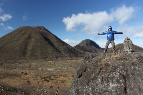
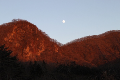
Since it was a weekday, the bus rolled into Numata station around 40 minutes earlier than originally scheduled, so I had time to eat some breakfast before boarding the one hour bus ride to the waterfall. The weather was perfect, as I could see Mt. Tanigawa rising in the distance, above the clouds. Mt. Akagi was also peeking its head out to say hello. I got off at the bus stop, unloaded the bag, and proceeded to unfold the bike. The man outside of the souvenir stall started quizzing me about my intentions. Instead of trying to dissuade me, he gave me a hearty “ganbare” and shoved a free can of pocari sweat into my hands! I strapped on my helmet and rode off into the sunset (well, at least up the steep hill to the start of the trailhead). I soon realized my first problem of the day: the gear shift was broken! Sure it was a 6-speed bike, but the bike only stayed in the highest gear. In order to ride in the lowest gears you had to hold the shifter in place. No wonder this bike was abandoned! Would I really be able to make it to the trailhead? I knew if I tried to ride the entire way, my legs would be like jelly and I’d be in no condition to go hiking! I resorted to a combination of riding and pushing the bike. Basically I’d ride on all the downhill and flat parts, and push the bike on the hillier/rockier bits. The bike just barely survived the 4-1/2 hour journey, as the chain kept popping off and various bike parts flew every which way. The only thing that saved me was the fact that the bike had rear shocks, so I couldn’t feel any of the bumps! By the time I arrived at the trailhead, it was already 11:30am, but I remember Julian’s previous advice: “Getting there is the toughest part of the hike”. Yep, the hardest part was behind me, but I was really starting to wonder how I’d get back to civilization before dusk. I ate a quick lunch, stowed unnecessary gear in the toilet hut, and started on my way.

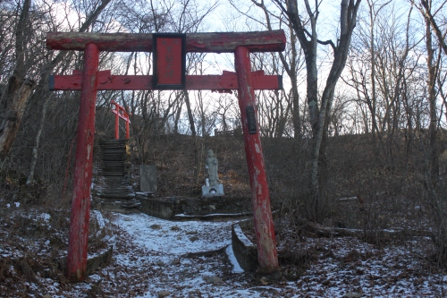
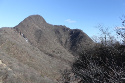
It turns out that the bike ride was the perfect warm-up for my body, as I felt great hiking along the trail. There was a “Beware of Bears” sign at the entrance to the trail, which never scares me. In fact, it’s been one of my dreams to see a bear in Japan. Most of them are nocturnal and completely harmless, but given a notorious reputation by the Japanese media because they come down to town in Autumn to eat the farmers crops. Anyway, I noticed that it was only 3km to the summit of Mt. Sukai. I now know why this approach is so popular! If there’s one thing I’ve learned over the years, it’s that Japanese hikers are basically lazy. If given a choice of approaches, they almost always choose the shortest one, or the one with a gondola!

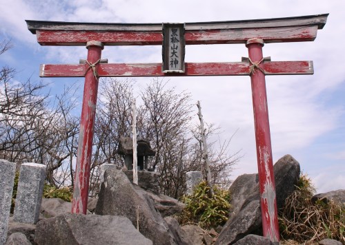
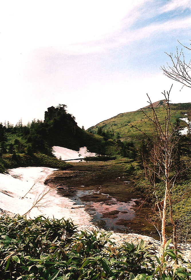
I flew up the short path, surprising myself by arriving at the ridge line in only 45 minutes! Sure the hike was ridiculously steep, but there were plenty of ropes and tree roots to grab onto along the way. I turned left for the short climb to the summit. The cloud was completely in, but for some odd reason it made the mountain extremely beautiful. Sometimes it’s nice to look at virgin forest and the color gradation against the white backdrop of cloud. I retreated back to the trail junction at the ridge line. It was here that I met the only other people of the day. A husband and wife team of hikers. They’d come up from the same path I’d taken, and were on their way to the summit. I told them about how I’d ridden my bicycle all the way along the forest road, and the gentleman responded with what must be my favorite Japanese phrase: “nosete ageru yo”, which translates “we’ll give you a ride”. I didn’t even ask, but here they were offering to save me another painful 20km ride on the road! “You’ll have to wait until we get off the mountain, though”, he added. “We should be back around 5pm.” This was the happiest I’ve felt in a long time, as I slowly and leisurely descended back the way I came. It was such a huge change from my hurried pace earlier. I must’ve spend about an hour sitting by the mountain stream, watching the water flow and reflecting on all my Hyakumeizan hikes: the hidden beauty of Japan, the kindness of the people, my extremely good timing. Sure enough, the couple returned at preciously 5pm and we headed to Hotaka kogen, where they were able to talk the owner into giving me an empty room and 2 meals for only 5000 yen!

The next day, I rode the bike back to the Fukuwari bus stop, left my bike at the police box for safe keeping (they never bothered to check if it was my bike or not), and spent some time sitting by the Niagara falls of Gunma Prefecture, so peaceful and absolutely deserted at 7 in the morning. I caught the bus to Jomon-Kogen station, and then the Shinkansen back to Osaka. I returned the bike to exactly the same place I’d found it, and marked Mt. Sukai off my ‘to climb’ list. I also have a daily reminder of my adventure every time I retrieve my bike.

Read Full Post »