Feeds:
Posts
Comments

Archive for the ‘Takashima trail’ Category

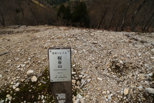
As we edge closer to Makino and the end of our 80km section hike, Ted and I study the weather forecasts and research about the current state of the forest road to Nukedo. We are perhaps just one heavy rain away from the road being lost to landslides, so time is of the essence. Late October and the stage is set, with a high-pressure system and a rare family-free weekend providing a much-needed catalyst. Ted points the car north on route 367 before shooting northwest into Fukui Prefecture and past the port town of Obama. Further east, after skirting the edge of Mihama city, Ted navigates the impossibly twisted switchbacks above the Mimi river as we finally reach the full parking lot of Nukedo where we last left the Takashima. It seems that we are not the only ones out to take advantage of the autumn weather.

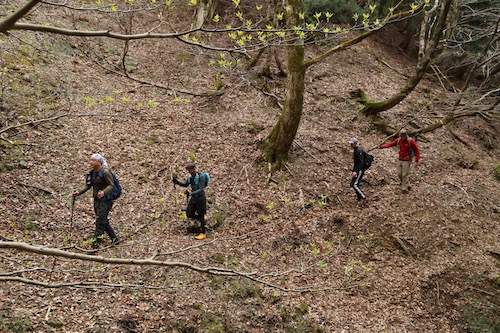
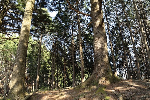
A group of school kids loiter at one of two trails leading skyward toward Ōtaniyama. The leader prepares to take them up the Mihama trail, so we scoot past and opt for the proper Takashima route running through neighboring Shiga Prefecture. We shoot off at a brisk pace, eager to reach the top of the spur ahead of the elementary-aged children. Dew glistens off the trees as we make our way up the shaded eastern slopes. The rising sun penetrates through gaps in the dense forest canopy, illuminating the brilliant autumn foliage in its seasonal amber hues.

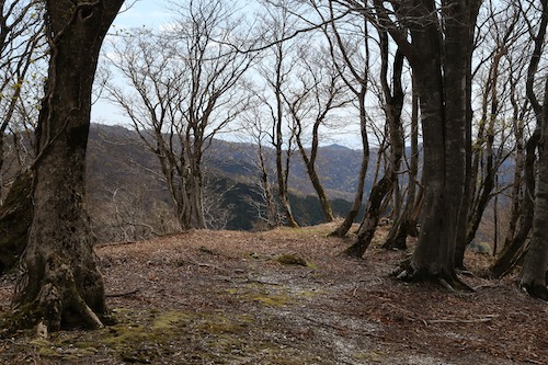
The Takashima leads us up a narrow spur through a kingdom of healthy hardwoods. For a change of scenery, I ask Ted about his fledgling career as a part-time method actor, for which he willingly enlightens me about his time on the set of the 2009 indie film Tengu.

The world of acting is one field I have yet to explore, unless you count a pair of appearances in long-forgotten TV commercials, an obscure music video, and an awkward interview on MUSIC EDGE, so I listen with perked ears as he provides a few titillating behind-the-scenes tidbits that make us forget about the steep climb at hand. Not only do we stay ahead of the school group, we make it nearly to the edge of the summit ridge before the squawks of a large troupe of macaques interrupt our Hollywood reverie. The primates stay out of sight, preferring the shaded depths of a steep valley on our left, but cries grow fainter just as we break out of the forest onto a massive network of rolling ridges of golden grasses and low-lying shrubbery.

What a welcome sight to behold as I scream for delight like a hyperactive child at the county fair. As much as I love a hardwood forest, there’s nothing like hiking on an open ridge with expansive panoramic views. Mt Ibuki sits due east, across the Maya blue waters of Japan’s largest freshwater lake. North of Ibuki, folds of foreshortened ridges in neighboring Gifu prefecture span the horizon, while the mighty Hakusan lies hidden behind a haze of cloud. Light winds coax us along on the gentle inclines to the summit of Ōtaniyama (8), where we glimpse our first unobstructed views of Mt Akasaka sitting on the far end of the oblong ridge. A track drops off here to the south for a couple of hours to the outskirts of Makino. This is the track we were originally planning to take on Day 6 of our hike before giving in to fatigue and an easier escape route back to our car. It has taken us a little over an hour from our car in Nukedo, and with the weather on our side, we pause here for a quick mid-morning snack while savoring the views.

The track drops abruptly straight down the northwestern face of Ōtani’s bulbous edifice, through swaths of Japanese pampas grass dancing gracefully in the breeze. The bright sun sends us scrambling for the sunglasses as we drop toward a narrow col dotted with gnarled hardwoods. To our right, seemingly directly below us, we stare straight down into the sprawling campground of Makino Kogen, our intended starting point for Day 8 if our current hike goes according to plan.

Golden foliage set against the deep blue of the autumn skies sends a smile through my face. Turning around, I see the same countenance spread across Ted’s content face as we silently share our delight at being blessed with that elusive tozan byori, or perfect hiking weather. The Makino range has a bit of a reputation for foul summer weather and blustery wintry blizzards that attract only the foolhardy. Long switchbacks take us through the radiant autumnal hues of the mixed hardwoods and up to the summit of the minor peak of Kanpū (7), providing a striking contrast to the snow-smothered scenery that I had experienced during my first visit here just 8 months prior.

We take in the expansive views while soaking up the rays of the sun, our legs stretched across the small gravel strewn throughout the broad plateau. With the paper map spread between us, we find ourselves with just a 2.5km hike to our turnaround point at Awagaragoe. It seems easy on paper, but one glance to the northeast reveals that we have our work cut out for us.

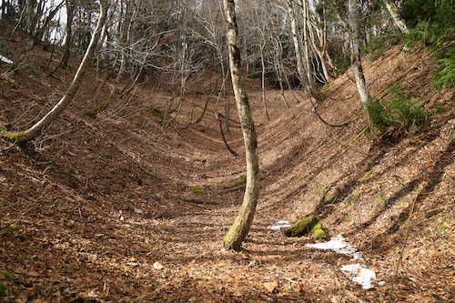
Dropping steeply down the northern face of Kanpū, the track takes us through a tunnel of twisted beech and onto gentler slopes carpeted with soft grasses leading to to the top of a rise revealing a ridge of rolling slopes. Ted and I spy the summit of Mt Akasaka at the end of this roller coaster of a ridge and it looks deceptively far. Beyond, on an entirely different ridge line, lies the elongated summit of Mt Norikura, the final peak on the Takashima Trail that taunts us like a rival, waving its finger as if to prove that finishing the trail today is an impossibility. We can only hope that this stable high pressure system gives us a chance to complete our goal before the first snowfalls of winter.

While easy to follow, the route hardly takes us in a straight line, instead it opts to hug the ridge tightly as it weaves in and out between forested hillocks and grasslands fit for bovines. We passing up and over a series of unnamed summits, and with each passing peak comes the realization that we will need to re-climb all of these peaks on our return to the car. I mean, we could turn left at Awagaragoe and drop down the old Wakasa Kaidō and loop back to the car. The problem with that is that it would add an extra 10km to our already long hike and it would involve walking up the forest road back to the car. Much better to stay on the ridge, even if it means retracing our steps.

At the top of the third rise in the ridge, we run into an elderly man involved in trail maintenance work. The gentleman informs us that he works for the Takashima tourism bureau and is in charge of promoting the Takashima Trail. We tell him that we are nearly 7/8 the way through our reverse section-hike as we boast about the incredible scenery on the Kyoto section of the trail. “Oh, I haven’t been that far,” he explains rather sheepishly. That is hardly surprising, as his only concern is with bringing money to his fiefdom of Makino instead of promoting the trail as a neutral 3rd-party observer. That’s the problem with tourism agencies across Japan, who are reticent to promote areas in neighboring prefectures as they don’t receive their share of the money if tourists go there. While the Edo era is long gone, feudalism in Japan remains a stronghold in many aspects of society.

It takes us an additional 20 minutes along the pleasant ridge to reach the first of a series of unsightly electrical pylons built to transport electricity from Mihama Nuclear Power Plant to the urban cities of the Kansai region. You can’t hike far in Japan without coming across either a forest road or an electrical pylon, and the Takashima has delivered both. We pass under the monstrous towers, with their low hum providing a drone-like rhythm to our measured footfalls. It is just after nigh noon when we reach Awagaragoe (6) and the first of the crowds ascending from the popular weekend playground of Makino Kōgen. In a rocky niche above the mountain pass sits a weather-beaten carving of the three-headed Hayagriva, apparently erected there to protect the horses that were traditionally used to carry travelers up and over the mountain pass.

With absolutely no impressive view to speak of, Ted and I decide to carry on a further 500 meters to the summit of Mt Akasaka (5) for a well-deserved lunch break. Before departing for the summit, I put on my Aladdin hat in an attempt at some Halloween humor that immediately backfires among the throngs of day trippers basking in the sunshine. They probably all think that I’m wearing it as a fashion accessory and even Ted starts calling me Lawrence in homage to the Seven Pillars of Wisdom.

After lunch I ditch the costume and we start our long retreat back to the car. I guess one advantage of doing an up-and-back is that the lighting is always changing and the shadows grow deeper as the sun moves further west. We decide to push it as far as we can before taking a break, hoping to get off the mountain before dark when the nocturnal creatures awake for the evening. Indeed, the way back seems to take just a fraction of the time, with the hardest part of the climb coming as we push up the headwall just below the summit of Ōtani and run into a group of two-dozen hikers just starting their descent. On the summit, a pair of hikers don helmets and appear to be loitering on the summit for an unknown reason.

Five minutes into our descent, we discover the reason for the loitering as they set sail in their paragliding gear, swooping out above the rolling plains of Makino. Perhaps paragliding is illegal in these parts, or maybe they were just waiting for the winds to work in their favor. Either way, it is a sight to behold and provides just the change to the scenery that we are needing. As our legs turn to jelly, the rock formation sitting at the far edge of the plateau provides us the perfect place for our final break. I break out the cappuccino energy gels as Ted breaks into a fit of hysterical laughter over someone or something named cougar. We are both giddy from the exhaustion but let those waves of guffawing wash over us as we finally muster up the energy to get back on our feet and stumble the last hour back to the car. With just one final section of the Takashima remaining, we keep an eye on the weather patterns and turn to some familiar companionship to help escort us across the finish line.

Finale

Read Full Post »

Shortly after finishing part 5, the rainy season kicked off unusually early, tapering off in early July before making a mysterious encore that lasted most of August. With the September heat beginning to dissipate, Ted and I hatch up a plan for the next section of the Takashima and spy a fair weather window at the end of the month. Once again, I board the first train to Kyoto and Ted navigates the car back to Ishidagawa dam which, due to a bizarre countermeasure against COVID-19, is currently closed to vehicles. We park on the shoulder of the road just below the dam and don our daypacks just before 8:30 as the sun still sits relatively low on the horizon.

Our route requires us to step over the chain-link barrier set up to keep vehicles from traveling along the battered road, and just a few minutes walk north brings us to the trailhead on our left through Wasatani (ワサ谷), looking a bit more overgrown and moist since our descent in May. I’ve got the gaiters strapped snugly around my shoes, and several steps along the route I spy my first mountain leech attempting to abseil up my leg. I sprinkle some salt as it jumps off my gaiter in fright and we pick up the pace until once again entering the cedar forest of switchbacks up the steep spur. A small brown Japanese tree frog sits camouflaged among the fallen tree needles and my footfalls send it hopping away to safety. No creatures and going to stop these men from reaching their hallowed ridge.

We make good work of the spur and rejoin the Takashima just before 9:30am and sit on a rotten log for a well-deserved break. I take off my gaiters, shoes and socks for leech inspection but am relieved to find that none have tagged along for the free meal. I spread the paper map out between us and study both the paper contours and compare them to the humpback ridge separating us from the summit of Mt Sanjo, our first major objective of the day.

I take the lead through a tunnel of beech trees contorted by the fierce winter gales that push in from the Sea of Japan. The accompanying precipitation can deposit well over a meter of snow, cutting off sinter access for most but the most experienced mountaineers. Through a gap in the trees, Ted and I can make out the grass-smothered slopes of Sanjūsangen, a perennial favorite from the hallowed Kinki/Kansai Hyakumeizan. The verdant slopes have already taken on that golden hue of autumn, as a brisk wind pushing in from the north reminds us that the first snows of the year are not too far on the horizon.

Fields of purple Kitatamabuji (monkshood) flowers reveal themselves as our beech tunnel gives way to open grasslands fit for a bear encounter. Ted and I are thankful for the westerly winds pushing our scent away from the fields and off the ridge into Shiga Prefecture, for the ursine creatures would surely find the sight of two humans trespassing in their backyard intriguing. I reach for the bear spray attached to my right hip, rehearsing the moves in case a sudden discharge is needed. Ted warns me not to spray upwind, as the bear would surely enjoy the sight of a scrawny hiker writhing in pain from having pepper-sprayed himself.

We enter an impressive strand of towering beech trees that give way to a clearing affording vistas of the summit plateau towering directly in front of us. It is at this sight that Ted and I congratulate ourselves for cutting stage 5 of our section hike short, for this is no place to be loitering at dusk. An occasional strand of yellow Takashima Trail tape reminds us that we are still on trail—though on the broad ridge it is really just a matter of following the natural ebbs and flows on the seldom used track.

After 20 minutes, green signage points us in the direction of Sanjo (三重嶽) as the route leads us up and over a series of small rises. The twisted trunks of beech trees mesmerize us by their artistic forms, with one such hardwood doing its best imitation of a sink drain pipe. How such forests can survive despite the odds in this fierce environment is a testament to the power and perseverance of living things.

The ridge narrows briefly before opening up again to reach a battered wooden signpost that informs us that the summit is just a 20-minute stroll away. We continue to navigate under the receding beech canopy and through the overgrown grasslands punctuated with groves of purple monkshood. At a gap in the trees I pause and turn around, awestruck by the unobstructed vista to the south, which reveals the folds of ridges of our entire section hike so far. I shout over to Ted through the wind, ushering him over so we can take in the sight together.

At the top of the next rise the angle abates, escorting us past a small pond and through yet more fields of wild grasses and ferns. It it truly hard to believe that we are still in Japan and we both feel as if we are setting foot on hallowed ground, walking through pristine forests in the footsteps of fallen samurai and mountains ascetics.

The final stroll to the summit of Mt Sanjo (10) seems to take forever, thanks in large part to my pausing every half a meter to snap a photo, for every footstep reveals ever-fascinating scenery. I don’t know if I will ever get the chance to revisit this place, so I want the memory to last. Just before the true summit, a handmade signpost pointing south informs us that Buna-ga-take is 5.1km away, and what a stunning five kilometers it has been. At the summit we rest in the shade and share a bite of Lara while a Japanese hornet does a flyby. The signpost has seen better days, having fallen victim to a foraging bear who has stripped the log post of most of its wood. We have also reached a milestone, with only 9 more stage points between here and the end of the trail.

We take a leisurely fifteen-minute break on top, enjoying the views and filling our tummies with calories that should sustain us until the summit of Mt Ōmikage, our next target on the ridge. At exactly 11:20 we once again hit the trail northbound, darting through giant trunks of beech while catching a glimpse of our next peak through a gap in the treeline. Ōmikage lies on a perpendicular ridge and it is topped with a rather large microwave antenna, making recognition easier. We need to continue to the north until we reach this east-west ridge, where we will change directions and embark on a rather elongated climb, judging by our current visual sighting at least.

The beech groves yield to a sprawling savannah-esque plain that could easily be mistaken for the Serengeti. We expect a herd of Wildebeest to rush through at any moment. Powered on by the late morning nourishment, I take off in a trot in order to gain a little distance between Ted and I, as a figure does helps provide a sense of scale to the images captured through my lens. I can’t help bursting into a heartfelt rendition of Toto’s Africa.

This is easily the best scenery of the entire Takashima so far, and we are both thankful for the stable high-pressure system providing us with pleasant skies.

Over a series of open ridges we trod, pushing ever closer to our next peak. We catch glimpses of Mt Aoba and other peaks of northern Kyoto Prefecture to our left, while on our right we gaze at the foreshortened ridges of eastern Shiga Prefecture. The rugged shoreline is also visible due north where the cobalt sea meets the unspoiled shores of Fukui Prefecture. We are truly in a magical corner of the Kansai region and can do nothing to hide our elation.

We pause briefly on the summit of Peak 943, the scene of a bear attack back in 2015. The poor hiker was southbound and had just spent most of the day hiking when he suddenly encountered a bear at close range in dense fog. An account in Japanese can be found here and it is the main reason why I decided to carry the bear spray. We scan the horizon but no creatures big nor small can be found.

Several more hills are traversed before we pass by a small pond and yet more groves of virgin beech. As we edge closer to the parallel ridge, the forest finally transitions to a mix of oak and cedar trees briefly just before the summit of Peak 889 before we duck once again into the sprawling city of beech. The shadows cast by the early afternoon sunlight provide an artistic blanket on the forest floor.

Finally, at 12:30pm, we meet the east-west ridge, where the Takashima takes a hard right turn and enters an ancient route known as the Ōmizaka Kodo (近江坂古道). The ridge line that we are now beginning to walk was once the main walking route between the ancient provinces of Ōmi and Wakasa and we are pleased to find not only the trail well-marked, but also the gentle gradient easy on the feet. Rather than taking a lunch break here, we decide to push on to Ōmikage.

The route is pretty straightforward at first until transitioning to switchbacks on the long approach to the summit. Ted starts to fall behind a bit, making us regret postponing lunch, so I slow up a bit to give him a chance to stay within earshot. I feel surprisingly good despite the distance we have traveled so far. It takes us an hour to reach the microwave antenna on the summit of Ōmikage (9), but we are relieved to find the true triangulation point a bit further along the ridge on a more pristine knob. I drop the pack and rest in the shade, and Ted makes his way up to the summit a few minutes later, where it is time for a proper lunch. Both of us are ravished and glad to make our packs lighter.

The half-hour break helps restore our depleted energy reserves, which we will surely need for the long journey back to the car. During our sandwich break, we once again pore over the paper map and agree that traversing over to Nukedo pass will allow us our best chance of perhaps catching a ride back to our car, for the pass is the junction of a trio of forest roads covering from both Shiga and Fukui Prefectures.

Shortly before 2pm the packs are once again strapped to our shoulders and we continue east towards the pass. By now the sun is starting to sink lower toward the horizon, lending softer shadows and providing excellent photographic lighting through yet another phenomenally beautiful section of trail. We have yet to meet a single other hiker on our entire route, a testament to just how remote and inaccessible the hidden folds of the Takashima truly are. At the top of a long rise, a shortcut trail to our right cuts down to the forest road, but we decide to push on to Nukedo by all means necessary.

Once past this rise, the trail begins to drop, gently at first, towards our elusive pass. The closer we get, the more abrupt the descent until we finally reach a trickling stream and pop out onto the roads at Nukedo (8-1). A paved road on our left leads down into Fukui Prefecture. I walk a short distance to a parking lot but am gutted to find no cars—our chance for a free ride is gone. On the Shiga side, the forest road back to our car is barricaded by a locked gate and looks as if no vehicles have been up here for at least a decade. I sit on a concrete wall to give my legs a brief rest as we think. Our original plan was to continue east to Mt Ōtani and a long escape route down towards Makino, where we could hail a taxi back to our car, but there would be no way to make it down before dark. Plus, the prospect of another ascent on weary legs is too much to bear. There is only one other alternative.

Ted and I look at each other and nod wordlessly as we climb over the barricade and onto the gravel forest road. It is preciously 3pm when we start the long slog back to the car. At least all we need to do is to follow a road back, but we are both shocked to find the road climbing. And climbing. And climbing back towards the long rise we had traversed on the way down from Ōmikage. Morale is at a new low as we walk in silence, leg muscles burning, past research cameras placed to keep tabs on the local ursine population. After a grueling 40 minutes we pass by the shortcut trailhead leading up to the ridge and the road finally begins its descent toward the valley far below. Ted double checks our location on his phone GPS and lets out a gasp as he inadvertently looks at the amount of horizontal distance left to cover. “Please don’t tell me how many more kilometers we have left”, I shout, knowing that it will only lower our sinking morale. Silently, I guess that we have about 15km to walk on the road, but we manage to avoid talking about this for the remainder of our walk. We do engage in small talk while trying our best to simply put one foot in front of the other. We are in a race against the setting sun but it is important not to rush when you have such a formidable distance to cover.

The road drops to meet a stream and after 40 minutes we reach an alternative trailhead to Mt Sanjo. This is the route we were originally planning to descend on day 5 before opting for the escape route that we had used for our approach to start our day. We break here for about 10 minutes, sitting next to the trailhead and stretching our legs for one final snack to help sustain us for the remainder of the walk.

We continue to traverse through bear territory, half expecting to come across one at every bend in the road. Somehow, the creatures continue to elude us as we make good progress on the long gravel thoroughfare. Further downstream we pass through a locked gate that looks remarkably similar to the once erected at Nukedo. Perhaps we are once again in an area where vehicular traffic is allowed.

30 minutes later we reach the end of the road, where it deposits us on a paved road that connects Ishidagawa dam to Hakodateyama ski resort. I recognize this road, as we walk past the place where we parked during my first ascent of Mt Sanjo back in 2015. This road has fallen into ruin during the last several years and now no vehicular traffic is allowed until repairs are made. The pavement looks to be in pretty descent condition until we reach a massive landslide just 10 minutes further long the road. After scrambling up and over this obstacle we continue past several other washed out sections of bitumen in the fading light of the day. We reach the car at 6:30pm in near total darkness. We have walked over 30km on this mammoth 10-hour day, but with vehicular access to Nukedo on the Fukui side of the mountain, we now have a clear path to finishing the Takashima trail, which will take just two more days according to our newly hatched plan. The hard part is over, or so we think.

This image has an empty alt attribute; its file name is takashima6-25.jpeg

Part 7

Read Full Post »

Early May and the middle of the Golden Week holiday brings Ted and I together for another rendezvous with the Takashima Trail. The next couple of sections of the trail are going to require both an immense amount of planning and an even greater exertion of energytwo of our fortes. This is our furthest drive yet, as we finally navigate the entire length of route 367 right past today’s starting point of Sakura-tōge and under route 303 to our final destination at Ishidagawa dam. We park at the dam, prepare our gear and hit the asphalt in high spirits, for we need to walk all the way back to where we last left the Takashima on route 367or do we?

The snaking curves of the road down from the dam lead us along an idyllic section of road following the Ishida river downstream past a bustling campground. Groves of parasitic wisteria flowers flutter in the gentle breeze under the soothing sunshine of early summer. We enter a hamlet with residents busy tending to fallow fields. A flattened rat snake lays victim to an early morning vehicle. “Looks like they’ve woken up,” exclaims my companion, apprehensive of an encounter with a living reptilian foe up on the ridge.

We stroll down the road and meet route 303. The lane we drove in on cruises safely under the national highway but instinct sends us up an incline to meet the busier road. “We should be able to hitch a ride from here,” explains Ted, still riding high with confidence from our successful hitchhike during part 4 of our adventure. Sure enough, the third car to pass screeches to a halt while Ted and I scurry to put on our face masks. Just minutes later we thank our driver, shoulder the packs and enter the forest at Sakura-tōge (14). Among a grove of cedar trees nature calls, so I dig a hole and go about my business while Ted checks the GPS.

Leaving the comfort of the valley floor, Ted and I commence our ascent up a steep spur adorned with the fresh foliage of the summer canopy returning to the mountains. The sunshine sparkles off of the leaves as we push on through groves of Japanese andromeda and rhododendron buds on the verge of blossoming. Beech and oak trees guide us upward along the narrowing spur as we catch our first vistas across the valley to the Hira behemoths of Buna-ga-take and Jyatani-ga-mine. I turn to Ted and he nods at me as we stare in silence and reflect upon our winter accident on what appears to be gentle slopes from this vantage point.

After half an hour the track reaches the crest of the ridge for a roller coaster of a walk alternating between monolithic strands of planted cedar and free-wheeling colonies of beech and oak. Through one section of the former, our trail meanders around a section of typhoon debris, but those ubiquitous strands of yellow Takashima tape liberally tied to an occasional cedar usher us safely through the mess and onto a long steady slope to the summit of Mt Ni-no-tani (13). True to its name, there are two summits on the plateau, so we break for a snack on the first peak before heading over to its twin and slightly higher of the two, home to an tranquil tarn.

Though a gap in the trees, a formidable wall of green towers over us directly north. It is Buna-ga-take, our target for the afternoon and not to be confused with the other Buna-ga-take sitting directly behind us to the south. Cause for celebration is unwarranted, as the map shows us we still have over 5km of hard hiking to reach its striking summit plateau.

The loss of altitude is almost immediate after setting foot down the northeastern face and we grasp onto tree limbs to help fight against the downward pull of gravity until the angle eases abruptly and passes by a section of golden grass that looks fit for a bear encounter. The ridge narrows briefly and we meet our first hikers of the day. The first guy is wearing trail running gear and is equipped with nothing more than a 2-liter bottle of water grasped in his right hand as he passes head on in silence and makes quick work of the steep slopes we have just come down. There have been reports of ultra trail enthusiasts doing the entire 80km section in one day but I think I prefer our more leisurely pace.

After a brief climb past an unnamed peak the trail once again loses altitude suddently and guides us through a section of lush ferns to reach the paved road at Misaka-tōge (12). It is hard to believe that we have only a dozen more checkpoints until finishing the trail, but it is still going to take a few days to get there. We sit on a log and break for an early lunch in the shade in the forest of the 280-meter high pass. This is the old road before the tunnel was built through the mountain and if we turn left here and walk for an hour we could reach Kumagawa-juku on the old Saba Kaidō, but tourist post towns are not what bring us to the Shiga-Fukui prefectural border. We have a mountain to climb.

Again we play a cat-and-mouse game of cedar forest and hardwood grove as we face the longest and hardest climb on the entire Takashima Trail. As on past sections of the Takashima, the conversation turns to writing and working with copy editors, as Ted is on assignment to finish his contribution for a new guidebook with a constricting word count. It is always the nemesis of any travel writer and part of the reason I prefer the freeform nature of blogs. Our banter takes our mind off of the task at hand until the ever-steepening slope angle forces us into silence: we search for those inner reserves necessary to see us though to our goal.

Our initial target is to make it to the western peak of Mt Akaiwa without stopping but shortly before the summit we collapse in a heap of sweat and exhaustion. We need Lara again, and Ted delivers the goods. I pass along some chocolate and other nibbles as we rehydrate and stretch our legs. It turns out our decision is a wise one, as once we get back on our feet the path further steepens to enter a rock outcrop adorned with fixed ropes.

We hoist ourselves up and onto an outcrop affording spectacular vistas back over to Mt Ni-no-tani and over to route 367 where we had started our morning. Boy have we come a long way.

The foliage begins to take on an early spring hue as we breach the 700 meter mark and walk past a junction on the western summit Mt Akaiwa. Dense groves of rhododendron and andromeda shrubs line our way as the track narrows. Dollops of the pink iwakagami (fringed galax) once again line the trail. We have entered an entirely different ecosystem up here, on the edges of snow country and evidence of the harsh winters that batter these mountains is apparent. It is as if the retreating snow fields had melted just days prior as tree buds begin to sprout and put on their summer coats.

Kobus magnolia flowers flutter in the light breeze. It’s hard to believe that these same trees bloomed one month earlier at around the same altitude further south along the Takashima. As we admire the views, a solo female hiker approaches from the summit plateau and passes by. She is on her way down to Misaka-tōge and it dawns on us why the majority of hikers do the Takashima Trail from north to south in order to avoid our herculean climb of Buna.

We skirt past a small pond and onto the summit of Buna-ga-take (11). Time check: 1:38pm. It has been nearly 5 hours since we left our car at the dam but we have arrived. The undulating ridge between our vantage point and our next summit of Sanjo looks formidable. A change of plan may be necessary.

With an impressive view of snow-capped Hakusan on the horizon, Ted and I straddle the ridge with the paper map spread out between us and start calculating. If we push on to Sanjo it will be after 4pm, and a two-hour descent on rubbery legs on a long spur means that it will be well after dark when we reach the car. However, just a kilometer from Buna’s summit, on the ridge we need to walk, is an escape route down a spur that will take us directly to our car. The choice is easy.

Fueled on by the prospects of a shorter day, we dart along the ridge and duck into a truly scenic section of gnarled beech trees sculpted by the strong winds and snow that batter the ridge every winter. It feels like we have stepped into an enchanted forest and fortunately for us, we are blessed with brilliant sunshine and not the mind-altering hallucinations brought on by thick fog and tired minds.

Unsure of our escape route, Ted and I keep a close eye on the GPS but we are relieved to find a signpost in Japanese for Wasatani (ワサ谷) letting us know that we have 3.8km to go before reaching the road to the dam. I lead the way in high spirits before jumping in surprise after nearly stepping on a giant rat snake. Ted is thankful that I am the one encountering all of the slithering creatures for him, as he has a fear of the serpents.

Our majestic hardwood forest soon turns into a monocultural cedar plantation, but fortunately the descent is negotiable along a series of long switchbacks that usher us down to a gravel forest road covered mostly in fresh grass. This leads to a stream smothered in concrete dams and the eventual paved forest road above the dam. We turn right and stroll along the closed road for 10 minutes to reach the car at 3:30pm. The drive back to Kyoto is spent strategizing about how to walk the next section of the Takashima as it is easily the most remote part and will take some thinking.

With the approach of the rainy season, we both agree to take a few months off to scour trip reports and rack our brains for the best course of action.

Part 6

Read Full Post »

The weather of early April continues to remain stable, offering plenty of opportunities to knock off the next section of the Takashima Trail. If our plan comes to fruition, we can reach the halfway point of our journey and what better way to celebrate this milestone than by inviting along a few extra friends. Cue my faithful Nagoya-based hiking partners Hisao and Haru, who bring along ultra-trail hiker Paul from Hike and Bike Japan. Meanwhile, Kyoto resident Van heads up by bicycle while Ted drives our vehicle to the rendezvous point at Kutsuki Michi-no-eki. After an early-morning discussion of the plan and a quick stocking of rations at the Lawson convenience store, we board the community bus bound for the secluded village of Kijiyama. We have the minivan to ourselves for the 40-minute journey along an incredibly narrow road hugging the banks of the Asao river. We alight in the sleepy village and are immediately greeted by a duo of anatomically-correct stone kappa statues placed in the village in an apparent attempt to trick hikers into falling for their ruse.

We walk along the paved road northwest past a grove of rhododendron that have somehow managed to bloom unseasonably early in the biting air of late spring: perhaps those pesky statues have coaxed those flowers out of their shy buds, Meanwhile, a grove of plum blossoms further on remind us that summer is still quite a long ways off. High above, the greenery is only just starting to return to the mountains after a long, dormant winter. Our road transitions from asphalt to dirt and starts gaining altitude towards the ridge. We follow suit shortly before cross checking our position with the GPS and realize that we have gone off route. We backtrack to where the incline starts and enter a narrow watershed lined with tape marks affixed to a series of hardwoods. I scan the forest floor for signs of mountain leeches but am relieved to find that the chilly temperatures have kept them at bay. In the early morning sunshine we follow the moss-covered stones toward the ridge and our impending return to the Takashima.

The trail keeps to the left bank of the river for the most part, but, like most gorge trails in Japan, ascends high above the river bank past a series of waterfalls before meeting up with the river’s edge further upstream. We exercise care in this section, walking single file while double checking our footholds. One slip here would be an early end to our day.

Haru takes the lead, escorting us past a depilated shelter once used by forestry workers before ushering us across an improvised wooden bridge consisting of cedar logs fastened together with thin wooden planks. The logs bend and bow under our weight but somehow they hold long enough to allow safe passage for everyone. About 50 meters upstream, we cross the river once more among the idyllic waters of the tranquil stream. It is refreshing to find these watersheds untouched by the hands of the concrete industry.

I stay near the rear, making sure everyone keeps pace among our sexy sextet of experienced hikers. Suddenly, I hear shouts from Haru ahead and rush to catch a glimpse of a rather large and bushy brown animal running up the adjacent hillside. Haru and Paul claim that it is a tanuki (a raccoon dog) but without a closer look at the markings I have no way of knowing exactly for sure. From my vantage point it could certainly have been one, but I wouldn’t be surprised if it were an anaguma, a Japanese mountain badger. Unfortunately the creature skitters off too quickly for anyone to gather photographic evidence.

At this next section we struggle briefly to find the tape marks, as they leave the river bed and skirt up the right bank of the river up a steep spur that leads much further upstream towards the headwaters of the Asao river. We walk past a rusted pulley system left behind by some inconsiderate loggers before we ascend a rugged incline to traverse high above the river along a flat trail adorned with fixed ropes. As we walk straight ahead, the river below rises up to meet us and from here to the ridge it is simply a series of negotiable switchbacks.

We reach Kijiyama-tōge (21) at 9:15, just one hour after leaving the forest road. It’s hard to believe I was standing on this exact location exactly 10 days prior. We catch our first glimpses of Mt Aoba between the bare branches of the hardwoods, while the brilliant white petals of the Magnolia kobus glisten in the morning light. A track here drops to the north into Fukui Prefecture, perhaps another route for porters in the olden days to use for delivering fresh fish to the landlocked villages in Kyoto. I explain to Paul and Hisao that a left turn here will lead them to the panoramic views from the summit of Mt Hyakuri-ga-take. Being seasoned trail runners and fast packers, they rise to the challenge, and we all agree to meet up further long the ridge as they will surely soon catch back up with us.

Ted, Hisao, Van and I head northeast along the Takashima up the first slopes of hearty beech trees. Ted and I explain a little about the terrain that we have experienced along the route up this far as they listen eagerly for a teaser of what is to come. It takes us about 20 minutes of steep climbing to top out on Mt Sakuradani (20), the first of several peaks planned for the day. The vistas down to Kijiyama village and beyond stop us in our tracks, as we settle in for a mid-morning snack. I shout across the valley toward Mt Hyakuri, hoping that Paul and Haru will return our greeting, but the distance is too great for our calls to reach them.

The lime green hues of the foliage beginning to return to the trees brings a sigh of relief that the dull tones of winter will soon be in the rear view. From the summit we head due east, along a bare section of stony ground that affords incredible views of the remainder of the Takashima trail. Directly ahead, the rotund hump of Komagatake stands tall, while further beyond we can trace the foreshortened ridges in the direction of Norikura, our final goal of the section hike. With a bit of luck we can reach it in just four more days, depending on how much of this ridge we can knock out today.

Onward we stroll, transfixed on not only the splendid beauty of the dense deciduous forest but also the jovial conversation about trails, travel, and outdoor gear. It is in these moments of trance-like movements that you really get to know a person, and in our quartet we not only share our experiences but also find time to become absorbed in our own thoughts and observations. To our left, the coastal areas of northern Fukui Prefecture grace us with our presence as if to remind us that we are indeed walking on the central divide. Meanwhile, Lake Biwa beckons us for a peek on our right as the contorted figures of the towering beech trees offer a welcome distraction from our gazing: stare too long out to the horizon and you will certain miss the sheer beauty that can be found right underneath your nose.

We traverse along a narrow section of ridge affording vistas back down to our starting point at Kijiyama. Towering over the village, like a protective watchtower, soars the humpback shape of Hyakuri whose southern face still clings tightly to one remaining snowfield. Here we run into our first hikers of the day, a middle-aged duo heading towards our starting point. After an exchange of pleasantries, the four of us continuing our forward march towards the folds of ridge directly ahead to Komagatake.

At the top of the next rise a hand-painted signpost informs us that we have arrived at peak 765, a common designation for peaks that have no name. The dried grasses provide a soft cushion on our feet as we gently descend to an old pass named Ikenokōchigoe. Apparently in the old days a track dropped off the ridge here to the north to Ikenokōchi village and further along to Obama. It certainly made more sense in the pre-automobile days to take the direct route over the mountains than to detour hundreds of kilometers around them.

The undulating ridge continues on, and the top of the next rise through a grove of towering beech takes up to Yosukedaniyama (与助谷山) (19) and a dilapidated signpost proclaiming that Komagatake is just 2.4km away. While we examine the maps a shout from behind announces the arrival of Paul, who has just spent the last hour running the ridge between Hyakuri and here. As we catch up on our prospective trail stories, Haru also rejoins us as our sextet is now reunited for the final push to the summit. And with such pleasant company comes a truly stunning section of curvy beech trees beckoning us forward.

A dirt forest road runs just below the true ridge for our next little section as our route takes a turn to the north. It is here that Ted and Hisao find out they are both fans of Soul Flower Union and spend the next half an hour engaged in a truly passionate exchange about music. We soon reach the junction for the western ridge course, the escape route that William and I took on our first visit to the peak. I am now back in familiar territory for the next 3.5km and spent most of the final climb to Komagatake telling stories of our battle with Asian giant Hornets during our first visit.

A couple of other hikers are lounging in the sun when we arrive at 780 meter-tall Komagatake (18) a little before 11:30am. We settle in for a well-deserved lunch while taking in the views across Lake Biwa to Mt Ibuki. Ted lounges in the trunk of a sprawling beech tree flanking the northern edge of the broad summit. We share a few snacks between us as we once again stare at the paper map in utter disbelief in how much more ground we have to cover. It is going to be a long afternoon.

We ask one of the other hikers to snap our photo so we can actually have a picture of all six of us together, before we once again shoulder the packs and hit the trail with an added pep in our step. A signpost indicates that our mountain is officially called Wakasa-komagatake to help differentiate it from the dozen or so other Koma peaks scattered throughout Japan. Shortly past this marker I lead the way down a series of log steps that I don’t recall during my first visit to the area. We pause and double check the GPS to realize we have inadvertently taken a spur trail on an adjacent ridge that eventually leads to Kumagaya Juku on the old Saba Kaidō. We backtrack and turn left for the correct track that leads due south over Komagoe (17) and through a series of Magnolia kobus flowers in their brilliant shade of shiny white.

The ridge continues to ebb and flow as we pass right by the gigantic beech tree that was smothered in giant hornets during my first visit. I for one am happy that the brisk early-April air has not only kept the bees away, but has also foiled any plans for the mountain leeches and snakes to awaken early from their winter slumber. During this next section of track I keep hyping up the brilliant waters of Koma-ga-ike but have set myself up for disappointment as the pond is but a tiny fraction of its mid-summer self. Still, the tranquil waters are worthy of a snapshot or two before we continue our march along the long, long ridge.

After passing by the junction for Mt Ikehara (my entry point during my first climb) I am once again in unfamiliar territory. Rather than cruising along the ridge, we find ourselves on a rather abrupt climb up a steep hill as Paul and Haru set off ahead as if on a training mission. The four of us march behind, a series of profanities erupting from my mouth as my legs are not ready for the sudden call of duty. On the summit of the unnamed and unmarked peak we find both Paul and Haru catching their breaths so we let out a sigh of relief that they find the climb just as tough as us.

Our route flattens out for a bit before a gentle descent turns into a sudden rope-grabbing plunge of altitude to Yokotanitōge (16) at an elevation of 450 meters. It has only taken us 90 minutes to reach this pass situated on a paved forest road—only the second paved road we have crossed since starting the Takashima. With one more major peak to climb today, we settle into a calm but steady rhythm through thick groves of rhododendron that are still a few months away from flowering. The waxy leaves are a refreshing site after the high canopy of soaring beech groves.

We soon find a signpost signifying that our final peak is just 1.7km away and the steady climb takes us just 45 minutes to reach Gyōjayama (15) among a shaded grove of cedar. “Cappuccino time,” I announce, as I toss a Koda energy gel over to Ted while the others look on with interest. Unfortunately I have not packed enough of the gels for everyone in our climbing party, but since Ted does have the car keys and is the one accompanying me on this Takashima journey, I know where my priorities lie. Paul occupies himself with trying to repair the broken summit signpost but soon declares it a lost cause, which is what we will all be if we don’t start making a move.

Ted and I, fueled on by the caffeine coursing through our veins, shoot out ahead of the others. We are expecting just a gentle descent to the main road, but our route sends us north over a series of rolling summits with plenty of elevation gain and loss between. This leads us to an undulating ridge of mixed conifer and beech, past a giant fir tree and under a massive electrical pylon before commencing one one final knee-knocking descent to reach a paved road. At last, with flat, easy ground to walk on, we coax to the finish line on route 367. Well sort of, for we still have 5km to walk on the busy road to reach our car at Kutsuki Michi-no-eki. However, I have hatched up a plan.

Once we reach route 367, Ted and I head further up the road toward the junction of Sakura-tōge (14). It’s kind of ironic that the actual Takashima Trail involves a short section of road walking before ducking back into the mountains, but all long-distance hiking trails in Japan require you to walk on a road at some point, as the country is too small and overdeveloped for large sections of wilderness to remain untouched. Anyway, Ted and I have no intention of walking 5km back to our car. We find a section of road with a broad shoulder and I fish the handmade cardboard signboard out of my backpack, a sign that I had made it the previous day in hopes of hitching a ride back to the car. It was time to put it to the test.

The first car swooshes by like we aren’t even there. The second car, however, comes to a halt about 50 meters in front of us as Ted and I trot up to find the driver ushering us toward the back seat of the minivan. We slip on the facemasks and head south on route 367 towards our car. Our ride soon catches up with our companions walking single file on the road. Ted rolls down his window and explain that he will retrieve his car and come pick everyone up. Paul catches word of this and decides to race Ted back to the Michi-no-eki. Our ride drops us off at Ted’s car and I head to Lawson for a cold drink while Ted speeds up the road to pick everyone up. I return to where Hisao’s car is parked and rest in the shade, rehydrating my body and stretching my tired legs. All of a sudden, I hear someone yelling “Wes” and look up to see Paul jogging the last few meters to Hisao’s car while Ted swerves the car into the parking lot. Paul has won the race against Ted’s racing automobile.

It is an unforgettable hike and a most fitting way to celebrate the 50% mark of the Takashima. With a little under 40km remaining, the light at the end of the tunnel is now in sight. Can we hike the next section before Golden Week?

Part 5

Read Full Post »

For the third week running, on the first of April no less, Ted and I find ourselves parked under the plum tree at the Family Mart in Ōhara, stocking up on provisions to not only sustain us on today’s hike, but also for the long drive up to the Oisugi settlement in the upper reaches of Kutsuki village. The previous week, we had driven the car along the forest road to the headwaters of the Adogawa, but this time we park the car across from Omiya shrine at a junction of two crossroads. Our plan is simple: take the left fork and retrace our steps to Nabekubo-tōge and continue our northern hike along the Takashima to Onyū-tōge and follow the old Saba-kaidō back to our car.

We make good time on the drive and arrive at the shrine shortly after 8am, greeted by a plum tree in full bloom. The bare ridge soars above the collection of depilated dwellings in the hamlet, some of which are in desperate need of re-thatching. Upkeep on these traditional thatched farmhouses is extremely costly, so it’s no surprise that most homeowners of limited means simply cover the thatch with a more durable corrugated metal. An informative signboard sits in front of a recently constructed restroom facility, providing yet another relief of the bowels before commencing on the long slog back to Takashima’s hidden ridge.

The hamlet remains quiet and still in the light of the early morning, with nary a soul in sight — though to the trained eye you can just about make out the eyes peering from behind drawn curtains gazing suspiciously at the two masked foreigners marching through their front yard. We reach the trailhead in about 15 minutes, drop the facemasks, and follow the brook upstream toward where we had last left the Takashima. Despite it being a week between our last visit, the trail is hard to pick up in places, but thanks to our digital aid we soon find the correct tributary and reach Nabekubo-tōge (25) about an hour after leaving the car. We turn right, initially accompanied by a dense cedar plantation on our right before the completely natural forest takes over at the top of a steep rise.

Through a gap in the trees, the adjacent folds of mountain ridges appear to be sprinkled with dandruff flakes, but upon closer inspection Ted and I let out a yelp of joy to discover that the hills are ablaze in the brilliant white petals of the mighty kobushi or Magnolia kobus. These stalwart deciduous trees feature a six-fingered glove of bright white flowers covering their upper branches. They are a sight to behold and really do give the cherry blossoms a run for their money for those lucky enough to come across them.

These signs of spring bring a welcome vitality to our walk, and at the crest of our first unmarked peak a green waymark shows a horizontal distance of just 4.8km to Onyū-tōge, our planned departure point. “We could be back at the car by noon at this rate”, exclaims Ted. The Takashima thinks otherwise.

Never judge a route by the horizontal distance to be covered — a vertical elevation profile is a much better way to access a walk. Without such vital information our hike turns into a roller coaster of a ridge walk, as it rises up and over a series of smaller peaks before dropping to a long saddle and turning into what Amber Heard’s lawyer can only describe as a ‘mega’ slog. I turn around and give Ted that all-too-familiar look indicating the start of a big climb. It won’t be the first time that expression is painted on my face on this fateful day.

Our conversation peters out to a series of grunts and profanities, mostly from my motormouth as I dig deep within my depleted energy reserves. It is best just to lower your head and work through the discomfort of the straining calf muscles as the feet struggle to continue their upward fight against gravity. The one upside to our muscular torment is that the scenery is second-to-none. Never in my wildest dream would I think that such an untouched and sprawling beech forest snuggles the Shiga-Fukui prefectural border along the central divide. Such spectacular beauty gives us the impetus to continue our forward progress. Giving up would be out of the question.

Even though our pace resembles that of an injured turtle, we somehow reach the summit of peak 803 in less time than indicated on the map. This gain in time, however, is quickly lost as we settle in for a well-deserved mid-morning snack and leisurely break. Once again, Lara comes to the rescue as Ted and I continue to expose each other to new trail nibbles. These all-natural fruit bars satiate our appetite and the caffeinated sports Yōkan helps us ward off the drowsiness caused by the 3am alarm clock. Restored vigor leads to a timely photo opp in the gap between two beech trees joined at the hips.

Our route diverges northwest briefly and drops to a tiny pond marked on the map as Okusuge, though there is nothing in the way of a signpost to indicate an official name for the nearly-dried marsh. Perhaps this area is a bit wetter in the summer season. We skirt around this depression and follow the tape marks as we change directions to the east and head upwards toward yet another unnamed peak. About two-thirds of the way up this slope we pass by an enormous horse-chestnut tree that appears to be home to a bear’s feeding platform. We don’t loiter around long to enough to check for inhabitants.

At the crest of the rise we once again teeter on the sea-saw ridge, taking in the views between gaps in the trees while the talk turns to vaccinations. Japan is about 6 months behind the rest of the world rolling out the inevitable inoculation as we place bets on which will come first, our completion of the Takashima, or our turn at the needle.

Those dark olive leaves of the diapensia plants that have been accompanying us on our journey finally show us their reproductive parts, as a series of majestic pink petals of the iwakagami flower finally begin to open. We can sense that summer is just around the corner as the rising heat of the late morning coaxes us to roll up our sleeves and make quick work of the ridge. Soon enough we spot a sign of encouragement: 700 meters to Onyū-tōge. I quicken my pace in anticipation of our arrival, only to be thwarted by the abrupt change in grade. It feels as if Ted and I are climbing up the transition of the quarter pipe of the Megaramp. Our only solace is that the vistas have really opened up behind us, revealing the Hira mountains in all of their beauty.

We enter a dry area of crumbly dirt scree sandwiched between groves of giant beech and cedar. Sweat flows freely from our temples as I once again gaze back at Ted in disbelief. If not for the proximity of the mountain pass I would surely like nothing more than to slouch down for a long break. At long last, we reach the top of yet another unnamed peak and find a sign informing us that our break point is just 100 meters to our right. We coast down to the paved road awaiting us at Onyū-tōge (24), the first asphalt crossing of the Takashima (or final crossing if you’re doing this hike in reverse). This would be an ideal place for your support team to greet you with cold drinks and a well-prepared meal but on this particular Wednesday, there is nary a soul in sight.

Instead of breaking here and heading off the trail, we discover that another pass is just a further 700 meters along the ridge, so after walking on asphalt for a few minutes we duck back into tree cover and reach Negorizaka-tōge at 11:35am, well ahead of schedule. This is the junction of the Saba-kaidō or old mackerel road, a route that fishmongers once used to deliver fresh fish to landlocked Kyoto city. We sit next to an old jizō statue and pore over the maps while chowing down on rice balls and other carb-laced delicacies. I remember this pass during my first climb of Hyakuri back in 2014 but never thought I would be sitting here 7 years later contemplating a second round with the mighty beast, but here we are.

Since it is still before noon, I propose to Ted that we should not only ascend Hyakuri this afternoon, but we should also continue along the ridge another 2-1/2km to Kijiyama-tōge, which will put us in good shape for our next stage of the trail. The only challenge with this is that we will have to retrace our steps back to Negorizaka-tōge so we can descend back to the car. Future Takashima trekkers should take note that section hiking this trail with only one automobile certainly is not the most efficient way to do the hike.

I guide Ted along this next section of path, pointing out landmarks that I remember from 7 years ago and giving plenty of warning to the steepness of the climb. With such pleasant weather we can see Hyakuri towering directly above us, which is both a blessing and a curse — for we can see what needs to be done before we can breach the fortress walls. Fixed ropes are a welcome addition as we push on through the lunch hour. We simply lower our heads as the switchbacks continue to steepen and dig deep within our inner strength as we inch toward the panoramic views of majestic summit. We surprise ourselves by popping out on top of Mt Hyakuri-ga-take (22) shortly before 12:30pm.

An elderly gentleman is settled in for a lunch break as we usher a quick greeting. He has climbed from the Fukui side of the mountain and is just as surprised to see us as we are to see him. Despite being three days into our trek, he is the first hiker we have come across, a testament to the remoteness of the Takashima trail and the difficulty of access. Instead of breaking here, Ted and I continue due north and immediately start losing altitude: the beech gives way to cedar and cypress before flattening out on an elongated ridge. We push past peak 711, vowing to have our own convenience store-inspired break on the return. The map indicates a 70 minute journey to Kijiyama-tōge (21) but we reach it in just 45 minutes and pause just long enough to snap a photo before turning around for our re-ascent of Hyakuri.

Peak 711 can not come soon enough as Ted and I settle among the rock formations on our pre-determined break point. I bust out the chocolate while Ted polishes off the afternoon tea bottle and we once again stare at the maps, wondering if we will be able to complete our hike before dark. The one advantage we have is that I know the route we need to take as it is the same descent trail I took back in 2014. After our invigorating snack, we force ourselves to our feet for the excruciating return to the summit. Three hundred vertical meters later, with burning calfs and tingly thighs, Ted and I give each other a high-five back on the top of Hyakuri and really take time to cherish the views. Time check: 2:04pm. We do in 90 minutes what most hikers would usually accomplish in well over 2 hours.

The drop off of Hyakuri is agonizing, but the fixed ropes aid in cushioning our descent. The most demoralizing part of the route is that, once you pass a junction for the Hyakuri Shindō route, you have to climb up Mt Hakuishi before dropping back to Negorizaka-tōge, but three-quarters of the way up, we discover a faint path to our right that avoids the summit and meets up with the track shortly before the pass. We would like to thank the kind animal that forged that path for us, even if it was made by the shapeshifting kitsune.

With no time to waste we immediately turn left at Negorizaka-tōge and bade farewell to the Takashima in favor of the Saba-kaidō. The route parallels a paved road and meets it briefly once, but for the most part we stay in the forest and navigate through a cluster of truly stunning Magnolia kobus trees in full bloom. The late afternoon light illuminates the petals like a spotlight on a stage actor and with no more ascents between us and the car the smiles once again return to our exhausted faces. At the bottom of the valley Ted admits that in his walk of the Saba-kaidō he somehow completely missed this section. Instead, he seems to have spent most of his time bushwhacking up a parallel valley if his memory serves him correctly. The last 20 minutes back to the car is a breeze, and with the fading light of the day we are already strategizing about stage 4 of our hike. For one, we will no longer be required to access the trail from this valley. We can now turn our attention to Aso village at the base of Kijiyama. Can we knock off the next section before Golden Week?

Part 4

Read Full Post »

It’s been exactly a week since our start on the Takashima, and here we are once again up in the bowels of northern Kutsuki. We need to ascend back to the ridge line to Iwatani-tōge, but instead of the steep spur from the previous week, Ted and I spy a forest road that will take us most of the way up towards Jizo-tōge, a further 3.8km along the ridge. Our plan? Walk up to Jizo and do a quick up-and-back along the ridge to Iwatani before continuing our northern trek to Makino.

Fortunately for us, the forest road is in decent condition, with just a few small potholes to maneuver around. We park next to the headwaters of the Adogawa river, marked by a small signpost and home to a toilet block in working order. With a water source nearby, it would be make a good place to camp for thru hikers as long as the mountain leeches are behaving themselves.

A deep cobalt sky accompanies us on the meandering walk along the dirt road towards the ridge. The bare canopy of the forest seeks the warmth of the sun as the shaded slopes cling tightly to their dusted coating of fresh snow. At Jizō-tōge (27) a gate across the road serves as the only indicator that we are standing at one of the entrances to the Ashiu forest, a protected woodlands under the jurisdiction of Kyoto University. It was in these woods that we inadvertently wandered during Day 1 of our section hike and Jizō pass serves as our entrance point for the start of today’s walk.

Our first mission is to backtrack to the east for 3.8km to Iwatani-tōge where we finished our first day. Leaving the road on our left, we climb a steep embankment that leads to a broad slope smothered with giant beech trees. To our right, one such tree plays host to an impressive collection of parasitic mistletoe clinging tightly to the silvery branches. Those looking for that festive holiday decoration just need to bring their own shotgun so they can shoot it out of the sky.

Remnants of last night’s snowfall provides a soft flooring under our shuffling feet as we enter a thick grove of rhododendron to reach an unnamed summit hosting an ancient Mongolian oak of an immense size. A depilated signpost points to the east, so we turn left here and hug the broad ridge as it guides us through an idyllic paradise of untracked hardwoods. So few are the visitors to this ridge that nary a trace remains, so we frequently consult with our digital navigation devices in hopes for a safe passage through the untamed wilderness.

The track undulates, sometimes dropping to a short saddle before gaining a few meters over a series of false summits. We have our work cut out for us on the return journey, but for now we can do nothing other than to set our sights on reaching the pass. After skirting past a partial clearing with bewitching vistas to the north, we pass over an 800m peak that the map refers to as Kabeyoshi (カベヨシ), which serves as our halfway point distance wise. An ancient Ashiu cedar tree stands guard as if to warn us that we still have quite a ways to go.

Stalwart strands of giant beech serve as loyal sentries to guide us through the wild labyrinth of virgin forest that sits on the edge of the protected lands of Ashiu. As we navigate through this forgotten terra firma, it dawns on us that we are experiencing a step back in time, to the true Japan of our ancestors, a place that many seek but seldom find. Centuries ago, most of Japan’s forests bore a striking resemblance to our current scenery, before modern industrialization led to the bureaucratic infatuation with trying to tame nature with monocultural seedling practices and the plastering of the hillsides in cement. We can do little more than walk in awe, humbled by the immense wilderness spread out before us.

Alas, one final drop brings us to Iwatani-tōge, where we perch ourselves on the exact same tree trunk as the previous week and dig into our provisions. It has taken us most of the morning to walk just 3.8km but we know the return journey would feel shorter as long as we keep moving. Thanks to the help of Ted’s traveling companion Lara we retrace our steps with renewed vigor.

Once back at Jizō-tōge, we continue north by first walking a short distance on the road back toward the car before veering left up an incredibly steep track marked with a series of tape marks affixed to the trees. The hillside looks like it would give way any minute, forcing us to work quickly up the switchbacks until gaining the ridge a short distance above our heads, where the terrain becomes a bit more forgiving. With stunning vistas to our left down to the Ashiu forests and plenty of virgin terrain spread out before us, our spirits are high as we keep our eyes on the lookout for signs of wildlife, ursine or otherwise.

The trekking poles help propel us along the ebbs and flows of the broad ridge, through yet more incredibly healthy swaths of pristine beech forest. At one broad saddle we notice a series of wildlife cameras installed to likely keep tabs on the bear population. We do a quick shuffle as we pass, knowing that some researcher will likely get a kick out of our improvised boogie brought on by the good forest vibes, spectacular weather, and sleep deprivation.

We push higher, following the contours as they lead past a track to the east that would take us directly down to the car if needed, but in these conditions it would be foolish to end our hike now. Instead, our route ushers us to an expansive depression hosting an elongated pond that is nearly dry with the lack of recent rainfall. We skirt the edge of this basin before an abrupt ascent to our left leads to the summit of Mikuni-tōge (26), where we settle in for a late lunch. My watch reads just before 2pm and we’ve made good progress considering the rugged ground we had covered. The kanji characters cause problems for many hikers, as both Sangoku and Mikuni are two different readings of the same kanji (三国).

A signboard on the summit indicates that the ridge leading west of here is off limits to those without special permission to enter, as it is within the boundaries of Ashiu forest; though I have heard stories of other hikers using this ridge as a way of linking up Hachigamine further west. It’s an enticing route, and I’m sure the researchers would be perfectly fine with you sticking to the ridge as long as you aren’t poaching wild flora or fauna.

Ted and I study the maps and spy a side track further along our route that will lead us back to the car. This should set up a more manageable Day 3 of our journey. With that in mind, we drop back down to the pond, bidding farewell to Kyoto Prefecture and continue to the northeast on a long descent to Nabekubo-tōge (25). A third of the way down the slope, a clearing on our left affords us with our first view of the twin-peaked Mt Aoba floating off the horizon to the northwest. It’s hard to believe that we are so close to the Sea of Japan, but then again, we are walking on the divide, so I suppose it does make sense.

At Nabekubo, we take leave of the Takashima for today and head down a rugged valley to the southeast. It’s a short 40-minute descent back to the paved forest road, where we turn right for the walk back to the car. With the Kyoto section of the trail now behind us, we spend the return drive back to the city in full-on planning mode, deciding that we should be able to reach Mt Hyakkuri in the next installment of our section hike.

Part 3

Read Full Post »

Mid-March. We can put off this endeavor no longer. The drive northward takes an hour, with an obligatory stopover at the Family Mart in Ōhara for nourishment and lavatory relief. Ted parks the car under a weeping plum tree in the convenience store parking lot and we make good use of the facilities before continuing up route 367 past the Buna-ga-take trailhead and further west on route 781 into the bowels of Kutsuki village. We park on the shoulder of the road, hop over a barrier, and stroll up a gravel forest road while studying the maps on our digital navigation devices. I signal to Ted to turn left on an incredibly steep forest road, which he reluctantly agreesthough his map indicates that following the stream is the most direct approach. We ascend to nearly the top of the spur until I zoom out on my map and realize, to my utter disbelief, that we are actually on the entirely wrong route. In our enthusiasm to hit the trail we had parked the car too early and were following a rather obscure and seldomly used track to Migo-goe (ミゴ越) on the far side of Kyo-ga-take (経ヶ岳). After some consultation, and a reflection upon our arduous track record, we both agree that a wise retreat back to the car is our best bet.

taka1-1

Once back at the vehicle, we indeed find the proper trailhead further along the paved road and park the car next to a farmer’s field near Kuwarabashi bridge. As we walk toward the bridge, a signpost indicates that today’s route sits along the so-called Fairy Trail, a trail-running race that will likely turn you into a fairy should you choose to brave the leeches and summer rains to participate. With the trail-running boom come more and more of these long-distance races that seem to be set up as a way to cash in on the trend. Joining these races will usually set you back at least one Fukuzawa note. If I were into trail running I would just save some money and run the race courses off season for free but I guess the idea of joining a race is to share your misery with fellow-minded sadists. Just beyond the bridge we find a large signpost for the Takashima trail and follow the first few meters of the track up into a damp forest of moss and cedar.

taka1-2

As we work out war up the switchbacks towards the ridge line, the conversation soon turns to self-publishing and the challenges of working with editors and the publishing industry. Since both of us are seasoned authors, with my guidebook and his walking anthology, the enthralling conversation gets our mind off the long climb, taking us up and out of the cedar plantations and onto a wild spur punctuated with the contorted limbs of the Ashiu-sugi trees dotted along the rarely trodden route.

taka1-4

Shrubs of rhododendron and andromeda add a green accent to the hazel tones of the forest floor as the spur gently guides us towards the towering ridge above. To our left, the slopes crescendo abruptly down a ravine choked with years of rock and tree fall, while to our right the contours fall away into Tamba valley and the sounds of a hidden stream flowing through the untouched valley. As the sun licks the trail all around us, we peel off the layers in an effort to speed the evaporation of sweat from our overheated bodies.

taka1-3

The route is liberally plastered with yellow tape reading Takashima Trail, affixed to the tree branches at such regular intervals that would give the Tanabata Festival in Sendai a run for its money. Don’t get me wrong way marks are an integral part of any long-distance trail, but perhaps stringing them every five meters is a bit overkill.  Just below the true ridge, our track converges with the upper reaches of Tamba valley, whose trough is dotted with patches of lingering snow. Fortunately, an unusually warm winter means that we are spared the agony of potholing through the usual thigh-deep drifts.

taka1-5

We reach the junction at Tanbagoe (31), the first of the 31 official Takashima trail posts lining the route. Ted and I pause here and try to imagine what life must have been like in the begone days as travelers used this route to enter Tanba province from neighboring domain of Wakasa. A tea house was erected here in centuries past to provide rest and most likely served as a checkpoint during the more turbulent times in Japan’s feudal history. A famous song, penned by the renowned Enka lyricist Ryūtarō Kinoshita, uses the Tanbagoe as the setting for a lover’s lament:

The Takashima trail heads northwest towards the first peak of Sangoku-dake, but Ted and I instead head south along the main ridge on the Shiga-Kyoto Prefectural border. The path ascends abruptly through a thicket of sprawling rhododendron to an unnamed summit, where route finding becomes a bit tricky. After a bit of a search through the overgrown brush, a careful study of the GPS coaxes us further southeast to the correct route which soon spits us out on a dirt forest road. Even the plantation overlords have made their presence known in these hidden upper depths of Kyoto. Fortunately the route soon leaves this blight and sends us up an impossibly steep slope to the summit of Kyō-ga-dake (経ヶ岳), where we pause for refreshments. A recently erected signpost proclaims that this is post #32 of the Takashima Trail. So much for the Takashima Trail terminating at Kuwahara perhaps this is a new extension?

taka1-6

Instead of continuing past Kyō-ga-dake and into the unknown, we retreat back to Tambagoe junction and return to official Takashima Trail territory, where a dense network of hardwood and conifers envelop the broad ridge of wild golden grasses and withered weeds. To say these hidden heights of Kyoto are untracked would be a disservice: we are completely alone, following the contours of the land as if we are the first ones to ever set foot in this magical paradise. A clearing between lofty trees would make for the perfect filming location if not for the difficult access and lack of amenities.

taka1-8

Armies of great buna, or beech trees, stand guard all around us, whose bare canopies stretch out in open arms towards the cobalt sky. It is these virgin buna groves that accompany us, as passive escorts, on our 80km march to Takashima. Ted and I gaze skyward as these hardwood centenarians demand our attention and respect. Forward progress is slowed as we aim to capture with our memories what cannot be captured through film.

taka1-7

We follow the undulating ebbs and flows of the ridge, through swaths of iwakagami plants, an endemic species of the diapensia family that can be usually be found in abundance in the Suzuka mountains and the highlands of Gifu Prefecture. The pink flowers usually open in late spring, but for now the raisin-colored leaves wait patiently for the spring thaw and the promise of a continued perennial existence.

taka1-9

A junction is soon reached, signposted for the summit of Sangoku, on a side track just off the main Takashima trail to the southwest. We turn here, edging along the top of a slope of verdant fescue grass poking through gaps in the receding snowpack. It has been an unusually warm winter, and the meter-deep snowfields are nowhere to be found, giving Ted and I a sense of relief considering our previous close call.

taka1-10

Shortly after the lunchtime chimes, we arrive at the bear-scarred signpost on the summit of Mt Sangoku (三国岳)(29) and take a well-deserved break in the soothing sunshine. Many hikers mistake the reading of the kanji for Mikuni but the name is apt as it sits on the border of the old provinces of Tamba, Yamashiro, and Ōmi. Now it doubles as the border between Kyoto and Shiga Prefectures and a quick look at our map indicates that our outstretched feet are actually in the northernmost terminus of Sakyō-ku in Kyoto city though we are literally hours away from what would traditionally encompass the border of the city. Over the last century, many smaller villages have been absorbed by the larger metropolitan areas, and even the summit of Mt Norikura in the Japan Alps is under the jurisdiction of Takayama city, though mostly in name only.

taka1-11

We backtrack to the main trail and turn left, following the folds of the ridge until they become enveloped in a blanket of snow. A track to the northeast loops back to the car, so we search around for a signpost or bit of tape for the Takashima, and finally spot one as the route takes a hard left and follows an adjacent spur smothered in twisty Ashiu-sugi. A signpost dangling from its axis informs us that Iwatani-tōge, our intended target, is apparently located in hell.

taka1-12

Pushing forward on the spur, we come across some green netting sitting by the side of the route, apparently ready to be spread over some endangered flora. The area looks neatly manicured, as if someone has been doing a bit of upkeep. Ted and I pause to consult with the GPS as we come to the realization that we have inadvertently stumbled into Ashiu primeval forest, a protected area under the jurisdiction of Kyoto University. Special permission is required to enter the area, so rather than risk an international incident, we retreat back to the dilapidated signpost, double check the map, and make a hard right here on a narrow spur that runs perpendicular to our current position. The spur is hidden by a thick grove of rhododendron and once we push through the first few meters the route becomes clear—we must lose altitude.

taka1-13

And drop we do, along a precarious root-infested track with steep drops on our right. We pick our way through the contorted mess of imposing beech, cryptomeria and oak as it leads us, at last, to Iwatani-tōge (28). We pause for chocolate and study the maps. We’ve got 3.8km to go until the next pass, where a long forest road will lead us back to the car. The alternative is to leave the Takashima and drop to Hōtani and a more reasonable walk back that would save a couple of hours of walking. The choice is obvious as we bade farewell to the Takashima.

taka1-14

A jumbled mess of thick rhododendron groves is our reward for choosing this route. Ted and I both turn to each other about a third of the way down and agree that coming back up this route would not be fun, for it involves a fair amount of route-finding and more time glued to our GPS than to the sights of the actual trail. The sound of moving water gradually comes within earshot as we snake past a gargantuan horse chestnut clinging tightly to the steep slopes. Improvised switchbacks through a carpet of thick cedar needles lead us to the shores of an idyllic mountain stream glistening in the late afternoon sun. Who knew such pristine tracks of land existed so close to civilization?

taka1-15

We turn downstream and eventually meet up with the remnants of an old forest road that takes us back to route 781 and a twenty-minute stroll back to the car. After such an enthralling hike in breathtaking scenery, Ted turns to me with an enticing offer: “Shall we come back next week?”

Part 2 

Read Full Post »

The Takashima trail is a long-distance hiking trail in northern Kansai that serves as the watershed divide between the Sea of Japan and Pacific Ocean. The 80km trail starts in Takashima city, running along the Shiga/Fukui border for most of the way until Mikuni-tōge (三国峠), where it then follows the Shiga/Kyoto border for the final 7.2 kilometers to Sangoku-dake (三国岳) further south in Takashima city in the former village of Kuwabara in the Kutsuki district. The majority of hikers start at Kunizakai ski resort and work their way southwest to Kutsuki, a route that generally takes 5 days to complete. Water sources are few and far between, making logistics a nightmare. With this in mind, Ted and I conjure up a plan to section hike the entire trail in reverse, starting in Kutsuki and working our way northeast to Kunizakai.

Can we make it before the start of the winter snows? Stay tuned.

Read Full Post »