Feeds:
Posts
Comments

Archive for March, 2013

The snow-capped perfection of Ontake’s curvy volcanic form was too much to pass up. Standing on the summit of Mt. Ibuki last month, my eyes were immediately drawn to the sacred peak. The snow cover was gently waning, and I’d be a fool to pass up the opportunity to scale the mountain before the onset of the rainy season. So in early June, I geared up for the train ride through Kiso Valley to Kiso-Fukushima, where I connected to the bus the popular trailhead of Ta-no-hara.

ontake7

Except for a few locals who got off along the way, the bus was completely deserted. The route wound its way through a massive ski resort, whose grass-filled runs lay dormant, waiting patiently for the snow to return for another season of abuse. Halfway up the switchback-obsessed route, the bus passed by a hill-climbing cyclist, who pushed through the incredible ascent with apparently simple ease. Either he exercises for the pure joy of it, or he must be training for a upcoming race.

ontake1

The upper half of Ontake’s majestic form sat in a thick blanket of cloud. Snow fields stretched from the concealed heights of the peak like a smudged Mondrian painting. A half a dozen elderly folks milled around the parking lot, unfastening gaiters from their early morning ascent. I guess most people are off the peak by late morning, but I knew my speed and fitness would not be a problem. It was the clouds I was worried about.

ontake2

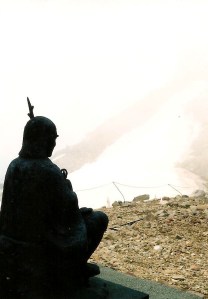
After a quick prayer at the shrine, I passed through the flatlands and onto the steep slopes of the volcano, passing by an impressive collection of Buddhist statues standing firmly among the pumice boulders and deep red soil. These works of art were placed in regular intervals among the straightforward route, a testament to the importance of this peak for ascetic monks. On this particular overcast day, the mountain was mysteriously absent of the white-clad pilgrims, who usually fill the peak during the busy summer months. Perhaps it was because the sacred structures flanking the summit plateau were still sleeping in their deep snow drifts of a lingering winter.

ontake5

Somewhere around halfway up the long slog towards the 3000 meter mark, I heard footsteps quickly approaching from behind. As I turned around, I made eye contact with an energetic climber dressed in bicycle gear. It was the same cyclist I had seen on the bus ride up. Not only was he riding the hill to the trail start, but he was running up the mountain as well. Soon after passing me, we hit the first of many long snow fields, and it was here that the rain commenced. The athlete halted his footsteps and retreated, blurting out a quick “zannen” before vanishing back down towards the parking lot. My guess is that this climb is a weekly occurrence for him,and he wanted to hit the pavement again before the roads became too slippery. The rain didn’t stop me from advancing, however, as I forged a path up the gargantuan valley of snow until it disappeared into the mist.

ontake3

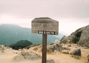
The rain only lasted about 10 minutes, letting up as quickly as it had come. I’m sure that cyclist was cursing his hasty decision, and I was half-expecting him to resume his hike, but I never saw him again. Once into deep cloud, the dirty white of the crusty snow meshed with the ghostly white of the clouds, and if it weren’t for the deep groove of footprints I never would have found my way to the ridge. Once at the summit of Otaki, the snow gave way to volcanic steam vents, which wore thick layer of sulfuric cologne. The shrine here was still buried up to the roof eves, but the final push to the summit lie on the wind-swept ridge, so navigation was a breeze except for the wafting aroma of rotten eggs attacking from all directions. The top of Ontake was home to yet more structures, which provide accommodation for arriving visitors, but only during the main climbing season. The doors were still boarded up, and the top lay deserted sans a few other hikers who had made the brave ascent in the dismal conditions. One such visitor stood out among the other elderly walkers: a young Japanese man out hiking along. Out of the two dozen Hyakumeizan I’d done so far, this was the first time (other than Mt. Fuji of course) to run into someone my age, so we immediately struck up a conversation.

ontake6.jpeg

He introduced himself as Fumito, a 24-year old originally from Kagawa Prefecture who had relocated to Shiojiri to work for Chubu Electric. I inquired about his choice of climbing routes, and it turned out he had started an hour earlier than me from the same approach: I very likely walked right past his car when disembarking the bus. Since I had no way of getting back to the station, I politely asked if he could honor my request. Gladly, he accepted, and both of us decided to descend together back down the same trail we had come up. My original intention was to traverse over to two small volcanic lakes lying just below the summit before making the long trek down to Nigorigo hot spring. There were two things inherently wrong with this idea: for one, I physically had no idea which direction the two lakes rested, since visibility in the thick fog was reduced to only a couple of meters. Second, the entire route on the northern face of the volcano was completely buried, with few hikers ever using that approach even in the summer season. I would surely get lost on the way down and even if I didn’t, I would have to negotiate some sort of ride out of the hot spring town.

ontake4

Fumito and I talked the entire way down, finally popping out of the clouds into unexpected sunshine. I told him of my quest to climb the Hyakumeizan, which he enthusiastically endorsed.  On the drive back to town, the skies opened up, dumping heavy rain that forced us to the shoulder of the road. Both of us praised our excellent timing, and I knew right then that I had made the wise decision not to do the traverse alone. Fumito dropped me off at Fukushima station, where we promised to go hiking again sometime soon.

Read Full Post »

The next morning, after a bit of a sleep-in (7am wake-up instead of the usual Japanese start of 4am), we packed our gear and contemplated our next move. The rain had moved in with a vengeance, and any thought of scaling Mt. Hiuchi in this natural shower seemed crazy, but here I was faced with a mountain so close that it would be a huge setback not to reach the summit on this outing. We reached a compromise: I’d head out alone, bringing only a water bottle and a bag of peanuts. Kanako would wait in the warm, dry hut for my return, at which time both of us would head down to the trailhead at Sasa-ga-mine. “See you in 1 hour”, I affirmed with a look of disbelief from the other hikers and hut staff. “There’s no way he’ll be back in an hour”, retorted the hut owner, proclaiming that Kanako wouldn’t see her husband until at least early afternoon. The map times alloted 2-1/2 hours just to reach the summit of Hiuchi from here, and that’s without the return time. A challenge was on and I was more than ready for it.

myoko2-1

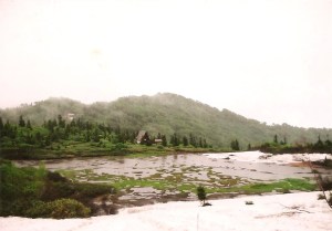
With a dash I set off into the downpour, wearing only my rain suit. I pushed up and over Mt. Chausu and down to the junction at Kouya-ike in only 15 minutes. From there, the marshlands in front of the hut resembled one giant lake, partially covered with yet another thick patch of slippery snow. Relentless I was in my pursuit, flying past the buried wooden walkways of the Tengu’s garden before reaching the ridge for the final push towards Hiuchi. The clouds had lifted a little, revealing the peak in all its verdant green beauty. Breathtaking though it was, I didn’t loiter around too long, marching up the final set of wooden steps to the high point. Time check: 40 minutes from Kurosawa hut. Not bad for a guy with a leaky heart valve.

myoko2-3

The snowfields catalyzed my ascent, and I would have easily made it back within the hour if not for a brief stop at Kouya-ike hut. “Excuse me”, I asked the staff, “do you know the bus schedule from Sasa-ga-mine to the station?” The reply bounced back as if returned by a professional table tennis player: “There is no bus”, explained the hut manager Masa, “but I’m heading down later today and can give you a ride.” With this extremely good piece of news, I once again set off for Kurosawa, arriving exactly 1 hour and 15 minutes after leaving Kanako behind.

myoko2-5

“You made it to the summit?”, quizzed the hut staff, still spellbound by my Jamaican speed runner pace. Rest breaks are pretty pointless when you’ve got no view and you’re soaked to the bone. I was ashamed to admit that I was pretty spent after that insane burst of energy. We ordered some hot noodles as reward for knocking off Hiuchi. I alternated mouthfuls of buckwheat with morsels of trail mix and chocolate, trying to up my calorie intake to compensate for the increased exertion. We finally hit the trail together just before noon, keeping a brisk pace in case the hut owner should beat us to the bottom. We didn’t want to inconvenience anyone by making them wait unnecessarily for us, so we skipped steadily ahead until reaching Fujimi-daira, where the trail from Kouya-hut met the main trail from Kurosawa. We rested leisurely here among the cover of the forest canopy, knowing that even if the hut staff caught us we could walk together in relative ease.

myoko2-2

Reaching the parking lot around 3pm, we searched for any signs of our saviors, but no one was in sight. We waited in the small shelter marking the entrance to the trail, hoping that we hadn’t somehow missed them. About half an hour later, the group of 4 from the hut strolled in, and we were whisked to Myoko Kougen station to catch our train. As a way of thanking the kind hut staff, we offered to treat him and his girlfriend to a later afternoon snack, so we headed to a noodle shop and listened to some pretty insane stories from our driver. “You see this scar?’, buzzed Masa, pointing to a gash just below his lower lip, “I fell off a cornice while skiing and my upper teeth went right through my lip.” This was a man that truly lived on the edge, and enjoyed every minute of his life.

myoko2-4

Overall, despite the foul weather and treacherous conditions, the mission was a resounding success. I was now up to 52 mountains under my belt, but had a long summer and autumn ahead of me if I wanted to reach the magic number 70 before the end of the year.

Read Full Post »

The rainy season lingered on, like the scent of a prematurely extinguished match. Marine Day drew near, and with no apparent end in sight, Kanako and I had our eyes set on two peaks in southern Niigata Prefecture. After an overnight bus to Nagano city, followed by a slow local train on the JR Shin’etsu line, we hailed a taxi at Sekiyama station through the pouring rain to the hilly hot spring town of Tsubame onsen.

myoko1-1

The streets of the town lay mostly deserted, the tourists confined to the dry comforts of their hotel rooms. At the start of the track sat two open-air baths, partially concealed by a row of landscaped bushes and a tattered bamboo fence. Seeing how we were just beginning our hike, it would have been futile to stop now for a bath, so we pushed on through the steady rain falling on the shuttered ski runs. Shortly into our stroll a group of 3 hikers descended, led by a lanky, bearded fellow wielding an ice axe over his left shoulder. His footwear consisted of woven straw sandals (waraji) with a dull pair of 4-point crampons tucked underneath. Long, red shorts covered three-quarters of his slender legs, while a simple white v-neck shirt kept his nipples hidden from view. Topping off the outfit was a traditional woven bamboo hat (kasa), which looked as if it had be surgically attached to his perfectly lined cranium. He had the aura of someone famous, but I could do nothing other than stare out in utter fascination and belt out a quick konnichiwa before his party raced off to the hot spring baths.

myoko1-3

The path we were on followed a torrent of a stream, skirting the edge of an occasional snowfield to reach the cause of the brisk flows: a towering waterfall that roared with such ferociousness as to send uninvited shivers down my spine. To our discomfort, the trail climbed directly parallel to the falls, steepening at ever-increasing angles. The snow made the footwork tricky, but the chains bolted to the rocks gave added support. Once past the top of the falls, the river, though flowing faster than most commercial airlines, narrowed to a meter-and-a-half across. The bridges that would make passage safe were long since washed away. Kanako and I searched for an alternative path that did not require crossing the waters, but the only way up to Mt. Myoko lie in a ravine on the left bank of the river.

myoko1-7

I jumped across first, dropped my heavy pack, and scooted to the edge of the bank. Kanako was pretty scared and none-too-confident, but once I extended my trekking pole to her, handle first, and instructed her to jump as if fleeing a gigantic swarm of caterpillars (her greatest fear, even more than snakes, spiders, and bears combined), did she lift off her feet, grab onto the pole, and fling herself to where I was standing. Grabbing her arm, I pulled her up safely away from the river bank and onto more stable ground. If she fell here there would have been no way to stop her from plunging over the falls to an almost certain death. Despite being drenched with both sweat and rain, both of us treated ourselves to a much-deserved break to help calm the nerves and slow the adrenaline.

myoko1-2

The route followed the bank of the river before hooking left, up a narrow valley towards the ridgeline below Myoko’s conical summit. Steady progress was made as the rain finally started to let up. At the ridge sat a junction, with a trail leading down to the ski lifts of Ike-no-taira resort. Turning right, the trail immediately steepened, passing through an area of tricky chainwork bolted to the slippery rocks. Thankfully we would not have to descend this area on the way back, since our goal was to traverse further north towards the meadowlands of Mt. Hiuchi. Thick cloud blotted out all visibility when the summit of Mt. Myoko was attained, shortly after 2pm. Silence and serenity were a much welcomed sight to an otherwise very popular mountain. Most groups had either already made their way off the peak or to their awaiting hut accommodation by now. After a quick snack, we geared up once again and continued on our lonesome journey.

myoko1-5

Just past the top, the trail disappeared in a massive forest of white. The northern flank of Myoko still had a tight grip on winter despite being mid-July. Without crampons, the route became slippery and somewhat treacherous, as we stuck closely to the trees to help aid in the balance. Gradually the gradient began to wither, as we reached an open area with a field of snow 50 meters wide that ran several football pitches in length. No tape marks or signposts became apparent, but I used my instincts to tell me which way to navigate. Turning left, we kick-stepped a path roughly parallel to where we descended, but the angle refused to ease. The snowfield continued, as if laid down on a marathon route to nowhere. Something just didn’t feel right.

myoko1-6

“Kanako, wait”, I commanded. I dropped my back and raced back down to where we had last seen the trail. There, on the other side of the snowfield, lay a red tape mark, partially buried in the thick ice. Racing back up to my companion, I broke the news to her while both of us carefully and systematically reworked our steps onto the correct path. From here, the snowfields continued to grow. I was really starting to wonder if summer would ever come to the hills of Niigata this year. Some of the traverses really required an axe, but trekking poles gave just enough of a brace, as long as the foot steps were carefully placed. Slipping here would mean a long slide down to a secluded marshland, which would add at least an extra hour of time to climb back out of. Darkness started to overtake us as we finally made it past the hairiest sections and into the flat plains of Kurosawa.

myoko1-4

Kurosawa is an octagonal hut that resembles an abandoned NASA spacecraft. When we entered the hut, shortly before 7pm, the entire place was dark. Even the hut staff had started preparing for bed. When we climbed the stairs to the second floor sleeping area, we couldn’t believe our eyes: every inch of floor space had been occupied by retired pensioners. The hut officially sleeps 60, but I’m pretty sure there were more people that that squeezed in there. We did manage to find a tiny space for the both of us near the entrance, which meant we’d hear every single person as they embarked on their midnight toilet breaks and 3am wakeup calls to start their hikes. At least we had a dry place to sleep.

myoko1-8

Donning our headlamps, we headed outside to cook up some noodles and warm tea. The damp weather and mist-filled clouds had done their best send temperatures to late-autumn levels. Even though we had brought camping gear, staying at the hut proved to be the better option. With satisfied bellies and properly circulating blood, Kanako and I retreated to bed, for we had another peak to bag the following day, followed by a long descent back to the valley.

Read Full Post »

I’ve always been confused by the idiomatic expression back in the saddle. Shouldn’t it be back on the saddle? After all, we use the expression get back on the horse, not get back in the horse. Regardless of the proper prepositional nomenclature, I decided that 17 days after being discharged from the hospital was a sufficient time to allow my body to heal. Kanako wasn’t so enthusiastic. “Don’t go to the mountains so soon,” she demanded,   “and don’t go by yourself”. We reached an agreement, allowing me to go to an easy mountain with a lot of people around in case I ran into trouble. Luckily we were using my definitions of “easy” and “crowded”.

kashi1

I boarded a late morning train on the Hankyu line bound for Nishinomiya-kitaguchi, where I changed to the Takarazuka line. I take this route weekly for my work when the semester is in full swing, but today’s target lay a few stations to the north, at a place called Sakasegawa, the river of the back-flowing rapids. After changing to a local bus and creeping along a busy roadway lined with subsidized housing and golf courses, I alighted in front of the local high school, prepared my gear, and set off towards the hills. I came armed with something that I did not have on that fateful hike in January: a GPS device. I was taking no chances on this outing, carrying not only the electronic navigation system, but also a guidebook and a detailed Shobunsha map of the entire area. There would be no wrong turns this time around.

kashi3

The narrow road to the trailhead was sandwiched between a broad park and river bank on the right, and dense brush and untouched forest on the left, with a collection of old, dying trees. Perched near the top of one of these trees was a kogera, the Japanese version of the pygmy woodpecker. Though I have heard the elusive birds a number of times, this was my first face-to-face encounter.

kashi2

After walking on the road for a few minutes, a worn out signpost revealed a small clearing on my left. The route immediately dove into a forest of pine and brush, reminding me of some of the drier peaks in California’s coastal mountain range. Rubber stairs were fastened to the crumbling hillside, which aided in the steep climb. Sweat immediately poured down my glasses and into my mask: I needed to keep my facial protection to keep the cedar pollen at bay. My last allergy test revealed that my allergies had reached dangerously sensitive levels.

kashi6

The gradient eventually leveled off when I hit the rolling ridge: the peaks weren’t massive but the contours and grade more than made up for it. Several trails darted off the ridge in a near vertical descent, in what the Japanese call a kiretto. The origins of this word are unclear, but one thing seems certain: even though it is written in katakana, it is not a loanword. The word comes from the Chinese characters depicting an open door (切戸). Generally, a kiretto is a v-shaped gap in a ridge, where the climber descends steeply to a saddle before climbing up again, much in the way that a door has a v-shape when left partially open. Due to my promise to Kanako to be safe, I opted for the easier route off the peak.

kashi5

It felt refreshing to be among the greenery of the forest, moving along deserted ridges with amazing views of the dust and smog of Osaka city, a place that I continue to call home despite my plethora of health problems. Eventually I would like to relocate some somewhere “cleaner”, but when you’re severely allergic to dust mites on top of most pollen, there aren’t many options.

kashi4

The first test hike was a resounding success. Other than the challenges that come with hiking in a full mask, the lungs held up. As long as I choose days with low pollen counts, I should be ready for a fun-filled (and safe) spring.

Read Full Post »

The rain came down in rhythmic sheets for most of the night, pushed on by the autumn gusts whipping through Ina valley on their way to Kofu city and the outer reaches of the Kanto plain. I rustled back and forth in the warm futon, trying to drown out the drum-like drone of the pellets bouncing off the hut roof. Fatigue eventually took over, and the next thing I remember was the sound of  shifting nylon, as groups of eager hikers donned their matching rain suits before heading out into the murk.

kai3-2

I got a more leisurely start, cooking up a light meal of warm noodles near the hut entrance, where I had a good look at the nasty conditions. Despite the uninviting weweather, I knew a mountain with my name on it lay hidden above the dreary mist. Sure I could have turned my back and called it a day, but it’s an awful long way from Osaka to Kitazawa pass.

kai3-6

After putting on my fire-engine red full body rain suit, I stepped out on the trail towards Mt. Senjo, a thousand vertical meters above me. The rain continued steadily but fortunately the wind remained relatively calm. The lofty alpine fields of the Japan Alps are a magnet for cloud cover, as any full-bodied mountaineer can attest. I accepted my fate with relative serenity, knowing that the views from Mt. Houou made the trip a resounding success. Today, however, I experienced a bizarre phenomenon that has yet to be repeated: though the rain made the journey from the stratosphere, the accompanying cloud did not. Once above the tree line, visibility were comparable to a cloudless, sunny day. The spiny crags of Mt. Nokogiri ran westward from the rocky spires of Kai-koma, as Yatsu-ga-take looked on from across the deep valley.

kai3-3

Once I hit Mt. Ko-Senjo, I got my first glimpse of the massive col that surrounds the summit plateau. Kita-dake was visible to my immediate left, all but the tip of the summit below the cloud line. Beyond, even Mt. Fuji remained clear up until the 8th stagepoint, appearing on the horizon as a perfect volcanic trapezoid. I savored the views, knowing the clouds could roll in at any moment to spoil the fun.

kai3-4

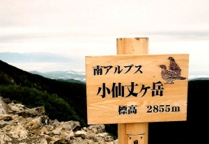
The final push to the top was along the outer edge of the col. The rain was reduced to a fine mist, so I unzipped the jacket to help air out my sweat-laden armpits. Step by slippery step I marched, reaching the highest point just after midday. The views to the north, hidden by the linear line of Senjo’s flowing ridge, were finally released from their tight grip, as I had breached the 3000 meter mark for the first time on the trip. To my utter disbelief, not only did the Minami Alps remain free from fog, but every peak in the Minami Alps stood clear.  In addition, Kiso-koma in the Chuo Alps soared up above the Ina valley, while Ontake and Norikura sat on the edge of the dark wall of cloud. The rest of the Kita Alps was swallowed by the low-pressure leviathan. I was glad to have made the decision to stay south this trip, as I still had plenty of peaks to climb that lay victim to this evil storm system.

kai3-5

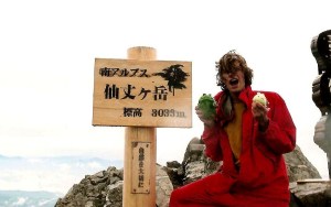
As I rested on the saturated rock outcroppings, a trio of young climbers reached the summit. They were part of a university mountaineering club in Nagoya. I asked them if they had been to the Aichi Expo, since it was currently in full swing. On cue, they pulled two stuffed toys from their packs: Kiccoro and Morizo, the two mascots from the World Exposition! What a better way to add variety to the usually summit shot, I thought, handing my camera over to the more competent of the photographers.

kai3-1

The chance encounter, along with the stellar views and the retreating storm system, kept my spirits soaring, and I flew back to Kitazawa in a fraction of the time it took me to ascend. Once at the pass, I boarded a shuttle bus bound for Hirogawara, followed by a bus back to Kofu and a long train ride back to Osaka. The Minami Alps were almost completely conquered: I only had the southernmost peaks of Tekari and Hijiri remaining. As fate would have it, they ended up being peaks #99 and #100, which probably says something about my affinity for this area of Japan.

kai3-7

There is a bit of a lesson to be learned from this soggy climb: even if the forecast calls for rain, don’t be fooled into thinking that nimbostratus clouds will blot out the view. With a little perseverance, you just might surprise yourself.

Read Full Post »

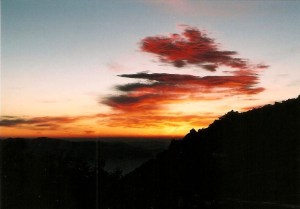
The horizon burned a fiery crimson when I finally hit the trail just before 5am. Breakfast consisted of a hurried bowl of warm oatmeal: the race against the rising sun was on. The maps said it would take around a hour to reach the ridge, but such time was not an option: if I had any chance of getting good shots of Mt. Fuji I would need to be sitting on the ridge now, before the first rays of the dawning day drew near. A brisk pace carried me through the sleepy stands of hardwood and conifers, which stood guard over the great heights of the rolling phoenix. The higher I climbed the brighter the horizon glowed. I knew I wasn’t going to make it but managed to get high enough to get a glimpse of color.

kai2-1

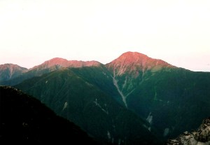
The scarlet clouds of a new day could only mean one thing: a low pressure system was on the move. While not always the case, a red sun in the morning is usually a warning of approaching storms, but would they hold out until I safely cleared the alpine danger zone? The final 50 meters to the junction was unbearably steep, as I spend the final efforts on all fours literally slithering my way back above the tree line. Gazing due west, the triplet peaks of Shirane sanzan glowed like the embers of a fire fit for giants. Perhaps I wasn’t too late after all.

kai2-3

By the time I reached the summit of my first target peak (Mt. Kanon, peak # 34) the sun had made a welcome appearance, casting strong shadows across the deep valley I had trudged up less than 24 hours earlier. In complete solitude, with a deep reverence of the wilderness spread out before me, I marched back towards the obelisk, which finally stood tall, unobscured by clouds.

kai2-5

The ridge undulated through an eternal array of deep folds, but with visibility so vast, I skipped daintily as if on an early morning stroll through an enormous park. After an hour or so I reached Hirogawara pass, and gazed down the long gully that took an eternity the previous day. After that I spend the rest of the day marching west, towards the rocky spires of Kai-komagatake, a peak which I had hoped to summit before nightfall.

kai2-2

At Miyoshino I took a well-deserved lunch break, staring out over the mighty Kita-dake and the rest of the spires of the Minami Alps. Sunrise was precise in her prediction of a change in the weather, as a layer of altocumulus clouds rolled in from the southwest. By now it was approaching 3pm, so with haste I jogged on to Asayo pass, which sat on a strategic perch nearly 2800 meters in elevation. It was here that I met my first hikers of the day, a retired couple from Saitama, just outside of Tokyo. I reached down to grab my camera, seizing the opportunity to get a self-portrait snapped as a memento for the epic hike. To my complete and utter astonishment, the camera was nowhere in sight. My best guess is that is was sitting on a rock at Miyoshino, a 20-minute walk away.

kai2-4

With daylight now starting to come into play and a weather system that would likely release precipitation before nightfall, I was left with a crucial decision: turn back and grab the equipment, or trudge on to the summit of Kai-koma. I had less that 500 ml of water remaining, and in the afternoon heat I knew I would need more liquids for the remainder of the climb. Explaining my predicament to the elderly couple, the wife immediately pulled out a bottle of unopened tea, explaining that they had no need of it since Asayo was as far as they were heading today. Thanking them profusely, I turned my back on my target peak and rushed back to Miyoshino, finding my camera sitting quietly on a rock.

kai2-6

Now that I was reunited with my gear, I retraced my steps back to Asayo and descended steeply down the other side, to Sensui pass, where a water source lie in the valley below. It was an hour round-trip, but what other choice did I have? I could have easily checked into Sensui hut and climbed Kai-koma the following day, but with the approaching weather front I knew my best window lie just before me. After filling up on liquids, I ascended back to the main ridge, reaching Sensui pass shortly before 5pm. According to the map, it was a 3-hour trudge up to the summit, followed by a 2-1/2 drop of 1000 vertical meters to the hut at Kitazawa pass. Things were starting to become interesting.

kai2-7

In a true race against the clock, I pushed up to the junction just below the peak in only 25 minutes. I was truly heading at a marathon runner’s pace now, but the fatigue and altitude were starting to affect my decision making. There are two route up to the summit once you hit Roppo rock: skirt up to the right and around the edge of the flank, or head straight up a near vertical rock scramble. I’m pretty sure you can guess which route I chose.

kai2-8

The route is marked by a dotted line on the map and for good reason. Though not technical, one slip here would send you bouncing off the boulders to an almost certain death. I held on with all my strength, following the yellow paint marks with all of my mental energy focused on my footholds. The X marks painted on the boulders showed which areas to avoid, and though the skies were dark, the low altitude clouds had held off. I can only imagine how tricky this route must be in less-than-ideal conditions.

kai2-9

It was after 6pm by the time I topped out. As I looked across the valley towards Mt. Senjo, I noticed the top had been swallowed by a curtain of white, with a thick layer of gray fanning out across the open sky towards my current position. I really had to get a move on if I wanted to make it off this mountain as a dry man.

kai2-10

I took the ‘easier’ route back down to the pass, which proved tricky in the loose scree that blankets Kai-koma’s sandy mound. The layers of stone have the look and consistency of snow when viewed from afar. Snow, however, would prove much easier to navigate than this pebbly playground.

kai2-11

Once back in the treeline, I rolled along the ridge to Mt. Futago, where I dropped my back and rearranged my gear. Rain would soon be falling, and I needed protection other than what the woods would provide. I stuffed a handful of mixed nuts into my mouth and finished off the remaining supplies of water, knowing that my next stop would be at the hut in the valley far below. Just before setting out I donned my rain jacked and fastened my torch securely to my forehead. I made it about 50 meters down the southern face of Futago before the skies erupted in a loud roar.

kai2-12

Thunder rumbled from an unseen source as I stumbled through the dark forest. Using the headlamp to guide me, I pushed on just like Michael Douglas and Kathleen Turner, reaching Chouei hut around 7:30pm. The caretaker, though startled as he was, gladly showed me to my awaiting room as other guests looked on with disbelief. I had a dry place to stay, and after firing up the stove, had a full belly to boot. Things were starting to look up, but the trek was far from over.

Read Full Post »

Three peaks in the northern section of the Minami Alps remained on my list. Rather than tackling them individually, I seized the opportunity to scale all 3 at once, though the route would not be easy: 3500 vertical meters of elevation gain spread out over a 30km area. Finding a window of holidays in late September, I boarded the overnight bus to Kofu, followed by the early morning shuttle to Hirogawara, the starting point for my unprecedented traverse.

hou1-1

During initial route planning, I mulled over the idea of starting at Yashajin touge, which would allow me to traverse the entire Houou mountain range. While tempting, it would add an extra 10km to an already long traverse, so the shorter approach from Hirogawara won out. The route involved a bit of backtracking, but I knew it would be the least popular of the 4 approaches to the peak. Solitude was something I longingly craved, for the previous month’s ascent of Yatsu-ga-take was anything but: scores of Kanto adventure seekers armed with entire families of unwilling under-aged mountaineers. I wanted a place that screamed wilderness, and knew taking the path less traveled would provide that remedy.

hou1-2

From the massive bus parking lot of Kita-dake’s extremely overcrowded entrance, I trudged past Hirogawara’s namesake mountain hut and ventured to the northwest, along the paved road to Kitazawa Pass, where I would eventually end my trek. Off limits to private vehicles, the deserted pavement was a welcome sight after the jubilant atmosphere of the nearby bus terminal. After 10 minutes of gentle climbing, I spotted the trailhead on the right bank of the shoulder and disappeared into the dark forest. According to the map time, I had a 6-hour slog ahead of me, but I knew  I could easily half that pace with my small pack and fit body. I decided to travel as light as possible: the tent and sleeping bag were traded for a few extra paper layers in the wallet that would cover hut accommodation. This was my first experience relying solely on the comfy lifestyle that the hut provides: a dangerous and costly addiction when compared to the bodily torture of carrying half of your body weight on your shoulders.

hou1-3

The route, though a little overgrown, was fairly well-marked despite the lack of foot traffic. After gently gaining altitude through the groves of oak, beech, and birch, I hit a massive boulder field which stretched all the way up to the horizon far above my head. Perhaps I had found the reason why this was the road less taken. Luckily visibility was good and it was a breeze keeping pace with the paint marks and arrows scattered through the steep alpine couloir. I hit the ridge after only 2 hours of steady climbing. The map said to allow at least 3-1/2 hours with their “middle-aged” allocations. The following day, I would need to backtrack to this point and continue to the west, but for now I headed east, up above the tree line to an unmarked crest just shy of 2800 meters above the sea. Shortly after descending the other side, I hit thick cloud and lost the views I had very much looked forward to: the rest of the Minami Alps spread before me while Mt. Fuji floated about them all. There was always a chance of capturing the scene the following morning if I could rouse myself out of bed in time.

hou1-4

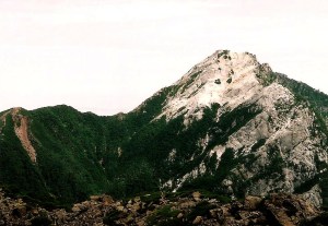
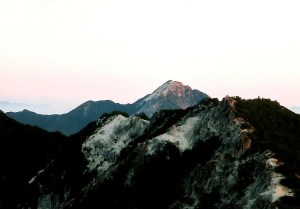
The path soon turned to a slick sandy grime, courtesy of the vast deposits of sandstone lining the entire Houou range. These fields of crumbly scree are one of the trademarks of the area, whose name translates at the Phoenix range. Perhaps these mounds of sand are remnants of the mythological birds, who must’ve have come here to die and reawaken from their own grit-like ashes. A little further along the glazed path, I reached the base of the obelisk rock formations of Mt. Jizo, the first of Houou’s three sacred peaks. I could just barely make out the phallic shapes of the rocks in the thick mist. Giving it a miss, I scrambled back down to the tree line and reached Houou hut shortly before dusk. After checking in, I headed outside to prepare dinner. Though I was staying in the hut, I opted to save a bit of money by providing my own meals: a savings of roughly 3000 yen when compared to being fully catered. The hut owners generally have a hierarchy when it comes to customers. Those paying for 2 meals generally get treated like kings, while those who are paying for bedding only are usually quarantined to a different part of the hut, where they must prepare their meals in isolation. Finally come the campers, who the hut owners want no part of, since they aren’t making a profit from the DIY crowds. There are exceptions at different huts, of course, but generally in the Japan Alps you can generally expect the level of hospitality to rise in accordance with the amount of money you are forking over.

hou1-5

Sometime around 8pm I settled into my futon and drifted off to sleep. I had a marathon day ahead of me and needed as much rest as I could spare.

Read Full Post »

A hour north of Tokyo and a short hop from Kasumigaura lake lies the twin-peaked summit of Mt. Tsukuba, one of Japan’s 100 Famous Mountains. While hardly a monster, the mountain played an important role as a training ground for followers of Shugendo. The mountain itself has a long and fascinating history, overshadowed by the 20th century additions of a ropeway, funicular tramway, and a mountaintop restaurant. These abominations can catch the casual visitor off-guard, but Kanako and I knew what we were in for, lowering our expectations for our impending visit. We’d already had lots of practice being let-down by scaling three of Kansai’s most developed summits (Ikoma, Rokko, and Kongo for those out of the loop), so we knew exactly what Tsukuba had in store for us….or did we?

tsukuba1

After a long train and bus ride from the capital city, the two of us arrived at Tsukuba shrine just before noon on a sunny but blustery Christmas day. The path immediately dove into a surprisingly calm and tranquil forest, which stayed within spitting distance of the tracks of the funicular railway. As we rose higher above the valley floor, I tried to picture what the forest must have looked like before Japan’s obsession with cedar began. The downfall of the great mountain started with the Meiji Restoration, when most of the great temple that flanked these slopes was destroyed in favor of the “state” religion of Shinto. Next came the cable car, whose tracks Kanako and I marveled at for the better part of an hour on the straightforward ascent. The railway was opened in 1925, which means the summit desecration must have ensued not long after. The route started to steepen, as the tracks entered a long tunnel and we traversed across the top of the entrance towards the saddle connecting the two peaks. Here the cedars gave way to deciduous forest which offered glimpses of the Kanto plain through the bare branches and dense underbrush. We stopped for a quick break, replenishing lost fluids on the somewhat tough climb. From all of the destruction on the peak you would think it would be a walk in the park, but after examining the map we realized there was a 600-meter vertical elevation gain from the shrine to the summit, most of it without switchbacks that would have made things a bit easier.

tsukuba2

Shortly before 2pm, Kanako and I topped out on the saddle, took one look at the shuttered restaurant blocking most of the path, and turned left, reaching the summit of Nantai (the male peak) a few minutes later. Here we confronted the stiff gales swooping across the plains from Tochigi. Tsukuba rises abruptly out of the valley, and there are no other peaks north of here until reaching the volcanic highlands of Oku-shirane, which lay in deep snow and a thick layer of cloud. The batteries on my camera started to give out, as I wondered if I’d be able to get any summit photos before they expired for good. I had plenty of film but no back-up power source. Our next stop along the ridge was Nyotai, Tsukuba’s female counterpart and the higher of the two peaks. The path from the restaurant to the high point was lined with concrete, an unwelcome sight after the greenery spreading out below us. We pushed past a pair of pensioners out for a Monday afternoon stroll, but apart from them, the whole area was deserted. Perhaps it was because of the impending New Year’s holiday, or perhaps it was the subzero temperatures that kept the crowds at bay. Whatever the reason, we had no reason to complain and enjoyed the solitude that peak #42 offered.

tsukuba3

After a modest lunch of chocolate and sandwiches, Kanako and I meandered down the eastern side of the peak, past some mesmerizing rock formations that must’ve provided those Shingon monks of yesteryear hours of meditative dedication. Instead of following the ridge all the way down to the hot spring and ropeway, we spied a loop trail on the map that would take us back to the bus stop. Turning right, the route dropped headlong into a thick forest of cedar and hardwood trees. By this time the light began to fade, as our late start meant that the sun would reach the horizon before we would. We quickened the pace as much as we could, but again the lack of switchbacks and the steepness of the angle afforded sturdy footwork that couldn’t be rushed. Exiting the forest shortly before 5pm, we reached the paved road above the shrine, following the zig-zags of the contours with our feet, and the orange glow of an advancing evening with our eyes. As I peered out at the horizon, Mt. Fuji’s majestic cone stood out like a cigarette butt in a sea of fiery ash. I brought the viewfinder to my cornea, but the batteries had long been exhausted. What I couldn’t capture on film I would have to simply emboss on my prefrontal cortex.

tsukubamap

Due to our poor timing, Kanako and I had over an hour to kill before the next bus, so we strategized about our upcoming traverse of Tanzawa, set to commence in two days time. We had one more day of lazing about Tokyo before the real work began.

Read Full Post »

Another setback part 3

The middle-aged nurse came in shortly before 3pm with an electric razor. I dropped my pajama pants and the artist went to work, removing all evidence of puberty below the waist. This was a necessary precaution, she explained, as bacteria can easily stick to hair follicles, leading to an infection. Plus, they would need to tape my entire groin area after the procedure, which would cause a lot less pain and friction if taped to a smooth, hairless surface. Still, it was much better than my last operation, where the nurses shaved me from my neck to my knees.

op1

The following day, a Thursday, I was scheduled for an early morning procedure to stop the bleeding in my lungs. Around 8:45 in the morning, the pre-op preparations commenced. The on-duty nurse entered my room with a variety of instruments, one of which she referred to as a “balloon”. Upon closer inquiry, I realized to my utter shock and horror that she was about to insert a Foley catheter into my manhood. I tried to reason with her, even convincing her I could hold my urine for the entire duration of the operation. As the tube came closer, I braced my body for impact. Kanako looked on with horror as screams of suffering echoed throughout the room. The tube seemed to be several kilometers in length. I felt as if I was being belated on a multi-pitch climb: the catheter inched its way into my bladder in agonizing stages. By the time the tube came to a complete halt, my cheeks were filled with tears and I truly thought my baby-making days were ruined forever.

op2

Next came the IV in the right arm, which was a piece of cake compared to the tube dangling below me. At 9:20am three of the strongest nurses invaded the room, picked me up, and put me on the gurney for transport to the operating room. Dr. Ishikawa greeted me with ease and started the preparations for the surgical task. The room itself was set up a bit like a recording studio. On the far side of the space there was a rectangular glass window that ran the length of the room. Behind this partition, two doctors looked on and gave instructions to my surgeon. Kanako was also allowed to set in mission control and overlook the proceedings. To my immediate right was a small computer screen where I could watch the procedure live. After some local anaesthesia in my right thigh, Ishikawa made a small incision and inserted a tube into my right femoral artery. Inside this tube, he inserted a series of smaller catheters that ran up towards my bronchial artery. From here, the current of the blood took them to smaller vessels aligning my left lung. Here, the master technician inserted tiny platinum coils to cut off circulation to the damaged blood vessels that were causing the bleeding. The operation is known as a Bronchial Artery Embolization (BAE), and Dr. Ishikawa is one of the world’s leading experts on the procedure. In fact, the Osaka-based doctor has designed and patented catheters bearing his name.

op3

About 20 minutes into the operation, I felt a strong pain in my lower back. I desperately needed to stretch or at least change positions, but I wasn’t allowed to move. The nurses came over and slid some cold compresses in the small space between my muscles and the table, which helped alleviate some of the discomfort. The procedure itself didn’t hurt very much, except when they inserted the contrastive agent into the arteries surrounding my chest. Three hours after starting, the surgeon signaled the end of the operation, and I was carted back to my hospital room with stern instructions not to move for another 5 hours. The muscle pain in my lower back intensified, but there was absolutely nothing that could be done about it except to bide my time until 5:30pm. Lunch was served at my bedside, but I wasn’t allowed to sit up or even lift my head. Kanako spoon-fed me like a child as I struggled to chew my food without choking on it. Swallowing proved more cumbersome, as the food seemed to stop short of my stomach and gather at the bottom of my esophagus like a poorly-designed septic system. I gave up on food after a few mouthfuls and retreated to the comfort of my I-pod. Music was the only way to forget about the paralyzing pain shooting through my back muscles.

op4

Around 5pm I gave up and secretly thrusted my arms beneath me, lifting up my body like a clumsy gymnast. I counted down the minutes as if waiting to open a birthday present at midnight, and at preciously 5:30pm, I rang the nurse call button and braced for the inevitable. “Oh, it’s 5:30 already”, she exclaimed, before grabbing the tube levitating between my legs. The removal of the bladder drainage mechanism wasn’t nearly as traumatic as the insertion: painful it was, but it was over in a instant. I slowly sat up, being careful not to pull a back muscle in the process. The back pain eased, and after 20 minutes of walking, gentle massaging, and slow stretching, I was pretty much back to my normal self. Dinner was served at 6pm, devoured at exactly 6:01pm, and I drifted off to sleep before the nurse could come back and remove the tray.

op5

Two days later I was released from the hospital, where the real recovery began. Dr. Ishikawa reassured me that the chest pain would ease after about a week and he was right. What I didn’t know is how unbearable the pain would be at times, and the sharp jabs kept shifting. One day I would have agonizing pain the minute I laid on my back and exhaled, while the next day sitting up straight nearly had me in tears. My energy levels have slowly returned, but the 3km I lost in the hospital has not. I’m not coughing up any more blood, but the cough does remain at times. I think I am finally ready to embark on a short hike to test out my lung capacity and to begin rebuilding some of the muscle tone I have invariably lost after spending a month without exercise.

Read Full Post »