Feeds:
Posts
Comments

Archive for November, 2014

The last remaining peak in Kyoto, and northern Kansai for that matter, refused to surrender peacefully. Back in late August, the thunder and torrential rain sent me scrambling for shelter, forfeiting any chance of knocking off the peak. A mid-October stable high pressure system brought a rare opportunity for revenge, so this time my trusty Kyoto confrère William joined me alongside newcomer Ed. William needs no introduction to readers of this blog, but those unfamiliar with the Hyakumeizan stalwart can get some background about the Kid and the Missus here.

choro2-7

The five of us set off from Demachiyanagi station after stocking up on supplies at the celebrated onigiri shop just a short hop from the ticket gates. After a couple of wrong turns through the twisty, narrow backroads of the ancient capital, we finally hit route 162, a byway that weaved along hills bursting with thick rows of Kitayama cedar trees rising abruptly from the narrow valley hugging both sides of a tributary of the Yura river. Further up the river basin the valley widened, passing villages of thatched farmhouses unswayed by the winds of change that have overtaken most of rural Japan. It was here that our journey turned west, skirting past a dammed section of river before curving around the southern flank of Mt. Chōrō in favor of a more leisurely ascent of the northern face. Or so we thought.

choro2-1

We pulled into the trailhead shortly after 11am, following a gravel forest road that hugged a stream glistening with emerald green water. While the walk was quite pleasant, a quick study of the GPS revealed that we were indeed walking up the completely wrong valley, so after retreating back to the car, the mistake was quickly solved by navigating the wheels one forest road to the right. We parked the car near a chain-link gate bolted securely across the paved forest road. You run into these roads all over Japan, whose asphalt is off limits except for those who work for the logging companies or those lucky enough to have access to the keys to the padlocks that are always tightly fastened to the gates like locked fortresses. We hit the road with our legs, with Ed and I pushing ahead while William and company took a more leisurely approach. Our haste was not without flaw, however, as we missed out on seeing a poisonous snake slithering along a ditch used for channeling rainwater down the slopes.

choro2-5

My map told me that we would have to follow this forest road all the way to the summit, but the charts also hinted at an old dotted route that cut through the paved switchbacks in a more direct approach to the top. Though the dotted trail did not register on the GPS, the five of us abandoned the road for a more scenic route. The trail immediately dissipated into a narrow creek framed on all sides by steep slopes. We headed right, skirting past an impossibly large beech tree balanced precariously on the 50-degree angle of the mountainside. The adults had no trouble with the inclinations, but for the Kid it was a monstrous effort. At one point the angle became too great, so we headed back towards the creek bed in search of a better route. If we had stuck with the road we would surely be on the summit by now, but Chōrō wasn’t about to give in so easily it seemed. Once we reached the safe havens of the waters, a choice was made to climb a spine on the opposite bank of the stream, as the angle was much more manageable. I once again took the helm of leader, punching through shrubs of rhododendron and towers of red pine in route to the mountain ridge.

Trees made for trusty handholds while the tree roots eased the burden on the foot work. About 10 minutes into the workout, as I pulled myself up with the right arm, my momentum suddenly halted when a tubular form glistened in the sunlight directly below my left foot. I jumped back, startling the snake stiff, as it tried to disguise itself by remaining perfectly still. It lay coiled there, like a piece of unkept rope waiting to to be tidied up. I signaled to the others to quicken their pace in order not to miss the free wildlife performance. The snake refused to budge, no matter how close we encroached, too frightened by the sudden encounter to make it a move. It was only when we gave the reptile ample breathing room did it slowly slither away to safety.

choro2-2

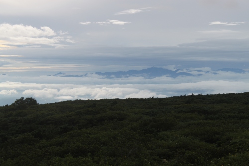
Fueled by the adrenaline of the close encounter, we pushed on, eventually reaching the ridge line marked by intriguing rock formations and stands of ancient hardwoods toughened by the decades of exposure to the Siberian winds and deep snowfall that blanketed these north facing ranges. Between gaps in the foliage, the twin summits of Mt. Aoba came into view, framed on the left by the waters of the Sea of Japan flowing through the bloated-fingered inlets of Miyazu Bay. Directly behind us, the summit of our target peak came into view. Though we were supposed to end up directly below the summit plateau, our shortcut had pushed us up a parallel ridge, but the correction of our impairment was easily amended on the pleasant stroll along the rolling ridge. Our hard work had once again paid off, as we sat on the edge of the old-growth forests of Ashu, a pristine area owned and protected by Kyoto University.

choro2-6

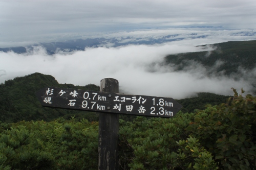
After a few minutes on the ridge, hunger pangs began to take hold and for good reason: it was already past 1pm and neither of us had stopped to refuel. At the crest of a long climb we stopped for lunch, Ed and I replenishing our energy reserves with a strong cup of mountain coffee. Once the caffeine took effect we once again tramped through the untouched slopes, eventually popping out onto a well-used path that doubled as the Kinki Shizen Hodo long-distance trail. This is a trail I’d been following the last few months, as this path connects just about every peak on the Kansai 100 list in northern Kyoto. If given the time and opportunity, a full traverse of the trail would be a worthy investment, as the section hikes I’d encountered over the last several months had been some of the best mountain routes in the entire region.

choro2-4

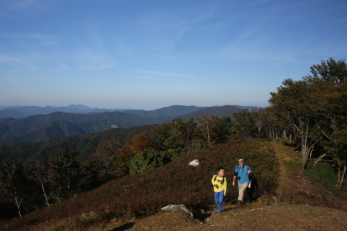
The trail dropped to a saddle, finally meeting up with the forest road we had left earlier in the day. From here, we were all surprised to find the angle rising once again, on a long, extended climb towards the high point. Sweat oozed from the pores on the unseasonably warm day, while the sun kept pace by reminding us that evening would soon be making her daily rounds. We hit the summit marker around 3pm with absolutely no one in site. For me, it was match point, and the final service was an ace. A victor prevailed in our wild game of tozan tennis, but it was too early for a victory lap. We still had to get off this mountain before dusk.

choro2-9

Ed and I opted for the loop trail that continued following the ridge before cutting down to the car, while William and family chose the easier option of just retreating down the forest road that we had followed on the ascent. The loop trail was brilliant in places and spectacular in others, but the final push to the car was a bit more than the knees could handle. Once again I had the bright idea to cut the switchbacks by making a bee line through a cedar forest, slicing open my hand while slipping on the moss-covered slopes. I reached for a handhold, grasping onto a thorn bush that slashed my left hand like a cat sharpening its claws on a shag carpet. When we reached the car I washed the wound in the creek and bandaged it up before we hit the highway back to Kyoto.

choro2-8

With peak #87 safely checked off the list, I could now focus solely on the remaining 13 mountains, all of which lay to the south of Osaka and few of which are accessible as a day trip. To add salt to the wounds, none of the peaks are accessible by public transport. It’s going to be a bit of a struggle to reach the magic #90 before the end of the year, but I am hatching up a plan to accomplish this with a little help from my friends.

choro2-10

Read Full Post »

“Mt. Oe is known as the Oni mountain”, explains Mr. Murata, the caretaker on duty at the visitor’s center at the base of the mountain. I had just alighted from a tongue-twister of a train station named Oeyamaguchinaiku, the closest public transport link to the trailhead. Since the station was deserted and in the middle of nowhere, I stumbled into the center and Murata-san called for a taxi, which would arrive in about half an hour. We spend the next 30 minutes deep in conversation, with my host explaining in great detail about the differences between oni and obake. Dreadfully, most was lost in the rapid-fire Japanese coming out of his mouth, but I did pick up enough to realize the historical importance of Mt. Oe’s volcanic peaks. Although many theories abound about the oni, one of the more popular legends states that the mythical oni-king Shuten-doji used the mountain as his home base while terrorizing people in the ancient capital of Kyoto. Oni can be translated as demon or devil, but the creatures are much more than just simple monsters, explained Mr. Murata. By the time the taxi showed up, I felt immersed in the basics on devil-ology, even if I can’t seem to recall much else from that conversation. (Mental note to oneself: next time carry an audio recorder or at the very least try not to wait 6 months before writing up a trip report) 

oe6

The taxi driver dropped me off at Onidake Inari shrine, a small nondescript building sitting three-quarters of the way up the rolling massif. A dozen hikers sat in repose on a handful of metal benches overlooking a spectacular vista into the valley below. The fresh greenery of the encroaching summer glowed brilliantly in the May sunshine. I turned away from the group and entered a virgin forest of beech trees clinging tightly to the eroding hillside. Wooden steps and gentle switchbacks made for an easy ascent, and the ridge line was breached in less than twenty minutes. Half a dozen ticks on the clock later, and the high point of Mt. Oe came into view, the exposed, grassy knob of the summit plateau affording incredible panoramic views of several neighboring prefectures. The folds of mountain ranges flowed seamlessly across the expanding horizon. Visibility this clear in a rarity in these parts, especially when the spring gales push the pollution across the sea from neighboring China. This was one of the fastest ascents of any of the Kansai 100, but fortunately the mountain range was an undulating ridge traversing over all of Mt. Oe’s quartet of peaks, giving me ample excuse to wander.

oe1

The path dropped steeply to a saddle before rising abruptly through a boulder field lined with alpine flowers and bamboo grass. After topping out on Hato-ga-mine (the pigeon peak), I took a brief rest, taking in the views straight down a valley tucked off to the north. My eyes traced the curves of a river vanishing off to the horizon where it met the azure waters of the sea expanding out to the curvature of the earth beyond. I could have stayed up here for hours, daydreaming about the locals preoccupied in the villages underneath my outstretched legs. My reverie was short-lived, broken by the cacophony of a trio of young, beautiful females dressed to the nines in sparkling fresh mountain gear and beaming with enthusiasm. Our brief conversation sent my blood pressure soaring above the charts, an indication that I had better get a move on.

oe2

I continued strolling along the pleasant spine of the range, reaching a parking lot filled with vehicles at the mountain pass. Most visitors end their excursion here, either entering their cars or walking down the paved forest road to the bus stop and Oni museum situated at the foot of the mountain. There was still one more peak to conquer, however, as I continued north to the conical mound of Mt. Nabezuka, which afforded views back towards the high point. From here, the ridge actually continued to yet another peak marked by a red building that appeared to be some kind of weather station. I made a cup of yama coffee, a concoction whose reputation is beginning to precede myself. The ingredients I cannot divulge, but partakers of the rejuvenating beverage are rarely left disappointed.

oe3

Once again I drifted off into reverie, only to be once again disturbed by a trio of middle-aged men huffing and puffing up to the high point, lit cigarettes in hand. Why someone would need a hit of chemical-laced nicotine in the middle of the mountains is something I’ll never come to terms with, but I took the sign as an indication to keep moving and for good reason: the next bus left in less than 50 minutes.

oe4

I retreated back to a junction and turned left, following a seldom-used path that spit me out onto a forest road, where a signpost sent my blood pressure escalating once again: Oeyama bus stop 3.5km. The race was on to make the bus, as my engines geared up. I stowed the camera away in the pack, knowing that snapping any superfluous photos would eat away precious seconds off the clock. I hate racing against time, especially after savoring the leisurely pace, but if I didn’t make this bus, I’d have to loiter around for 2-1/2 addition hours, meaning I wouldn’t get back to Osaka until well after dark. I darted off in the pace of a brisk walk. If I burst into a gallop I would likely send my heart rate into choppy waters, putting my mechanical heart valve at risk of overload. I kept my eyes focused on the trail, skirting the switchbacks with the speed and agility of a mogul competitor. I reached the top of the paved road in only 15 minutes, despite the map times indicating a one hour descent. From here, I continued the escalated pace, finally arriving at the bus stop with only 5 minutes to spare, which meant I had no time to check out the museum to learn more about the oni legend.

Mt. Nabezuka took precedence to any cultural investigations, but perhaps it is a blessing in disguise. By forfeiting a visit to the museum, it offered an excuse to return. The beauty of Mt. Oe on a clear day is unheralded, so perhaps I may just have to join Mr. Banff on his visit to the peak, since it is still on his long list of mountains left to climb.

Read Full Post »

Mt. Byobu, Miyagi Prefecture’s highest peak, lies in the southern half of the Zao mountain range. Although I’d been to the Zao range twice previously, it was time to give Minami Zao some attention. The clouds hung heavy over Yamagata city in the early Sunday morning gloom. The second bus of the day wove through the sleepy outskirts of Tohoku’s liveliest city before navigating the switchbacks to the idyllic hot spring resort town of Zao Onsen, where the office of the taxi company sat deserted in the thick fog. I rapped on a door, startling a middle-aged man reclined in a back room. He sprang to attention, offering to drive me to the trailhead at Katta-toge for a mere 8000 yen. I balked at the price, but had no other options considering the only bus off the mountain left at 1pm, a bus I had every intention of making. I bargained him down to 7000 yen and hopped in the back seat.

zao3-1

The road up to Katta-toge meanders through a series of switchbacks across fields overgrown with weeds and pampas grass. In the winter these slopes are home to one of Japan’s most prestigious ski runs, but here in the cloud there was scarcely a sign of human encroachment. A bit further up the plateau, the taxi burst through the cloud perimeter, revealing a massive sea of condensation floating as far as the eye could see. The driver was so moved with the spectacle he shut off the meter just as it reached 6000 yen. “Thanks for giving me a reason to get out of the office”, he exclaimed, turning a glance in my direction with a broad smile stretching from ear to ear. At the trailhead I strapped on the daypack and immediately dove into a dense forest buzzing with the sweet smells of pine and wildflowers. The route dropped gradually to a long saddle that was home to a small emergency hut, which I decided to check out on the return visit. There’s no sense in wasting valuable time scoping out a sleeping space when the weather is cooperative.

zao3-3

I pushed up towards the first peak of Maeyama, through a rocky area perched on the spine of the volcanic massif. Behind me, the mound-like form of Mt, Katta stood tall among the fortress of cloud, the switchbacks of the skyline road stretching across the slopes like the slashes of Freddy Krueger.

zao3-6

The angle eased a bit before dropping to a small saddle at the base of the straightforward climb to Sugi-ga-mine, a nondescript peak sitting at 1745 meters above sea level. The trail was lined on either side by wildflowers of every color imaginable, lending the area to inclusion on the Hana no Hyakumeizan, the venerable list of 100 Famous Flower Mountains of Japan. This was in stark contrast to the igneous minefield of the rest of Zao. Indeed, the volcanic activity had long subsided further south in this range, giving birth to aromatic forests of pine, as well as a lush plateau of wetlands that the local ursine population use as a playground. The area bears a striking resemblance to the rolling hills of Mt. Azuma a bit further south of here, a range that is visible in good weather. By now the cloud had rolled in, wiping out the view and bringing that long promised rain with it. I pulled out my rain cover but continued hiking in short sleeves as the rain jacket would only keep the sweat from evaporating.

zao3-5

On the far side of Sugi-ga-mine the trail dropped yet again, this time losing around 100 meters of vertical elevation before petering out into a marsh. I fueled up here, stuffing some chocolate and almonds into my mouth for the final 1.0km slog to the summit of Byobu. The undergrowth kept most of the moisture away until the creeping pine of the summit plateau left me fully exposed to both the wind and rain, but it was hardly chilly in the mid-August humidity. The views from here must be spectacular here on a blue sky day, but I just had to use my imagination in the fog that grasped tightly to Miyagi’s highest point.

zao3-10

The rain had let up on the return journey, revealing those views that I may have been rewarded with if I had bothered to loiter around on Byobu long enough. By the time I got to Maeyama visibility had all but returned. The lunchtime bells signaling high noon wafted up from a concealed valley on my right, while the businessmen in Yamagata city on my left were just starting to duck out of their offices in search of a cheap bento. I dropped back to the saddle, taking the right fork for the short stopover at the emergency hut. The shed-like structure, built on stilts to help protect the fragile environment, could comfortably sleep 8 people. I used the wooden floor space to stretch out and dry some of my gear while tucking into remaining rations. A small toilet room sat off to one side, marked with signage created by a caretaker with a sense of humor.

zao3-2

After adequate rest, I hit the trail again and turned left to return to where the taxi had dropped me off earlier in the day. Instead of ending the journey there, however, I crossed the road and followed a poorly maintained trail that shot straight up the side of Mt. Katta. Dense vegetation dripping with rain water swallowed the trail, requiring a monstrous effort of swimming, slashing, and ducking. It was easily the most taxing part of the entire hike, leaving me soaked from head-to-toe once the scree fields of the summit plateau were breached. Clouds continued their grip on the plateau as I checked the condition of the emergency hut where I had spend an exciting night during my first visit to the mountain. The fog was some of the thickest I’d seen yet. I’ve had better visibility in a steam sauna as I felt my way through the mess using my feet for navigation. At the bottom of the short descent I spotted the concrete structure of the rest house and visitor’s center, the bus stop sitting in the parking lot directly behind. I had only 5 minutes to spare, so I was left without a clear view of Okama’s elusive crater lake. The peak was clear only 30 minutes before, so I knew it was only a matter of time before the clouds cleared again. Defeated, I trudged towards the bus stop with my tail between my legs. After a quick detour to relieve myself, I plopped down on the soft upholstery of the charter bus that would shuttle me back to Zao Onsen. As the bus navigated through the curves of the skyline road, I reached for my camera to confirm the quality of my pictures. However, my camera was nowhere to be found. I searched under the seat and emptied my pack as panic started to sit in. The last place I had seen my camera was the restroom, when I placed it on the shelf above the urinal. “Noooooooooo”, I screamed.

zao3-9

I hopped off the bus at Zao Onsen and immediately went to the tourist information center to solicit help. After a phone call, the kind attendant had some promising news: “yes, they did find your camera and will hold onto it for you.” Unfortunately, there was a catch: “the hut staff are all based in Miyagi, so if you want your camera you’ll have to either retrieve it yourself or have them mail it to you COD.”

zao3-4

Since I was slowly making my way back down to Osaka, I couldn’t possibly travel without a way to visually document my journey. My original plan was to relax in a hot spring bath, but instead I marched up the road in anger, thumb outstretched in hope that someone would come to my aid. It was already after 3pm and the staff already told me that the rest house closed at 5pm, so I was running out of options. On the march up the road I passed by the entrance to the Zao Ropeway, a ski gondola that whisks visitors to the mountain ridge just below Jizodake. “Aha,” I said, “there is hope after all.”

zao3-7

I abandoned the futile attempts at hitchhiking and bought a one-way ticket aboard the ropeway. “The last gondola is at 4:30pm”, explained the ticket agent. “How on earth are you going to return?” I reassured them that I knew exactly what I was doing and I would simply traverse across the ridge and hitch a ride down from the rest house. This did little to calm their fears, though, so I knew that lying would be my best option in case of further interrogation.

Next I went through the ticket gate, where the attendant once again inquired as to my reason for buying a one-way ticket. “Oh, I’m staying in the hut on the summit”, I answered. There were no further looks of fear or concern as I repeated my answer upon inquiry at every stage of the boarding and alighting process. Fortunately no one questioned my ability to  overnight by simply carrying a nearly empty 18-liter pack.

zao3-8

The views from the gondola were breathtaking to say the least, as the mountains continued to float above the immense sea of cloud enveloping all of Yamagata Prefecture. At least 15 of the Hyakumeizan laid stretched out before me, but without a camera I merely had to capture such scenery with my prefrontal cortex. The clouds still hugged the ridge line, however, and once off the gondola and into the fog the real race begun.

The overgrown path

The overgrown path

The map time to the rest house read 90 minutes, but with less than an hour before the rest house closed I went to work. I flew up the steep climb towards the summit of Mt. Jizo, an area I had tramped through during my second visit to Zao. With nothing to see and no camera to capture the scenery anyway, I moved quickly, picking my way though a vast plateau of loose volcanic rock that was punctuated in places by wooden walkways. Beyond the summit the route dropped steeply to a saddle before rising again to the top of Mt. Kumano, Zao’s highest point and target for Hyakumeizan baggers. I reached the summit in only 10 minutes from Mt. Jizo. It was my third visit to the high point and my third time without anything as much as a view. From here, the trail dropped yet again until flattening out on a series of rolling inclines. My pace was a brisk walk averaging around 6 kilometers per hour, so it was hardly a surprise when I rolled into the rest house in less than 30 minutes from the top of the gondola. I asked for the manager, who was as happy to see me as I was him. I had saved him the trouble of having to deal with a lost item, and he had saved me the hardship of my upcoming trip to Chiba without a camera.

zao3-13

I walked back outside and up to the lookout point for the Okama crater lake. Although I had seen the lake clearly during my last visit, it was still caked in a frosting of wintry white, and I desperately longed to see the emerald green hues that draw so many mouth-gaping tourists year after year. I waited patiently as the clouds started to dissipate. Mt. Kumano suddenly came into view, and indeed all of the surrounding peaks were clear of cloud………except for the crater lake itself!

zao3-15

The fog hung heavy around the waters, but gave enough of a tease to satisfy my hunger. With that in hand, I walked down to the parking lot, stuck out my thumb, and immediately got a ride all the way to Yamagata station by a cheery young couple from Fukushima Prefecture.

zao3-14

Zao once again put up an unexpected fight. Don’t let the modest size or ease of access fool you: mountains under 2000 meters can create just as much excitement and surprise as Japan’s loftier peaks. You just need to come mentally prepared and with enough flexibility to power through the obstacles. Speaking of which, it looks like my visit was timely indeed, as Okama crater lake is showing signs of increased volcanic activity, which may very well put the entire area off-limits.

Read Full Post »