Well, I finally decided to get with the 21st century and have started creating visual content to go along with these written tozanlogues. Don’t fret—I will still continue to document my trip reports on this blog as I continue to catch up on two decades’ worth of hiking escapades. Feel free to follow the progress on my new channel if you’re interested.
Archive for January, 2023
A Visual Addition
Posted in General, tagged hiking, hikingjapan, Japan on January 31, 2023| 2 Comments »
Mt. Oike Chapter 2 – Lost World
Posted in Kansai hikes, tagged Hiking in Japan, Kansai 100, Kansai hikes, Oike, Suzuka mountains on January 4, 2023| 1 Comment »
The Suzuka mountains may best be known as Nagoya’s playground, but that doesn’t stop this Osaka resident from making every effort to explore the entirety of the range. It doesn’t hurt to have a local companion willing to share in this mutual love for the area. Hisao points his car in the direction of Mie Prefecture for a second look at Oike, the highest peak in the Suzuka chain. My first trip here involved a monumental effort after the closure of route 306, but with the Mie-Shiga thoroughfare once again open to vehicular traffic, we make a bee line to Kurakake-tōge, the easiest approach to the ridge.

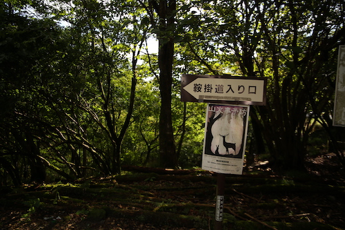
Under partly clouds skies on a weekend in late September, Hisao and I scoot into one of the last remaining parking places just outside of the Kurakake tunnel entrance. After a brief shuffle through our gear, we shoulder the packs and follow the switchbacks past the tattered ruins of a corrugated metal shack and onto steep slopes dotted with purple monkshood flowers shimmering in the gentle breeze pushing in from the east. The path narrows in places, with fixed ropes aiding in a hairy traverse across the dizzying drops of a narrow gully clogged with toppled timbers. It takes just 20 minutes to reach the junction on the ridge. A right turn here leads hikers to Mt Mikuni, a aptly-named summit situated directly on the border of Shiga, Mie, and Gifu Prefectures. It’s hard to believe that Gifu Prefecture stretches so far south to touch the Suzukas but Japan’s 47 prefectures have been crafted like an intricate jigsaw puzzle that defies belief.

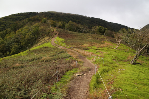
While the chance to place three different body parts in neighboring prefectures does seem tempting, we instead turn our attention south and head left on the well-traveled walkway toward Oike’s imposing figure. Our route follows an undulating ridge offering enticing vistas out to the blue waters of Ise Bay, with the path ducking in and out of the hardwood forest before skirting past a rusted electrical pylon in need of some upgrades. A dead grove of brown ferns sits to our left, while moss-coated oaks on the western slopes seem to make the most of their moist environs. After traversing up and over a few nameless bulbs on the ridge, we pop out onto a path of loose scree running through what can only be described as a massive moss garden. The maps call this place a Japanese garden and it is easy to see why.

Hisao and I let out screams of delight as we become enveloped in the unique scenery. To the north, the clouds have engulfed the ridges of Mt Ryozen but it does nothing to deter from our delight. Some may even say that the shade provides even better lighting to capture the verdant blanket of green beneath our gaze.

The line of electrical pylons stretching across the neighboring slopes, while marring the landscape, do little to detract our attention. Finding such a sprawling network of flourishing moss is rare indeed, and one has to wonder if Fukuda Kyūya would have chosen Oike instead of Ibuki if he had a chance to discover this part of the Suzukas earlier in his life.

Then again, the Hyakumeizan author may very well have been put off by the plethora of leeches that have invaded the land over the ensuing decades. At least on Mt Ibuki you don’t have to worry about having your blood sucked by the persistent segmented worms. Fortunately for us, the leeches prefer gullies to ridges and as we climb hiker into the encroaching fog, all thought of the gruesome creatures vanishes from our thoughts. That is, until encountering a trail-running duo on the summit of Mt Suzukita, the first of Oike’s multitude of smaller summit peaks.

“Which path did you take?” I ask, curious about the trail conditions further below.
“Kogurumi valley,” responds the taller of the two.
“How were the leeches?” I enquire, hoping to squelch my fears.
“No problem,” comes the reply.
“Then what’s that attached to your leg?” exclaim I, as a small leech clings comfortably to his left shin.
The runner reaches down and casually removes the bloodsucker as his companion looks on with disgust. I turn to Hisao as we both break into laughter at the scene unfolding in front of us.

Up here on the bare ridge we feel the full brunt of the winds, so after this quick exchange of unpleasantries Hisao and I continue our march south toward the summit plateau. The main route veers left at the bottom of the next col but Hisao beckons me to follow him to the right along a rarely-trodden path no wider than a foot width. Although we are most likely following the imprints of a deer trail, my leader truly knows where he is going as he has been through the area on snowshoes in winter. Hisao looks as if he’s on the hunt for fresh game to supplement his lunch.

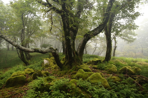
We push through golden grasslands dotted with jagged Karst and sprawling carpets of lush moss until leaving the jungle behind in favor of the shaded canopy of the hardwoods entwined in a labyrinth of pastoral ferns and cushiony boulders straight out of Lord of the Rings.

It is easy to see why Hisao choses this route, for among the splendid scenery there are no other hikers, for they have all opted for the straight path to the summit for their proof photos and claims of having ticked another peak off of their mountain list. I certainly fell into that trap during my younger days, but when faced with climbing a mountain a second time, I tend to prefer a more thorough exploration of the slopes.

Carefully we pick our way through nature’s maze, taking great care not to disturb the delicate moss as the contours coax us off the northern flank and down to an idyllic tarn labeled on the map as Moto-ike (本池). As I study the map further, I realize that the entire area is dotted with hidden lakes and ponds which explain the origin of Mt Oike’s name, which literally means ‘honorable pond’.

With such breathtaking scenery spread out before us, our pace grinds to a crawl as every turn affords even more impressive scenery than the last. Lush forests give way to golden grasslands that further yield to sprawling fields of Kharst before once again leading us through yet more incredibly alluring forests, all under the playful eye of an overhead struggle between the swift-moving fog and the piercing warmth of the sun.

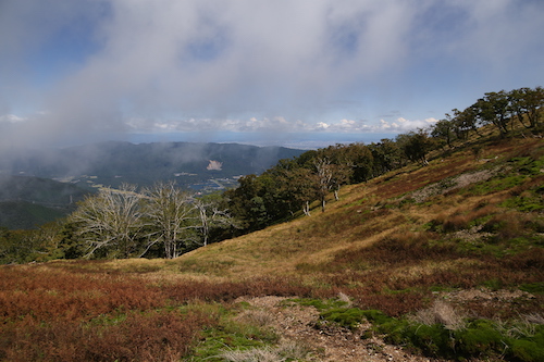
Eventually the forests give way completely to a colossal tableland straight out of an African textbook. I resist the urge to break into a Toto song so instead give out several yelps of joy as we clamber up to an outcrop called the Tengū’s nose, which give us a bird’s eye view of contorted folds of ridge encompassing the eastern past of the Suzuka massif. Just below the thick cloud bank the sunny shores of Lake Biwa peek out to say hello.

We race down from the cliff’s edge and make out way over to yet another outlook by the peculiar name of Botanbuchi. We rest among the rock formations and take in the mesmerizing views. It is now half past 11, and with very few hikers in sight, we settle down for an early lunch while alternating our gazes between the limestone cliffs disappearing from beneath our outstretched legs in front of us, and the unparalleled beauty of the golden tablelands stretching out behind.

“Are we really in Japan?”, I ask Hisao, wondering how I could have missed such incredible scenery during my first visit to this mountain. I thank Hisao profusely for convincing me to give Oike a second look, for it truly is one of the best peaks in the entire Suzuka chain.

Feeling refreshed, we meander through the plateau and up onto an adjacent ridge which takes us up and over a very crowded summit. Hikers area spread out among the jagged rocks, taking shelter from the winds and enjoying their midday meal. We opt not to loiter for anytime longer than necessary to snap a quick photo before ducking back into the lush forest and onto the well-trodden main route back to the car.

By now the fog has completely engulfed the mountain, bringing an entirely new dimension to the forests—one of enchantment.

This spell that the mountain has cast upon us is briefly broken as we skirt through a narrow valley and up into unexpected sunshine. Hisao once again leads me off-trail to a hidden pond called Kita-ike or northern pond, a tarn that very few hikers bother to take the time to visit as they all stick to the same up-and-back path to the high point. From the narrow shores of the waters we are able to follow the natural contours of the land as they lead us back to the summit of Mt Suzukita, thereby completing our rather extended loop of the summit.

From here it is simply a matter of retracing our steps back to the car and through the garden of moss, which never ceases to impress us even on the second time around.

On the walk back to the car, Hisao informs me that Oike is even more outstanding in the winter, and on our traverse back through the forest I do notice a piece of tape affixed to a tree that is used to demarcate the entrance to the winter route from the Shiga side of the mountain. Perhaps I will take Hisao up on his offer for a third round, for by now we can all realize that my fellow companion can be highly trusted with his mountain recommendations.