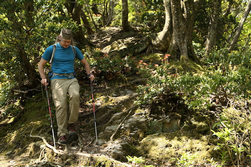
Early May and the middle of the Golden Week holiday brings Ted and I together for another rendezvous with the Takashima Trail. The next couple of sections of the trail are going to require both an immense amount of planning and an even greater exertion of energy—two of our fortes. This is our furthest drive yet, as we finally navigate the entire length of route 367 right past today’s starting point of Sakura-tōge and under route 303 to our final destination at Ishidagawa dam. We park at the dam, prepare our gear and hit the asphalt in high spirits, for we need to walk all the way back to where we last left the Takashima on route 367—or do we?

The snaking curves of the road down from the dam lead us along an idyllic section of road following the Ishida river downstream past a bustling campground. Groves of parasitic wisteria flowers flutter in the gentle breeze under the soothing sunshine of early summer. We enter a hamlet with residents busy tending to fallow fields. A flattened rat snake lays victim to an early morning vehicle. “Looks like they’ve woken up,” exclaims my companion, apprehensive of an encounter with a living reptilian foe up on the ridge.

We stroll down the road and meet route 303. The lane we drove in on cruises safely under the national highway but instinct sends us up an incline to meet the busier road. “We should be able to hitch a ride from here,” explains Ted, still riding high with confidence from our successful hitchhike during part 4 of our adventure. Sure enough, the third car to pass screeches to a halt while Ted and I scurry to put on our face masks. Just minutes later we thank our driver, shoulder the packs and enter the forest at Sakura-tōge (14). Among a grove of cedar trees nature calls, so I dig a hole and go about my business while Ted checks the GPS.

Leaving the comfort of the valley floor, Ted and I commence our ascent up a steep spur adorned with the fresh foliage of the summer canopy returning to the mountains. The sunshine sparkles off of the leaves as we push on through groves of Japanese andromeda and rhododendron buds on the verge of blossoming. Beech and oak trees guide us upward along the narrowing spur as we catch our first vistas across the valley to the Hira behemoths of Buna-ga-take and Jyatani-ga-mine. I turn to Ted and he nods at me as we stare in silence and reflect upon our winter accident on what appears to be gentle slopes from this vantage point.

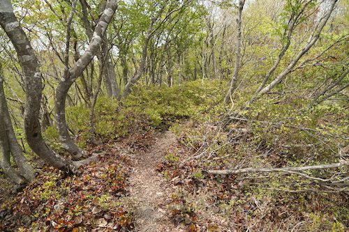
After half an hour the track reaches the crest of the ridge for a roller coaster of a walk alternating between monolithic strands of planted cedar and free-wheeling colonies of beech and oak. Through one section of the former, our trail meanders around a section of typhoon debris, but those ubiquitous strands of yellow Takashima tape liberally tied to an occasional cedar usher us safely through the mess and onto a long steady slope to the summit of Mt Ni-no-tani (13). True to its name, there are two summits on the plateau, so we break for a snack on the first peak before heading over to its twin and slightly higher of the two, home to an tranquil tarn.

Though a gap in the trees, a formidable wall of green towers over us directly north. It is Buna-ga-take, our target for the afternoon and not to be confused with the other Buna-ga-take sitting directly behind us to the south. Cause for celebration is unwarranted, as the map shows us we still have over 5km of hard hiking to reach its striking summit plateau.

The loss of altitude is almost immediate after setting foot down the northeastern face and we grasp onto tree limbs to help fight against the downward pull of gravity until the angle eases abruptly and passes by a section of golden grass that looks fit for a bear encounter. The ridge narrows briefly and we meet our first hikers of the day. The first guy is wearing trail running gear and is equipped with nothing more than a 2-liter bottle of water grasped in his right hand as he passes head on in silence and makes quick work of the steep slopes we have just come down. There have been reports of ultra trail enthusiasts doing the entire 80km section in one day but I think I prefer our more leisurely pace.

After a brief climb past an unnamed peak the trail once again loses altitude suddently and guides us through a section of lush ferns to reach the paved road at Misaka-tōge (12). It is hard to believe that we have only a dozen more checkpoints until finishing the trail, but it is still going to take a few days to get there. We sit on a log and break for an early lunch in the shade in the forest of the 280-meter high pass. This is the old road before the tunnel was built through the mountain and if we turn left here and walk for an hour we could reach Kumagawa-juku on the old Saba Kaidō, but tourist post towns are not what bring us to the Shiga-Fukui prefectural border. We have a mountain to climb.

Again we play a cat-and-mouse game of cedar forest and hardwood grove as we face the longest and hardest climb on the entire Takashima Trail. As on past sections of the Takashima, the conversation turns to writing and working with copy editors, as Ted is on assignment to finish his contribution for a new guidebook with a constricting word count. It is always the nemesis of any travel writer and part of the reason I prefer the freeform nature of blogs. Our banter takes our mind off of the task at hand until the ever-steepening slope angle forces us into silence: we search for those inner reserves necessary to see us though to our goal.

Our initial target is to make it to the western peak of Mt Akaiwa without stopping but shortly before the summit we collapse in a heap of sweat and exhaustion. We need Lara again, and Ted delivers the goods. I pass along some chocolate and other nibbles as we rehydrate and stretch our legs. It turns out our decision is a wise one, as once we get back on our feet the path further steepens to enter a rock outcrop adorned with fixed ropes.

We hoist ourselves up and onto an outcrop affording spectacular vistas back over to Mt Ni-no-tani and over to route 367 where we had started our morning. Boy have we come a long way.

The foliage begins to take on an early spring hue as we breach the 700 meter mark and walk past a junction on the western summit Mt Akaiwa. Dense groves of rhododendron and andromeda shrubs line our way as the track narrows. Dollops of the pink iwakagami (fringed galax) once again line the trail. We have entered an entirely different ecosystem up here, on the edges of snow country and evidence of the harsh winters that batter these mountains is apparent. It is as if the retreating snow fields had melted just days prior as tree buds begin to sprout and put on their summer coats.

Kobus magnolia flowers flutter in the light breeze. It’s hard to believe that these same trees bloomed one month earlier at around the same altitude further south along the Takashima. As we admire the views, a solo female hiker approaches from the summit plateau and passes by. She is on her way down to Misaka-tōge and it dawns on us why the majority of hikers do the Takashima Trail from north to south in order to avoid our herculean climb of Buna.

We skirt past a small pond and onto the summit of Buna-ga-take (11). Time check: 1:38pm. It has been nearly 5 hours since we left our car at the dam but we have arrived. The undulating ridge between our vantage point and our next summit of Sanjo looks formidable. A change of plan may be necessary.

With an impressive view of snow-capped Hakusan on the horizon, Ted and I straddle the ridge with the paper map spread out between us and start calculating. If we push on to Sanjo it will be after 4pm, and a two-hour descent on rubbery legs on a long spur means that it will be well after dark when we reach the car. However, just a kilometer from Buna’s summit, on the ridge we need to walk, is an escape route down a spur that will take us directly to our car. The choice is easy.

Fueled on by the prospects of a shorter day, we dart along the ridge and duck into a truly scenic section of gnarled beech trees sculpted by the strong winds and snow that batter the ridge every winter. It feels like we have stepped into an enchanted forest and fortunately for us, we are blessed with brilliant sunshine and not the mind-altering hallucinations brought on by thick fog and tired minds.

Unsure of our escape route, Ted and I keep a close eye on the GPS but we are relieved to find a signpost in Japanese for Wasatani (ワサ谷) letting us know that we have 3.8km to go before reaching the road to the dam. I lead the way in high spirits before jumping in surprise after nearly stepping on a giant rat snake. Ted is thankful that I am the one encountering all of the slithering creatures for him, as he has a fear of the serpents.

Our majestic hardwood forest soon turns into a monocultural cedar plantation, but fortunately the descent is negotiable along a series of long switchbacks that usher us down to a gravel forest road covered mostly in fresh grass. This leads to a stream smothered in concrete dams and the eventual paved forest road above the dam. We turn right and stroll along the closed road for 10 minutes to reach the car at 3:30pm. The drive back to Kyoto is spent strategizing about how to walk the next section of the Takashima as it is easily the most remote part and will take some thinking.

With the approach of the rainy season, we both agree to take a few months off to scour trip reports and rack our brains for the best course of action.
