Feeds:
Posts
Comments

Archive for the ‘Kanto hikes’ Category

My first visit to Kobushi, an autumn ascent under perfect skies, is one of the highlights of my Hyakumeizan quest. Usually the rule of thumb when reclimbing the Meizan is to never re-attempt a peak you had perfect weather on the first time around. However, my return to Kobushi is for another purpose – Saitama’s highest peak.

Had I been attempting the prefectural high points during my Hyakumeizan days then I would not have needed to return. You see, Saitama’s highest mountain, Mt. Sanpō, is just 10 meters higher and a short 30-minute climb from the summit of Kobushi. Instead of the popular trail on the Yamanashi side, I start from the Nagano village of Kawakami and the idyllic surrounds of Mōkidaira trailhead.

Naresh, Alekh, and I navigate the narrow farm roads through Kawakami shortly past midnight on a calm Friday evening. The torrential rains of the previous day have given away to fair skies and a bright full moon. We park in a corner of the large parking lot and settle into a fitful sleep: Naresh pitches his tent while Alekh and I cram into the trunk of the automobile. Cars continue to trickle into the parking lot throughout the night, robbing us of a chance of uninterrupted sleep. At 5am we spring to life, fueled by the fresh cups of chai and a light breakfast of bread.

The path starts out as a gravel extension of the forest road, through a flat section of track smothered in thick moss, an homage to the wet weather that typically blankets the Oku-Chichibu highlands. Thick clouds move swiftly through the strong gusts pushing through the troposphere, the last remnants of the typhoon now battering the east coast of Hokkaido. The muted morning light brings out the verdant greenery of the primeval forests – we point our lenses in all directions in order to capture the sheer beauty of the place.

We soon reach a junction for a trail that heads to Jūmonji-tōge, an alternative finish point should we choose to do the full 18km loop hike. We continue straight, sticking to the right bank of the swift-flowing waters of the Chikuma river, mesmerized by the crystal clear water and hypnotic hissing as the river pushes past large boulders and twigs. This is easily one of Japan’s most pristine sections of river, with absolutely no sign of concrete nor any dam intrusions to its natural flow. A pair of fishers wade in the river, casting their bait in search of succulent sweetfish.

The track is clearly marked and easy to follow as the three of us push on in unison, slowly upward toward the source of the river. Parts of the route remind me of virgin swaths of the Minami Alps, dotted as they are in a twisted network of larch, spruce and hemlock, all rising upward towards the bright sunlight now beginning to pierce the clouds above. Most hikers approach Kobushi from Nishizawa gorge, along a long, steep spur dominated by views of Fuji and the South Alps. Having done both, I can comfortably say I prefer this hidden entrance to Kobushi’s lofty perch.

After a couple of hours we reach the source of the Chikuma river, the start of a long journey to the northeast to the Sea of Japan, 367km to be exact. Upon entering Niigata Prefecture, the river name changes to the Shinano, which many will recognize as Japan’s longest and widest river. Here, at an elevation of 2200 meters, the water trickles out of an underground stream, with a plastic cup in place so that visitors can sample the cool, refreshing water. We fill up our water bottles and settle down on a toppled tree log for a snack and a quick perusal of the map. An 8-point buck (east coast counting system for ruminant aficionados) grazes in the forest just above, oblivious to our gazing stares. Seeing such stags in the wild is a surprisingly rare sight, as most deer just stick to the twilight and dusk hours for their meals.

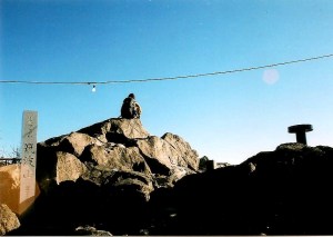
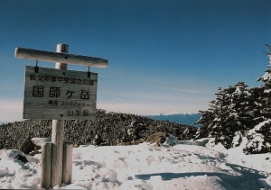
From here the path steepens, but after a twenty minute push we top out on the ridge, the start of familiar territory as I had traversed this exact route during my first walk along the spine of Chichibu. Turning left, we glimpse a view of the top of Fuji before reaching the edge of a landslide where the views really start to open up. Just above it, the summit of Kobushi baths in the late morning sun, hikers resting behind their wide-brim hats and ultraviolet arm sleeves. It takes just 10 minutes to reach the summit, just as the cloud begins its daily rise to blot out the views. We gaze at Fuji briefly before a few summit snapshots and an additional snack. Mt. Sanpō sits on a steep spur to the north, its bulbous form sitting backstage as a stand-in to the main star Kobushi.

The track north immediately loses altitude through a pristine primeval forest of towering conifers, the broad track lined by a carpet of healthy ferns. After bottoming out the path starts the long, somewhat steep, climb to the top of  Saitama. Between gasps for breath I use the GPS to gauge progress as we top out shortly before noon. In a celebratory mood, Naresh boils water for chai as we eat a filling lunch while admiring the abundant 6-legged creatures in flight. Despite the altitude, a swarm of dragonflies enjoy the wind gusts above the peak while a particularly persistent horsefly tests our patience.

Feeling energized by the caffeine, we continue walking along the ridge, committing ourselves to the full loop. It seems like a breeze on the map, but the immediate loss of 200 vertical meters to the aptly-penned shiri-iwa, or big ass rock as we have nicknamed it, has us rethinking our decision. The next hour or so on the sabre-toothed ridge is certainly kicking our ass – perhaps the real origin of the shiri-iwa nomenclature.

We take turns overtaking a trio of gung-ho hikers who share our astonishment of the undulating nature of the route. At the junction just below Bushin Shiraiwa, a craggy peak now off limits to hikers, we pause to catch our breath and wipe the sweat from our brows. Naresh is starting to feel the contours in his knees, so as he straps on the knee braces we look over the remaining stretch of trek – just one peak separates ourselves from Jūmonji-tōge, a peak by the name of Oyama.

Oyama, as it turns out, lives up to its ‘big mountain’ moniker. While the climb is short but steep, the descent along the northern face is adorned with more chains than Flavor Flav, a tricky ordeal on weary legs. We lower ourselves gently down the near-vertical cliffs and finally reach the mountain pass and hut just before my bowels explode in a fit of rage. I had been holding back the inevitable ever since summiting Sanpō, and the 200-yen tip charge for the western-style toilet is perhaps my wisest investment of the day.

Worn out but by no means exhausted, the three of us once again garner up the energy for the final descent of the day. Compelled by a desire to reach the car, the pace is swift yet unhurried, and upon reaching the shores of the Chikuma river can we once again smile at the marathon effort required to scale Saitama’s highest peak. Most hikers break this loop up into two days by overnighting on the mountain, a wise choice considering our battered state.

With peak #45 safely off the list, I can now turn my attention to the mighty mountains of Hokuriku for the final duo of peaks on the highest prefectural 47 list.


Read Full Post »

The next morning I awoke around 9am with sore shins and a stiff back. I cooked up an omelette in the hostel kitchen and marched up the main road a short time later, this time in route for the summit of Mt. Mihara. This was my second sea to summit attempt in as many days. My target peak sits directly opposite Hachijō-fuji, offering the opportunity to have a head-on view of the perfect cone that draws hoards of mountaineers to her curvy slopes. It took about a half an hour to reach the forest road that would lead up to the trailhead, but I headed a bit further to a supermarket in search of lunch and other provisions. After that quick detour, I found the deserted road that wound its way through the jungle up towards the ridge. The first thing that came into view was a sign indicating that the forest road was closed to all thru-traffic due to construction, but surely the road crew would be taking a beautiful Sunday off to enjoy the village festival that was now in full swing.

hachijo2-1

It took about thirty minutes to reach the construction zone, and low and behold the place was alive with crews preparing the road for resurfacing. They were also putting finishing touches on a sparkling new web of concrete on the hillside that resembled a Belgian waffle. You’ll find these erosion control devices in every prefecture of Japan, but I was a bit taken aback by the scale of the frenetic work until I remembered the calendar. It was the end of March, the time when all of the prefectural governments must spend their yearly budget money, so the public works projects are at their most hectic in these final days of the fiscal year. This is especially true at the current time, with the prime minister’s Abenomics initiative to kick-start the economy by investing unprecedented money into needless public works projects that his forefathers in the LDP were so efficient at setting up through the years.

hachijo2-2

To add insult to injury, further up the road to nowhere stood a cedar plantation carved out of the jungle foliage. Alas, my plan to escape the pollen by heading to this remote island was foiled after all. The only remedy for my frustration was a one-fingered salute backed by a chorus of expletives.

hachijo2-4

Eventually, I did find a signpost pointing towards the summit of Mt. Mihara on the left side of the road, but for now the trail remained disguised as a concrete escarpment that terminated at a towering antenna erected by the kind folks at NTT. It was here that the path to the ridge truly began, and in grand fashion no doubt, by way of a series of moss-laden concrete steps that put the pumice steps at Hachijō-fuji to shame. What was I doing up here?

hachijo2-3

After a few thousand steps, the trail did indeed breach the ridge, where a small signpost pointed the way to NHK of all places. The views did open up towards Fuji, which was now in the process of being swallowed in that familiar dark cloud. To my right, condensation drifted up from the southern part of the island threatening to engulf the summit of Mihara which stood directly in front of me. I stepped on the gas pedal, reaching the summit plateau where two antenna stood proudly on the wind-swept grasslands. A few meters higher sat the official high point, 700 meters above the ocean that was floating somewhere out there beyond this cloak of fog.

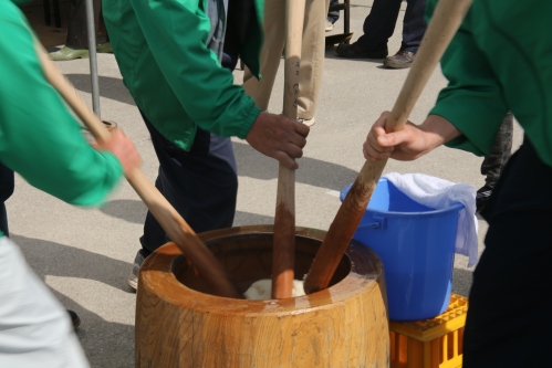
I retreated back out of the cloud like a dog with its tail between its legs. This fickle island weather was not making a good impression on this seasoned mountaineer. It was time for a change. Once back at the main road, I turned left and followed the automobiles and volunteer staff manning the intersections to the village office, where the local festival was reaching crescendo. Booths hawking local delicacies lined the interior of the multi-purpose hall, while a side room had island flora on display from some of the talented flower arrangers that call this isolated isle their home. Outside, men in green vests pounded mochi while another tent on the opposite side of the large open plaza served miso soup to a handful of elderly residents relaxing in the shade. I filled my belly with every free sample that I could get my hands on before eventually completing the exhausting walk back to the hostel.

hachijo2-6

The following day was my last on this island, and I proclaimed that there would be no more hiking. For one, I had climbed the only two mountains around, and two, I was in desperate need of a bath. The local bus circling the island provided motorized transport this time around, and I settled into an outdoor bath perched high on a plateau overlooking the mighty blue waters of the Pacific. Surely this must be the best bath among all of the Izu Islands, if not the Kanto region itself. It was an ample way to finish off my sojourn, with two mountains and two hot springs that left a favorable impression. Is Hachijō island the perfect weekend getaway for nature-starved Tokyoites? Perhaps, but Kansai residents may find better solace in seeking out the hidden coves of the Tango Peninsula in northern Kyoto.

hachijo2-7

Still, the short foray into those secluded islands of Tokyo whet my appetite for volcanic exploration. I vowed to make a return visit, next time to the sulfur-spewing flanks of Miyakejima as well as the tufted highlands of Kozushima.

Read Full Post »

In the southern part of the Izu island chain, approximately 300km from Tokyo, lies the idyllic island of Hachijō. Formed by tectonic uplift and volcanic activity, the gourd-shaped isle is home to excellent hiking and breathtaking hot springs, if the tourist literature is to be trusted. An in-depth investigation was necessary to determine the validity of such claims.

I set off from Takeshiba port on the Tachibana Maru, a high-speed, energy-efficient vessel that bears a striking resemblance to a Norwegian passenger liner. The color scheme, designed by renowned illustrator Ryohei Yanagihara, is apparently a tribute to the original Tachibana Maru ship that sailed these very waters in the Taisho era. The ship bobbed up and down in the turbulent sea like a rubber duckie in a hot tub, but the ferry eventually reached Sokodo port an hour behind schedule under strong gusts and menacing skies. After dropping off the kit at the nearby hostel, I set off on bicycle to explore the island. Thick cloud smothered the upper heights of Hachijo-fuji, so I simply needed to wait until a fair-weather window presented itself.

The guy manning the tourist-information counter recommended an electric bicycle and for good reason – the island is anything but flat and getting to the secluded hot springs on the southern tip of the island was an immense challenge without some kind of mechanical support. The ride was smooth enough, and after an hour of steady pedaling I reached the main cluster of hot spring baths at Nakanogō. My eyes were immediately drawn to a signpost pointing to Urami waterfall. I parked the bike and hit the trail into the jungle, following the narrow path as it crept deeper and deeper into the thick, vine-laced interior of the island. After twenty minutes of steady climbing the falls came into view. The water fell from a rock face about 10 meters above the jungle floor into a small pool stained brown with runoff from the higher reaches of the rain-sopped massif of Mt. Mihara. The path went directly behind the waterfall. I stood there some time admiring the spectacle of the wind sculpting the water into a twisted palette reminiscent of a typhoon-fueled rain squall. The hike was just the appetizer, however, and the main course awaited back at the parking lot.

hachijo1-3

A small narrow path just opposite the entrance to the falls led down to a small open shelter housing an exquisite open-air bath. Ever the bastion of modesty, the Tokyo-controlled island requires all visitors to wear a bathing suit into the mixed-bathing facility. Ill-prepared as I was, I bowed my head at a small shrine, asking for permission to use my boxer shorts in lieu of a proper suit and slowly eased into the steaming waters.

hachijo1-5

The first hot spring had lived up to its reputation, but how about the mountains? The next morning provided the answer. I awoke to clear skies and bright sun. Although the trailhead starts at the 8th stage point high on the flanks of the conical volcano, the only true way to appreciate the scale and immensity of the Fuji lookalike was to start from the beach, kitty-corner the hostel. I strapped on the day pack shortly after 9am and hit the trail, er I mean pavement of the main road leading inshore. The road from the ferry terminal led directly to the trailhead – all I needed to do was to follow the switchbacks and resist the urge to stick out my thumb. In search of lunch, I ducked my head into the first shōten I came across, shelling out 250 yen for a two-liter bottle of water. The convenience store, if you could call it that, only sold dried food, but the elderly woman behind the counter informed me of a larger supermarket just up the hill that sold onigiri. I marched up the road, eyeing the lines of the volcano as they converged towards the skyline that was starting to thicken with cloud. I picked up some yakisoba and a couple of rice balls at the store, wincing at the 88 yen signs affixed to the two-liter water bottles next to the checkout counter.

hachijo1-4

The road up to the trailhead meandered through the forests choked with tropical vegetation as steady streams of rental cars glided past. All I needed to do was stick out my thumb and any one of them would have come to my aid, but I was set on doing the entire mountain, road and all. It took about an hour to reach the start of the trail which, I found to my horror and disgust, was also made of concrete. The original trail consists of over 1200 steps made out of volcanic pumice, but a newer concrete channel snakes alongside the route, as if to beckon lazy hikers onto its slithering back. Is this what the suits in the government offices of Tokyo do with their extra budget money?

hachijo1-7

I pushed on in utter disappointment, but the state of the trail was the least of my concerns. A thick blanket of fog had engulfed the mountain, blotting out the views and my motivation to continue further on. I had reached the crater rim and was less than 50 vertical meters from the summit, but sat stooped on the volcanic pebbles cursing my ill-fated timing. If only I had hitched a ride earlier in the climb. The yakisoba helped lift the spirits as did the row of hikers dotted about the crater rim, drifting in an out of the cloud vapor. I pushed on, opting to head in a clockwise direction in an effort to get the buddhists on my side.

hachijo1-6

I reached the summit a short time later and raised the hands in triumph: it’s not everyday you can spend the morning on the beach and enjoy lunch on the top of an 850-meter high volcano. The crater rim was beautifully sculpted, both by the eruptions throughout the centuries and by the strong storms that often batter the summit highlands. The path consisted of ankle-deep mud in places and waist-deep bush in others. Every now and again the mist would start to break up only to be replaced by another layer of cloud. I reached a small clearing which apparently offers wonderful vistas, and a voice deep inside of me ushered me to pause. I surveyed the crater rim and spotted a group of four hikers heading counter-clockwise in the direction of my vicinity. As they crept closer, their fuzzy silhouettes came into focus. At the same time, a small pointy island floating offshore also came into view. By the time the quartet had arrived the cloud veil had miraculously lifted.

hachijo1-8

I peered down into the crater, the sheer drops forcing me to take a few steps back. It was frightening to think about how close I may have come to sinking into that void with such poor visibility earlier. There was a sheer drop of around a hundred vertical meters into what I now recognized as a double-crater. Hachijō-fuji had graced me with her awesome presence and I was star-struck and enamored with her searing beauty. When I completed the circumnavigation of the volcano the sun had made a much-welcome appearance, transforming the ash gray waters of the Pacific into an aquamarine paradise. A pair of hikers sipped on hot coffee at the junction back to the trailhead. I chatted with them a while before ducking down a path that led directly into the crater floor. A shrine was set up in the center, lined with smooth rocks that looked like they were picked from a riverbed. Messages were inscribed on the stones in a variety of styles and colors, the meanings of which I could not perceive.

hachijo1-9

I did eventually make my way back to the junction and down to the parking lot, where the latte-drinking couple from earlier were resting in the warm sunshine. They offered me a ride down to town and, in homage to Yuichiro Miura, I took them up on the offer and was soon back at the supermarket where I had purchased my provisions earlier in the day. I stumbled back to the port and collapsed in my bed, hatching up another insane climbing plan for the following morning.


Read Full Post »

A hour north of Tokyo and a short hop from Kasumigaura lake lies the twin-peaked summit of Mt. Tsukuba, one of Japan’s 100 Famous Mountains. While hardly a monster, the mountain played an important role as a training ground for followers of Shugendo. The mountain itself has a long and fascinating history, overshadowed by the 20th century additions of a ropeway, funicular tramway, and a mountaintop restaurant. These abominations can catch the casual visitor off-guard, but Kanako and I knew what we were in for, lowering our expectations for our impending visit. We’d already had lots of practice being let-down by scaling three of Kansai’s most developed summits (Ikoma, Rokko, and Kongo for those out of the loop), so we knew exactly what Tsukuba had in store for us….or did we?

tsukuba1

After a long train and bus ride from the capital city, the two of us arrived at Tsukuba shrine just before noon on a sunny but blustery Christmas day. The path immediately dove into a surprisingly calm and tranquil forest, which stayed within spitting distance of the tracks of the funicular railway. As we rose higher above the valley floor, I tried to picture what the forest must have looked like before Japan’s obsession with cedar began. The downfall of the great mountain started with the Meiji Restoration, when most of the great temple that flanked these slopes was destroyed in favor of the “state” religion of Shinto. Next came the cable car, whose tracks Kanako and I marveled at for the better part of an hour on the straightforward ascent. The railway was opened in 1925, which means the summit desecration must have ensued not long after. The route started to steepen, as the tracks entered a long tunnel and we traversed across the top of the entrance towards the saddle connecting the two peaks. Here the cedars gave way to deciduous forest which offered glimpses of the Kanto plain through the bare branches and dense underbrush. We stopped for a quick break, replenishing lost fluids on the somewhat tough climb. From all of the destruction on the peak you would think it would be a walk in the park, but after examining the map we realized there was a 600-meter vertical elevation gain from the shrine to the summit, most of it without switchbacks that would have made things a bit easier.

tsukuba2

Shortly before 2pm, Kanako and I topped out on the saddle, took one look at the shuttered restaurant blocking most of the path, and turned left, reaching the summit of Nantai (the male peak) a few minutes later. Here we confronted the stiff gales swooping across the plains from Tochigi. Tsukuba rises abruptly out of the valley, and there are no other peaks north of here until reaching the volcanic highlands of Oku-shirane, which lay in deep snow and a thick layer of cloud. The batteries on my camera started to give out, as I wondered if I’d be able to get any summit photos before they expired for good. I had plenty of film but no back-up power source. Our next stop along the ridge was Nyotai, Tsukuba’s female counterpart and the higher of the two peaks. The path from the restaurant to the high point was lined with concrete, an unwelcome sight after the greenery spreading out below us. We pushed past a pair of pensioners out for a Monday afternoon stroll, but apart from them, the whole area was deserted. Perhaps it was because of the impending New Year’s holiday, or perhaps it was the subzero temperatures that kept the crowds at bay. Whatever the reason, we had no reason to complain and enjoyed the solitude that peak #42 offered.

tsukuba3

After a modest lunch of chocolate and sandwiches, Kanako and I meandered down the eastern side of the peak, past some mesmerizing rock formations that must’ve provided those Shingon monks of yesteryear hours of meditative dedication. Instead of following the ridge all the way down to the hot spring and ropeway, we spied a loop trail on the map that would take us back to the bus stop. Turning right, the route dropped headlong into a thick forest of cedar and hardwood trees. By this time the light began to fade, as our late start meant that the sun would reach the horizon before we would. We quickened the pace as much as we could, but again the lack of switchbacks and the steepness of the angle afforded sturdy footwork that couldn’t be rushed. Exiting the forest shortly before 5pm, we reached the paved road above the shrine, following the zig-zags of the contours with our feet, and the orange glow of an advancing evening with our eyes. As I peered out at the horizon, Mt. Fuji’s majestic cone stood out like a cigarette butt in a sea of fiery ash. I brought the viewfinder to my cornea, but the batteries had long been exhausted. What I couldn’t capture on film I would have to simply emboss on my prefrontal cortex.

tsukubamap

Due to our poor timing, Kanako and I had over an hour to kill before the next bus, so we strategized about our upcoming traverse of Tanzawa, set to commence in two days time. We had one more day of lazing about Tokyo before the real work began.

Read Full Post »

Mid-January and my final foray into Chichibu-Tama-Kai National Park to knock off the last unclimbed Hyakumeizan in the Kanto region. The early morning train rolled into Chichibu station under clear skies as I changed to a bus bound for the trailhead at Hinata Ooya. The route required a change of buses a little further on, where a lone figure waited at the adjacent bus stop. “Ryokami,” I asked, not sure if the single 30-something female were out for a day hike or not. She nodded in the affirmative, and I soon found myself with an unexpected hiking companion for mountain #78.

Yoko, the name of my new hiking partner, hailed from Saitama but was on her first journey up a winter mountain, albeit without any equipment or experience under her belt. I’d feel personally responsible if anything were to happen to her, so naturally we walked in unison up the deserted trail under crystal blue skies and the slight crunch of lingering slush. The path was well trodden and pretty much impossible to get lost, as it followed a tranquil stream up a narrow valley. We soon found ourselves ascending through areas of shaded ice, inching our way along the precarious path towards the switchbacks that led to the mountain hut.

Once at the hut, we refilled the water bottles and prepared for the exhilarating climb towards the rocky ridge, through areas of chain-covered rock that Yoko skillfully maneuvered through. I quickly followed suit, offering advice on the trickier footholds. Soon we reached a rustic shrine with a magnificent red torii gate. Mt. Fuji rose up through the tree line, as the rest of the peaks of the national park looked on with envy. From here the ridge became an array of short climbs followed by steep descents over a series of false summits until we finally topped out on Ryokami’s modest peak. Time check: 12:01pm, just in time for a light meal.

While resting on the tiny boulder-lined summit, we talked about other peaks in the area that were worth climbing and somehow during that conversation we’d made a plan to climb Mt. Adatara the following month. Of course, first we had to make it off this peak alive!

The descent proved much more challenging than the approach, for while climbing on ice unaided can be done with careful precision, descending an ice-filled gully in next to impossible without a pair of crampons. Times like this call for desperate measures. “Are you right-footed or left-footed,” I asked Yoko, who was understandably feeling a bit uneasy on the impending traverse. Reaching into my pack, I threw her my right crampon while fastening the other to my left foot. We’d both descend with only one crampon. Not the best solution, but traction on one foot is better than none at all.

Together we carved our way through the frozen forest. I’d kick-step a place for her left foot while she’d do the same for my right. After about an hour of crisscrossed footwork we escaped through the danger zone unscathed. The final stroll back to the bus stop was quite relaxing, until we came face-to-face with a mountain serow grazing in the trail directly in front of us. Startled, the shy creature bolted for the neighboring forest while Yoko and I picked our jaws up off the trail. Never before had I seen a kamoshika so up close and personal. Our brush with wildlife provided that much needed adrenaline boost for the rest of the hike back to civilization. While killing time waiting for the bus, we stopped in at Ryokami Sanso for some tea and refreshments while sitting under a kotatsu that was still heated the old-fashioned way: by a bed of charcoal in the stone floor. Yoko and I made a successful ascent of Ryokami, but how would we fare on the snowy, wind-swept slopes of Mt. Adatara?

Read Full Post »

A free weekend in late November and I find myself once again in the urban chaos of Tokyo. Every time I come here I vow never to return, yet somehow always end up rubbing elbows with the masses on the Yamanote line. My plan this time around is to climb a mountain, ANY mountain! I turn to my trusty companion Yuuki who I haven’t seen since that fateful day over 2 years ago when I finally knocked off the Hyakumeizan. We quickly narrow our choices down to 4 peaks: the scenic lake and conical perfection of Haruna-fuji, the impossibly twisted rock formations of Mt. Myogi,  a grand hike to Oodake at the foot of Okutama, or the overdeveloped mess of Mt. Takao. All 4 of these prestigious areas I had never had the opportunity to explore, but after a review of the logistics, we opted for the one with the easiest access.

We set off from Ebisu station at the crack of dawn, and the train was already packed with day-trippers heading to the hills. At Otsuki station the masses disembarked on their way to Lake Kawaguchi and Mitsutoge, while a healthy portion of budding outdoor types held on for the final push towards Takaosan station. Chung-chung: the doors of the mighty metal box swung open and disgorged hundreds upon hundreds of tourists, all headed for our intended destination! I’d been warned about the crowds beforehand but truly couldn’t believe my eyes. Yuuki and I jostled our way though the ticket gates, grabbed a free map, and escaped to the nearby toilets.

Nourishment was at the top of our list, but unfortunately the nearby soba shop was still closed, so we grabbed some rice balls from a street vendor and marched in unison with the other zombies towards the cable car entrance. “We should be alone on this path” I quipped, pointing to the red Inari Yama Course (稲荷山コース), a sturdy, 3.1km ridge walk meandering through pristine forest. Our summation was that 90% of the daytrippers would choose the paved course under the gondola. We were partially right in that only about 15% of the visitors chose the long route, but on this hectic autumn Sunday we’d forgotten to factor in the crowds. What’s 15% of 20,000 again? You get the picture.

Despite climbing nearly 200 peaks in Japan, this was the first time I’d actually come face to face with a bona fide tozan traffic jam. Although we didn’t keep official count, I’d venture to say we overtook close to 400 people on the easy climb to the summit. I know that sounds a bit far-fetched, but if we passed one person every 7 meters (which I’m absolutely sure we did since we were overtaking people the entire way) then it begins to sound a bit more believable, doesn’t it?

Even though the map said it’d take 90 minutes to the summit, we were sitting on the top in under 50 minutes, thanks to the unseasonably warm weather and our skillful maneuvering though the sea of humans. On the summit the path merged with 5 other routes to the top, where the visitors easily numbered in the thousands. Easily. Yuuki grabbed a beer while I staked out a place to sit down. Imagine sitting in the middle of Shibuya crossing and you can get some sort of idea what we were faced with. The toilet queue was even longer than it was at the station, as I gave up entirely and munched on my soggy rice balls. Luckily for us, Japanese people have some sort of mysterious affliction to the sun, as we sat on the very best location on the entire summit, soaking up the rays. Yama girls in all directions slowly emerged, pristine with delicately layered swaths of make-up and only the finest and most fashionable outdoor goods. Down-filled skirts with the gaudiest of socks pulled halfway up their spandex covered shins. Where on earth did they get these god-awful fashion ideas? “Here”, cried Yuuki, pointing to the reverse side of our map, which revealed the following illustration:

The two explorers retreated in disgust, but not before purchasing a bag of mikan oranges from a neighboring food stall. Hoping to avoid the crowds, we traversed 30 minutes further north to the summit of Mt. Shiroyama (城山), where sizable crowds and an extensive network of restaurants greeted us. We settled down at a wobbly picnic bench and devoured our oranges while watching the fashion victims. Would this madness ever end?

The next target peak of the day was Mt. Kagenobu (景信山), where we discovered an even larger collection of restaurants and the same relentless crowds. Desperate times called for desperate measures, as Yuuki bought another beer and we splurged on hot noodles and oden. There were so many people that the restaurant was calling out orders by the customers’ last name. The shop clerk nearly fell off his chair when I told him to just call me gaijin. Sure enough, heads truly turned when the cook shouted out gaijin san, ooda dekimashita (hey foreigner, your order is ready!) I carry my Osaka sense of humor with me wherever I go.

Halfway into our luxurious feast, the faint sound of a helicopter wafted through the air. Scanning the horizon, we spotted what looked to be a news helicopter approaching to film the crowds. “It’s heading for us”, I exclaimed! As the copter noise grew louder I became intrigued with the sheer size and unfamiliar red tint on the porpoise-shaped nose. “Hey, that looks like a rescue copter”, Yuuki shouted, spotting the Chinese characters for the Tokyo Metropolitan Fire Department on the belly of the aircraft. The copter circled the peak once before hovering above the summit directly behind the restaurant. Off we went to investigate.

Two rescuers quickly abseiled to a grass clearing and hurriedly scampered to a nearby picnic bench. An unidentified figure laid motionless, the victim of either over-consumption of alcohol or acute heart failure. I’m not a huge fan of gawking and peacefully retreated back to my waiting meal. Several more firefighters descended from the copter for back-up assistance, as another half a dozen climbed from the parking lot at Kobotoke (小仏) Again, this was another first for me in Japan, though I must admit that it’s not something anyone should have to witness up close. Earlier in my mountaineering career I saw a recovery operation at Long’s Peak in Rocky Mountain National Park, but it was from a safe 20km distance. Seeing a copter hovering 20 meters away is an entirely different story.

Yuuki and I took the rescue as a sign that we should abandon our attempt to climb Mt. Jinba (陣馬山) and take the easy escape route to the south. Along the way, we passed the rescuers we’d seen on the summit and thought about asking what happened, but again, it’s not something that I really need to know about. Someone couldn’t make it off the mountain under their own power and were successfully airlifted to safety. Does the cause for that assistance really matter?

Safely arriving at the paved forest road, we turned left and raced towards the bus stop. Upon arriving, we realized that we had 45 minutes to wait until the next bus and would be the 50th person in line to make that bus. When I mentioned to my companion that it’d be a lot faster and more interesting to hitch a ride back to Takao station, his eyes lit up like an 8-year old on Christmas morning. “Yes, just like old times”. You see, Yuuki and I had our fair share of flagging down rides on Mt. Zao and Mt. Nantai and were eager to brush up on our skills.

Yuuki has developed an uncanny technique for hitching rides. Left arm fully extended, thumb outstretched, he reaches up with his right hand for the bill of his blue Kavu hiking hat, lowering the cap as if to ask for a donation while slightly bowing his upper torso. A quick twinkle of the eye to the driver and whammo: a free ride to our chosen destination. We walked down the asphalt road towards town and thumbed down whatever came toward us. First a motorcyclist gave a quick nod, followed by the firetrucks, who chuckled from the comfort of their cabs. The first driver that stopped had a car-full of kids and absolutely no room for us, but just wanted to stop and politely tell us he couldn’t take us. The next car pulled over and we slyly crawled in, much to the disbelief of the other Japanese hikers who’d opted for the 10km hike back into town. Back at the station, we boarded a Tokyo-bound train, vowing to never visit this place again. Don’t get me wrong. I’m sure Takao has its merits, but the heyday of strolling through an untamed piece of nature so close to the capital is truly gone forever.

Read Full Post »

The lights came on at 6am, which, for Japanese mountain hut standards, is a late start. The amicable caretaker prepared a modest meal consisting mostly of pickled vegetables and rice: precisely the same food we ate the previous night, but such is life in a dwelling with no running water. I was so tired and hungry I could’ve eaten anything, and my wife didn’t exhibit the faintest sense of dismay. I raced excitedly back and forth between my simple breakfast and the window, trying to catch a peek at the horizon. I definitely didn’t want to miss this photo op, so I grabbed my gear and bolted for the frigid solitude of darkness.

The horizon slowly changed hues, while I jumped around in circles trying to stave off hypothermia. Unsurprisingly, none of the other 4 guests followed in my footsteps, deciding that a warm kerosene heater was more important than watching nature’s light show.

Most people think that the moment the sun scrapes the edge of the horizon as the most beautiful part of the sunrise but I beg to differ. Still, I knew the others would eventually follow suit and join me in welcoming a new day.

Shortly before daybreak, Kanako and I turned out eyes (and lenses) away from the glow of the east and faced mighty Fuji, for it was time to give the birthday girl one last present on our unforgettable trip. Atmospheric conditions seemed perfect for nature to deliver the phenomenon known as akafuji, forever memorialized in a Hokusai print of the same name. “Here it comes,” I screamed.

“Quick, get one of me,” my wife demanded. It was perhaps the only time in my life where watching the actual sunrise took second stage to the spectacle occurring further west.

Even the Shirane-Sanzan joined in on the fun.

One of the other 3 guests joining our early morning camaraderie was a curious young gentleman named Satoshi Nagata, who spent the better part of the morning taking panoramic photos for his remarkable website, Panorama 360. Web technology now allows designers to create realistically stunning three-dimensional views that, when viewed on a large screen, appear to magically transport the viewer to the scene in question. Click here to see Satoshi’s composition on the morning of December 28th, 2005. My crouched figure appears at the edge of the photographer’s skewed shadow, while the bright yellow jacket of my lovely wife prepares to snap a photo of the other husband and wife team. We later all gathered together in the lobby of the shelter, where the warden presented the birthday girl with a commemorative shikishi, a square personalized celebratory signboard.

After a long exchange of pleasantries, we geared up and bade farewell to our generous host, and all headed in unison towards the bus stop at Tono. Crampons definitely helped with the icy bits below the summit, as we all cruised towards Jizo-taira (地蔵平) before a short climb towards the junction at Himetsugi (姫次), the highest point on the Tokai Nature trail that stretches from Tokyo to Osaka. It was here that we entered the tree line and lost the jaw-dropping views of Japan’s most revered peak. I used up the last of my film, zooming out to capture the entire stretch of the Japan Alps hovering in the distance.

On the bus ride back towards the metropolis, I reflected upon the year, which started with a long traverse in March of another one of Tokyo’s famous peaks, Mt. Kumotori. From there I embarked on two separate traverses in the Minami Alps, followed by a relatively productive autumn which knocked off a few of the more challenging day hikes. I still had 7 more peaks to go before hitting the magic #50, but was determined to reach my goal before the next rainy season. Time to plan.

Read Full Post »

As we dropped off the northern reaches of Tou-no-dake’s bald flank, the path turned to crusty snow and ice. We held off on crampons for the time being, sticking slowly and firmly to the exposed edges of the wooden steps. Kanako seemed to enjoy her first true descent on the unbroken traverse.

Once out of the trouble zone, we cruised on the heavily-eroded sun baked ridge towards the summit of Mt. Tanzawa. We thought about abandoning our goal of Mt. Hiru in favor of staying at Miyama hut, but my internal voice told me to keep moving. It was 2:30pm when we reached the signpost.

Kanako seemed to be possessed by some unnamed spirit, for even though she was starting to show signs of fatigue, she never complained about it. Fueled by the power of the anniversary of her birth, I once again let her take the lead on the windy path, hoping she’d settle in on a steady pace.

We hit our next roadblock at a place called Oni-ga-Iwa (The Devil’s Rock). The loss of daylight was now clearly noticeable on the pink tinted hills, as the path turned into a tricky rock scramble. Kanako, none too confident on the steep terrain, froze with unease. Patches of ice made the descent downright treacherous, but it was too late to put on the crampons. Acting as her guide, I talked her through the area step-by-step like a choreographer working through a particularly complex dance routine. Reaching the final saddle before our target, I looked back on the towering inferno.

My wife’s energy was zapped, as her pace turned to a crawl. I raced ahead to drop off my pack on the summit, only to find my wife gazing blissfully at a pack of wild deer upon my return. “Just a few more meters” I quipped, well aware that she’d be quite content with her current position. “I’ve got a present awaiting.”

I led my wife by the hand, pulling her the last few steps towards Mt. Hiru’s impressive vantage point. Directly in front of us, the glowing ball of the Solar System’s brightest star sank rapidly behind Japan’s highest peak.

We gazed silently in disbelief,

as dusk fell on the sprawling metropolis a thousand meters below.

“This is the best birthday present ever,” proclaimed Kanako, who suddenly realized that the best gifts in life are those which cannot be bought. We slowly retreated to the warm hut, startling the caretaker with our ‘late’ arrival (even if it was only 5:30pm). I had another gift planned for the following morning and was praying that the high pressure system would honor my request.

Part 3

Read Full Post »

We both woke before dawn, anxious to flee the capital city before the onslaught of the morning commute. Leaving the warm confines of Madoka’s cozy apartment, Kanako and I head southwest to Shibusawa, home to the Tanzawa mountains and our playground for the next two days of celebrating my wife’s 28th birthday. Things just had to go smoothly.

From the bus stop at Okura, we flew up the forest road under picture perfect skies, chatting gingerly about life in the mountains. I knew we had a tough 1400m ascent staring us straight in the face, but refrained from spoiling the birthday girl’s chipper mood by keeping this information to myself. Entering the forest, we started our relentless climb up the spine of the mountain range that runs through the heart of Kanagawa Prefecture on the outskirts of Tokyo. The path snaked past a couple of teahouses before entering an area of golden grasslands.

“Turn around”, I said, after letting Kanako set the pace for our morning goal of Tou-no-dake. “Woah”, replied the newly-turned 28 year-old beauty, whose cries of joy turned to wails of delight upon discovering the towering cone in the distance was indeed Mt. Fuji.

The smiles continued unabated as we reached the knob that housed Sonbutsu hut. It was just past noon as we took a quick lunch break and observed our surroundings. “When do we check-in”, asked my wonderful wife, as I gently led her to a clearing overlooking the peaks to the north. “As soon as we reach that hut”, I proclaimed, pointing to a point way off in the distance. Most hikers do not attempt to make it to Hiru-ga-take in one day from Ogura, but I knew exactly what I was doing…..or did I?

Part 2

Read Full Post »

The night was long. Too long. Bitterly cold, I drifted in and out of consciousness, counting down the minutes until daybreak. Retreating to the hut to cook some breakfast, I pored over the map. Last night’s companions had already started the long slog to Mt. Kinpu, so I sat all alone, thinking about the big day ahead. “Let’s hope the weather holds”, I prayed, remembering the depressing mist of Kinpu the previous afternoon. I stepped out of the hut, looking upwards. Not a cloud in sight. Breaking down camp never felt so good.

kobushi2-1

The trail climbed behind the hut, revealing jaw-dropping views of the Minami Alps to the south, separated by the city of Kofu in the valley over a thousand meters below. Mt. Asama was completely caked in a thick layer of powdery frosting. It took about 40 minutes to reach the junction at Mae-Kokushi. Off came the pack for the 5-minute detour to Mt. Kitaokusenjo (北奥千丈岳), the highest point of Chichibu-Tama-Kai National Park. 2600m above sea level and not a soul in sight. The snow was waist deep on the exposed peak, and it was only November! I retraced my steps to the junction and slogged on to the top of Kokushi-dake (not to be confused with Kobushi), where Ms. Fuji was patiently waiting. I let out a warm “nice to see you again” before settling down to a mid-morning snack.

kobushi2-2

Refueled and refreshed, I head down the back side of the ridge, completely losing the track in the knee deep snow. Scant few traverse along the path I was heading, making my adventure so much more exciting. There was only one way to go – down to a long, flat saddle and up the other side to Kobushi. The more I descended the thinner the snow became, until I finally hit bare soil at the low point. I took off the crampons and surveyed Mt. Kobushi across the valley. I could see the summit, but I still had several hours of ups and downs before reaching my goal. I clasped my hands together and offered a small request to the gods: “stay with me sunshine”.

kobushi2-3

The next hour or so was fairly uneventful, until reaching rather peculiar set of footprints. “That’s funny”, I thought “it’s much too cold to go hiking barefoot this time of year”. Wait a minute, this human only has 4 toes. The lump in my throat grew ever so slightly larger, and the reality of the situation finally sunk in: BEAR PRINTS!~

kuma

I immediately froze, making as much noise as humanly possible, for I had no idea how fresh the prints were and wasn’t really keen on finding out either. The bear definitely knew where the path was, as I followed the prints for well over a kilometer, until reaching the junction just below the final summit climb. The prints descended down into the valley below, while I dug in the crampons for the final steep slog. Again, not a soul in sight, except for Ms. Fuji again, glistening blissfully in the distance. With peak #76 successfully scaled, I descended to the mountain hut just below the summit. It was still open for business, and I thought long and hard about the cold, miserable previous night spent in the tent, checked my finances and……checked in! A very wise investment of 3000 yen for a warm futon.

kobushi2-5

I awoke early the next morning, hoping to catch the sunrise from the summit. Alone, I waited for well over an hour before realizing that the sun wasn’t coming out today. The views were still stupendous in the eerie wintry grayish-blue overcast landscape that lie before me.

kobushi2-6

Frigid air and quickly numbing toes warranted an early escape to lower altitudes, and off I departed for Nishizawa gorge. I had another reason to head down to civilization: Fumito was on his way down from Shiojiri to meet me at the trailhead. Only 1400 vertical meters between us, which was knocked off in a flash. I stashed the pack behind a group of toilets, and Fumito and headed on a nice stroll through the gorge, followed by a meal of”houtou’ (famous soup of Yamanashi Pref.) and a warm bath.

kobushi2-7

So there you have it – 3 peaks knocked off in 3 lovely days.

Read Full Post »

Older Posts »