Feeds:
Posts
Comments

Archive for September, 2009

I checked-out of the decrepit hotel in the dingy town of Tokachi-shimizu early on a cool and calm Saturday morning. The dreary drizzle of the previous night gave way to stunningly blue skies, the perfect climbing conditions for knocking off my final peak in Hokkaido.

poro1

I walked out to route 274, stuck out my thumb, and moments later stood at the turnoff of route 237, hoping for the best. About an hour later I found what I was looking for – a ride to the trailhead from a kind gentleman out for a weekend cruise. He wouldn’t accept my repeated offers of petrol money even though he’d drove at least 100km out of his way to help me. The generosity of people in this country continues to floor me.

poro2

The first 4km of the trek was along a gravel forest road following a clear, swift flowing river of emerald hues, while the remaining 4km to the mountain hut zig-zagged in, on, and around that very same water source. This is what makes Mt. Poroshiri one of the toughest of the Hyakumeizan. Most people are concerned about the bears in Hokkiado, but the biggest cause for worry here, however, is drowning. One person lost his life the previous month in a swift flowing current after a heavy rain storm,while another climbing party had to be helicoptered to safety a few years ago after being trapped in the mountain hut for over a week. This is definitely not a mountain to be taken lightly.

poro3

As I reached the first of several dozen river crossings, I couldn’t help notice the wide variety of footwear that other hikers were sporting. Wetsuit booties and ‘shower climbing’ shoes seemed to be the equipment of choice. One hiker went for the hybrid approach,

poro4

while I opted for the comfort of my sandals. There’s no use buying an expensive pair of protective footwear if you’re only going to use them once. I started to regret my choice on the 3rd or 4th crossing, as my feet would go numb with each ford, and I’d have to stop to let them thaw out at regular intervals.

poro5

Luckily, the water level was normal, but I can see how treacherous it would be after a significant downpour. Weaving in and out of the crystalline waters like a freshly woven carpet, I arrived at the mountain hut along the river’s edge shortly after 2pm. I dropped my gear and found a snug area near the top of the stairs on the 2nd floor of the rustic structure.

poro6

Slowly but steadily streams of climbers filed into base camp, with a few pitching tents wherever space allowed. Here it was on a weekend during peak summer hiking season, and I knew that the hut would be filled to the rafters with noisy pensioners. I wasn’t disappointed.

poro7

The next morning I was forced awake by the throngs of inconsiderate beasts who were intent on making as much noise as possible in the pre-dawn glow. “Don’t Japanese people know how to whisper?” , I wondered. I’ve been witness to this insane cacophony countless times before and I knew exactly what to do: head for the hills!

poro8

800 vertical meters of altitude was knocked off in near record time, as the last week of scaling massive peaks finally paid off. I broke above the tree line just as the morning sun was casting deep shadows in the col below. I’d caught up with the first big climbing group of the day, as I crawled at the back of a queue at least 50 people deep. I let out a loud “konnichiwa” and they miraculously let me through.

poro9

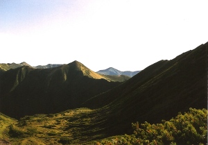
I didn’t expect alpine territory at 1800 meters above sea level, but it’s exactly what I got, with incredible views thrown in for good measure. Visibility was close to 200km in all directions, but the most striking feature of the Hidaka mountain range is the lack of human encroachment. In fact, the view was completely devoid of electrical towers, roads, villages, or tree plantations as far as the eye can see. It could very well be Japan’s final frontier, and it’s a place that will live in my heart forever.
poro10

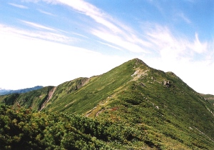
On the final summit push, I ran into a trio of young university students with over-sized packs. “We’re the kitchen for the large tour group,” answered the leader when interrogated about their early morning intentions. “We’ve got to cook breakfast for our clients and have it ready by the time they summit.” We hiked the final 200 meters of so together, being the first party to reach the summit on that stellar Sunday morning. The culmination of years of hard work, the major peaks of Hokkaido were truly conquered in only the most perfect of weather conditions. Tears welled up in the corner of my eye, as I could now count the remaining Hyakumeizan on one hand.
poro11

I had another reason for joy as well. The tour group kitchen staff offered to give me a ride back to Sapporo if I chose to leave the mountain today. I could either head down today and be guaranteed a ride back to civilization or risk staying another night in the hut and pressing my luck for a Monday afternoon return. I decided to mull it over while completing the circuit over Mt. Tottabetsu.

poro12

The path left the summit and descended steeply towards Nanatsu-numa col. The lakes that give the area its namesake were bone-dry, evidence of either an unusually warm summer or perhaps a lack of winter snowfall. This area is a haven for Japanese grizzlies, so I sang to myself lest i should surprise any of the nocturnal creatures. The majority of hikers don’t bother with the loop, opting for the comfort of heading back the way they came, thereby contributing to trail erosion. I didn’t meet a single soul during my 3-hour detour, but that was perfectly fine by me.

The branch trail back down to the valley was the most overgrown excuse for a path I’ve seen yet. Swimming through head-high bamboo grass and losing the track countless times, I somehow stumbled down to the source of the river that takes so many lives every year. I took off my boots, opting for the barefoot approach back to the hut.

poro14

Once I was reunited with my belongings, I ate a quick lunch before deciding to take up the offer of a free ride back to Sapporo. I had a ferry to catch the next day and didn’t want to risk being stranded should an unexpected rain squall cut off the escape path. I loaded up the gear and braced myself for the 8km slog.

poro15

By the time I arrived back at the forest road, my left foot had developed a sizable blister, but I pushed on as if in a drunken stupor. This was turning into quite an epic day, but at least I had no more peaks to worry about for the next few weeks. Eventually the cooks came back to the parking lot and off we rode into the sunset.

Read Full Post »

As a brutally wet August comes to a close, I venture off into the hinterlands to knock off 2 of my remaining 5 peaks. It won’t be easy though, with torrential rain on the horizon and nearly 3000 meters of vertical elevation gain awaiting. Successfully scale these peaks and all that lay between myself and the completion of the Hyakumeizan are three backbreaking ascents in the Japan Alps. It’s going to be a tough autumn.

echigo1

The taxi ride from Urasa to the trailhead was short but enjoyable, thanks in part to the cheerful commentary from my helpful taxi driver. “Look over the the right and you’ll see the remains of the forest road, washed out just two weeks prior,” boasted the middle aged gentlemen. Let’s hope history doesn’t repeat itself on this journey, I prayed.

echigo2

The water source at the deserted campground had a notice that H2O should be boiled before drinking, but in order to save time I opted for my water filter. “3 liters should be enough,” I surmised, as the thick air hung heavy all around. I took off down the gravel forest road and immediately broke into a sweat. It was as if the rainy season had never departed, and I was beginning to wonder how a 1700m vertical climb would feel in such sticky conditions.

echigo3

After a 4km stroll on the desolate, pockmarked road, I arrived at the trail head. A small, wooden sign confirmed my initial suspicions about the distance. I stretched the legs, said a quick mantra, and started the long, relentless ascent.

echigo4

The higher I climbed, the steeper the path seemed to become. I was heading up the mountain via the traditional pilgrimage route that connects all 3 peaks of the ‘Echigo Sanzan’. Most people completing the circuit start across the valley at Mt. Hakkai, traverse the knife-edge ridge connecting it to Naka-dake (the ‘middle’ peak), and then follow the ridge to Komagatake, descending via my current path.

echigo5

On this majestic Friday morning, I met only one other soul, a middle-aged woman who was on her way down from completing the 3-peak circuit. “The views are outstanding from the top”, boasted the pilgrim. I’d fallen into a bit of a trance climbing up the steep spur and had forgotten to look up. Sure enough, the sky was clearing, and Mt. Hakkai rose serenely due south of my position. “Looks like I can put away the raincoat.”

echigo6

Indeed the higher I climbed, the more beautiful the weather became, until I popped out on a unnamed peak filled with bamboo grass. Luckily someone was kind enough to cut back the overgrown flora, making navigation a cinch. I collapsed in a heap of sweat and took in the views. Although the sun was shining brightly in the brilliant blue sky, my nemesis otherwise known as fog was rising quickly out of the west. I knew I’d soon be swallowed by the thickening inferno, but was content with at least getting a view up this far.

echigo7

I pushed on another 20 minutes until reaching the main ridge. I turned left, following the contours to the summit of Komagatake, my 96th peak. I sat in the thick mist, barely able to move after such an exhilarating ascent. No views to speak of, but there was still one more chance the following morning.

echigo8

The path down to the emergency hut was short but steep, and I quickly dropped off my stuff and checked-in. The first thing I noticed was the abnormally heavy weight of my hiking slacks. I’d completely forgotten to take out my wallet before starting the climb and it became a wrinkled, sweat-filled reservior. I changed into some dry clothes and draped everything on the benches outside to dry. I laid out all of my money separately, placing stones neatly on top of each. The caretaker just laughed and gladly waited before accepting the modest accomodation fee.

echigo9

Clouds swirled all around, providing some unexpectedly picturesque scenery in the late afternoon wind. A storm was definitely brewing, but when or how long it would last would be unknown. The caretaker kept a close watch behind his binoculars, searching for other approaching hikers. Fortunately no one else showed up, so I was given free reign of the entire place.

echigo10

That night nature put on one spectacular light show, as I raced up and down the stairs in order to catch a glimpse of the electrical storm. The hut kept me well-insulated from the elements as the rain fell down in great sheets. Imagine if I were stuck in a tent on the exposed summit. Sometimes emergency huts can be a mixed blessing in disguise, even if they leave an unsightly blight on the landscape.

echigo11

I slept soundly as the hard rain continued until the morning. Breakfast was leisurely consumed as I casually plotted out my plan for the day, which involved a steep descent into narrow valley that offered a warm bath as bait. The thoughts of the silky waters drove me to my feet, and the unexpected letup of the rain was as added bonus. I grabbed the caretaker and we headed back up to the summit together.

Never give up on a mountain just because the weather is cloudy. It just may surprise you.

echigo13

The sight of a thousand peaks floating above the drenched valleys is indescribably mystical. I flew down the mountain in an elevated mood. The skies remained dark but dry all the way down to the base of the peak, as I once again blessed the low pressure system on her impeccable timing.

echigo14

One more peak to go on this epic weekend. Would my lucky streak continue or would I finally receive my long overdue punishment? Only Hira-ga-take would be able to answer that.

Read Full Post »

I roll out of my cozy sleeping bag a little before 6am on a cool September morning. Sandwiched between a row of coin lockers and a protective railing on a traffic island in the middle of Takayama bus terminal, I escape detection while rolling up my evidence. Tucking into the station to illegally recharge my cell phone in the restroom, I impatiently wait for that magic bus that’ll whisk me to Shin-hotaka hot spring, the starting point for my long journey across the Japan Alps. My plan was complex – knock off Mt. Kasa, Mt. Washiba and Mt. Suisho before heading north along the ridge towards Mt. Eboshi, scaling Mt. Harinoki before descending to Ogisawa. 3 nights on the mountain if everything went according to plan.

kasa1

Shin-hotaka was nearly deserted as I started up the long forest road shortly before 9am. I opted to go as light as possible, carrying only a sleeping bag, provisions, and water, all crammed into a 30 liter pack. The turnoff towards Mt. Kasa came a lot quicker than anticipated, and I said a quick prayer to the weather gods before beginning my ascent.

kasa2

Even though it was mid-September, the heat of summer still stubbornly hung around, and I soon found myself drenched in sweat. Undisturbed, I continued my lightning-quick pace and rose higher and higher above the valley floor. The Hotaka range rose gracefully behind me on a day surprisingly devoid of cloud cover. I pushed on as long as I could, opting to take a break only when reaching the ridge line. This tactic soon proved fruitless, as it was a brutal and relentless climb that offered absolutely no end in sight. Exhausted, I dropped my gear, pulled out my energy gel and some chocolate, hoping to find my second wind before my legs completely gave way. Miraculously, I pushed on, popping out on Shakushi-daira shortly after 11am. Most people take between 4 and 5 hours to reach this point, but I was on my 24th peak this year and feeling quite fit. However, I still had another hour or so just to reach the ridge and I’d just entered alpine territory above 2500m, where altitude sickness could very likely set in.

kasa4

I slowed my pace a bit and increased my fluid intake. The summit of Mt. Kasa rose majestically to my left – my target for this afternoon. I checked the time when reaching the main ridge: 12:45pm. I knew I would have to come back to this point in order to traverse over towards Mt. Washiba, but when? Should I stay at the hut just below Mt. Kasa or try the impossible and actually go to Sugoroku after summiting the aforementioned peak? Decisions, decisions.

kasa3

Even though I only had 200 vertical meters to scale, it still took an eternity to reach the summit. I collapsed on the peak, wiping the sweat from my brow and wondering exactly when the fog would roll in. I finished most of my remaining provisions and foolishly pushed on towards Sugoroku. As soon as retreating back to the junction, the clouds rose up from the valley below. It was probably just as well, since it would keep me from seeing just how far I had to go. I descended into a steep col and climbed back up the other side. Darkness was setting in as I stumbled into the campsite just behind the hut.

kasa5

Whew, a long first day that would make my work a little easier on Day 2. Fingers crossed for more wonderful akibare weather.

Read Full Post »

The car dropped me off in front of Hirosaki station just before 3pm. I quickly checked the bus schedule: 3:05pm departure for Dake-onsen. Not in time for the last shuttle bus to the 8th stage, but it would have to do. At the hot spring, I walked up the road with my thumb outstretched. 20 minutes later a kind woman stopped and gave me a lift to the toll gate. I pressed on, speaking with the attendant about the frequency of vehicles. She provided me an answer that almost gave me a coronary: “the toll road closes in 5 minutes, so I doubt anyone will be coming this way.”

iwaki1

As I stood there in shock, wondering how long it would take me to walk up a meandering toll road, I heard a small rumble from behind. I turned my head, rubbed my eyes twice and pinched myself to see if I were dreaming, for here came a red Toyota Corolla up to the toll booth. I quickly went to work, offering to split the fare with the driver in exchange for a ride. I was back in business!

iwaki2

The 8th station was nearly deserted as I put on my pack for the 20 minute hike to the 9th stagepoint. The sky was a bit overcast, with menacing clouds swirling just below. My map had an emergency hut marked at the trail junction to the traditional approach and I went to investigate. Small and cozy, the concrete bunker provided a dry roof overhead but not much else. Regardless, I dropped off my pack and headed up the ridiculously steep trail to the summit.

iwaki3

I’d made my goal of reaching the top of my second peak in one day, but the adventure was far from over. I found to my great surprise that there was an emergency hut directly on the summit that was unmarked on my map. It was in much better condition than the one I’d left my pack in, and it was completely deserted. The weather looked like it might hold out, and the panoramic views left me with only one decision: go back down and get the pack!

iwaki4

I retraced my steps and decided to leave the tent and other non-essentials in the first hut in order to lighten my load. Stove, check. Sleeping bag, roger. Water. WATER! In all my haste in racing to the summit I’d forgotten to fill up at the parking lot! Auugghhh! Not to fear, as a water source was clearly marked on the trail directly in front of me. But how far to the water source? Could I make it back before dark? These questions raced through my head as I scrambled down the dry gully.

iwaki5

150 vertical meters later I’d found what I was looking for, and filled up 3 liters of refreshing liquid. Sweat was pouring off of my forehead, as I still had to climb back up to the first hut, retrieve my belongings, and scramble back up to the top in time to watch the sunset.

iwaki6

My legs were quickly becoming gelatinous on the final summit push. All of that brisk walking around Hakkoda and my hasty decisions on Iwaki were starting to take their toll. My pace slowed to a crawl, and the last few steps seemed to take an eternity. Still, I’d done it. The timing was impeccable, as the sun broke through the clouds as soon as I’d set down my gear. The light show began. I cooked up some pasta as the sun began to sink.

iwaki7

Lower

iwaki8

and lower

iwaki9

and lower, until it sat on the edge of the Pacific. The tip of Hokkaido was clearly visible in the distance, as were the endless rows of pristine mountain ranges. Between myself and the setting sun lie the Shirakami mountains, some of the most unspoilt wilderness in this vast land. Mt. Iwate rose way off towards the south, and the first lights of Hirosaki and Aomori cities twinkled far, far below. Here I was, completely alone. “Hitori-jime!”, I shouted, which can be translated as “mine, all mine.”

iwaki10

I sat on the steps of the summit shrine, filling my belly with nutrients and observing the onset of darkness. The night was as calm as any I can remember. It’s hard to believe I was so close to civilization, yet so far removed as if on another planet. I gazed out towards Aomori city just in time to see the colorful light show. Scarlet flashes of light raced towards the sky, exploding in intricate circular arrays. The Nebuta fireworks festival was in full swing, and here I was with a bird’s eye view from 1600 meters above the valley floor. It doesn’t get much better than this.

iwaki11

I awoke well before dawn and stumbled back out towards the shrine steps. The cities of Aomori and Hirosaki still shimmered in the warm summer air as the horizon began to awaken. As long as I live I will never grow tired of watching the sunrise and sunsets, and I can think of no greater joy than witnessing the phenomena from the summit of a wonderful mountain.

iwaki12

Saying farewell to the rocky summit was one of the most difficult things I’ve done in a while, but I wanted to leave with an unspoilt image in my mind. In just a few hours, the peak would be crawling with hoards of daytrippers who’d opted to take the chair lift up. I wanted to avoid all of the mayhem, so I slipped quietly down the gully towards Iwaki shrine, past rotting snowfields and glorious mountain flora. The path was steep, slippery, and exposed, giving me an unexpected workout with the weight of my full pack. Once in the forest things became much easier, until finally arriving at the trailhead of the most traditional route up the peak.

iwaki13

With the peaks of Aomori Prefecture behind me, I set my sights on the volcanic peaks of Iwate prefecture. Next stop: Hachimantai.

Read Full Post »

The threatening skies during my ascent of Mt. Shari held off until boarding the train to Mashu, where the rain fell in great sheets. At the station, I learned that the last bus to Lake Akan left just 5 minutes prior to my arrival: perhaps a deliberate ploy by the taxi companies? The rain eliminated any chance of catching a ride along route 241, so I took a deep breath and jumped in an overpriced cab bound for Lake Akan. Such is the life of a hiker on a tight schedule and too much persistence.

akan1

The next morning brought drier skies as I boarded the first bus to the trailhead. The youth hostel was completely booked, leaving the kokumin-shukusha next door as the only other option. I booked a room, dropped off my heavy pack, and climbed past the signs warning of volcanic gases.

akan2

I quickly overtook a young, solo, French hiker who spoke pretty decent Japanese. Well ahead of schedule, I slowed my pace and appreciated the rare companionship. It was her first active volcano and my 15th or so, but we both stood in awe upon reaching the gigantic crater rim. Even though the clouds were hovering around the crater edges, we could stare straight down into the mouth of a hissing, smoldering monster. Little did we know that the behemoth would let out a belch precisely 3 months after our adventurous visit. The power of nature.

akan3

The clouds engulfed us as we circumnavigated the ‘safe’ side of the rim, cutting off our views of the small crater lakes below. Akan-fuji was completely hidden from view, so we ignored the spur and dropped into a beautiful pristine forest, arriving at Onetto campground with a little time to spare before the last bus. In the meantime, we opted for the short side trip to Yu-no-taki, a hot spring waterfall. While the waterfall was somewhat scenic, the free open-air bath had been completely dismantled, robbing us of a refreshing soak.

akan4

Defeated, we retraced our steps, bidding farewell at the bus stop. It was now around 4pm and the late afternoon sun was sinking much too quickly for my liking, as I still needed to make it back to Nonaka. Fortunately the trail was well-marked but utterly deserted. It was here that fear start to set in, as the forest surrounding Lake Onetto are a feeding ground for Japanese grizzlies. And here I was, caught without a bear bell or spray around the time when the noctural creatures start to emerge from their afternoon slumber. I advanced into the forest, making as much noise as possible in order to scare away the potential predators.

akan5

By sheer luck, the creatures never surfaced and I was able to be reunited with my waiting backpack. The baths at my hotel were definitely some of the best in Hokkaido, if not Japan. Peak #94 was over and done, but I still faced the most difficult hurdle in my quest: mighty Poroshiri.

Read Full Post »