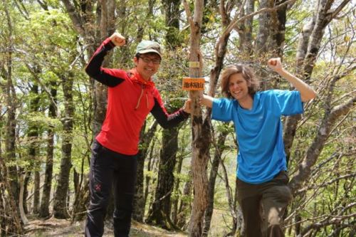
Mt. Ikegoya is one monster of a mountain, and the make-or-break peak in my Kansai 100 quest. Check this one off the list and it’s a relatively easy cruise to the finish line. The 1000-meter vertical elevation change is contained within one 2-1/2km stretch of trail that is not for the faint-of-heart. Throw in a vertigo-inducing traverse above a raging waterfall, and sprinkle in a small army of blood-sucking leeches and you’ve got the makings of a true adventure.

Nao and I set off at dawn on a calm and clear day in mid-May for the trailhead nestled deep in the Daiko mountains on the Nara-Mie prefectural border. The only access is via the north along a narrow poorly-maintained gravel road past Hasu dam and the phalanges of the accompanying lake sitting at the confluence of dozens of lush mountain streams. Our plan was to follow on such tributary by the name of Miya-no-tani all the way up to its headwaters, where the true climb commenced, but our first challenge involved getting there.

The road to Hasu dam was a double-laned asphalt bylane that looked as if it could accommodate a battalion of army tanks, but beyond that we inched along a meandering. potholed lane littered with rockfall and landslide debris. Every year sections of the route get washed out in the summer rains and maintenance crews struggle with the upkeep, but luckily the road had recently been touched up and we forced our way to the small parking lot marking the entrance to the trail.

Initially the path traversed high above the river bed along a series of metal walkways before dropping down to the waters edge, where a combination of faded paint marks on rocks and strips of tattered pink tape offered guidance in our upstream pursuit of the source of the river. Nao had explored this section of track once before several years ago before being chased out by hundreds of river leeches that climbed his trousers and abseiled from the trees. Our timing, however, was perfect, as the segmented worms were still lying dormant in the soil beneath our feet, patiently awaiting the summer rains.

Whenever the walls of the gorge closed in, the trail switchbacked up to more gentler slopes, crossing yet more metal bridges and walkways as we pushed higher and higher up the valley. Despite the undulating path, we had not even covered a hundred vertical meters in that first hour of scrambling. We hit a fork in the river, marked by a signpost indicating waterfalls in either direction. While the 40-minute detour to the 80-meter Kazeore falls, one of Japan’s 100 falls, seemed tempting, we knew that such diversions could cost us precious daylight hours that we could certainly use on the descent.

We turned right here, following the steel ladders and fixed ropes further to the base of Taka-taki, or the ‘tall one’. This 60-meter high beauty drops straight off a cliff face and into an emerald pool that would make quite the summer watering hole if not for the leeches. After crossing the stream, a signpost warned hikers of the next section of the trail – a harrowing traverse above the falls.

Pausing a bit for a refilling of liquids and a chocolate bar, Nao and I climbed the jagged switchbacks up the 60-degree slopes to the base of a band of cliffs draped with fixed ropes. A slip here would be fatal, and judging by the size of the metal signpost in the river bed, such falls are all too common for those unfortunate souls with two left feet. We hung tightly to the striated rock, making sure we had four points of contact with the earth at all times. It would be an even trickier route to descend, but fortunately for us we had our eye on an alternative trail that dropped down an adjacent valley.

Once above the falls we lost the trail completely by mistakenly climbing a spur to our right instead of continuing upstream. Only by cross referencing our GPS waypoints with the paper map did we realize our mistake, but all was corrected by backtracking back to the river bed and continuing on towards the proper junction, which we reached at midday.

The paper map had this next section of trail marked as a 1-hour, 45-minute ascent so we dropped our gear and nibbled on rice balls and almonds. We had a 700-meter climb staring us straight in the face and really nowhere to go except up. It was a short section of switchbacks to reach the beginning of the spur, which quickly became an all-out war with exposed tree roots. Forcing our way on all fours up the improvised staircase, we made steady progress up towards the ridgeline, which lay out of sight somewhere high above us. We thought it wiser to simply put away our GPS devices, as frequent glances at the contours would only serve as reminders of how much further we had to go.

Voices above us crescendoed as we overtook our first climbing party of the day, a trio of sweaty, middle-aged men who stepped aside to let us pass. Once above the 1000-vertical meter mark the angle abated, revealing large swaths of virgin beech trees sitting on a soft carpet of wild grasses and dried foliage. It was easily one of the most breathtaking stretches of unspoiled forest in the Kansai area, and a reminder of the power of the Daiko mountains.

After all, it was these same slopes that provided the last hideout of the Japanese wolf, which was last seen back in the Meiji era in a small village on the leeward side of Ikegoya’s rugged slopes.

We topped out just one hour leaving the river bed behind. Though the tree-lined summit afforded no vistas of the surrounding mountains, it was still a pleasant place to relax and take in what nature had to offer. It was my 94th mountain, and one of the best to date. I brewed up a cup of coffee in preparation for the long, knee-knocking drop back to civilization.
Our return route required a 30-minute stroll along the ridge line past the small pond that gives Ikegoya its namesake before reaching a junction at the summit of Mt. Kirifuri, where the vistas finally started to open up. Unfortunately, the vistas were not the only thing to reveal themselves, as my caffeinated drink on the summit kickstarted my bowels. I dropped off the trail to dig a hole for my deposit of fertilizer as Nao waited patiently.

We veered right at the junction and followed a pleasant strolling ridge that ran parallel to the steep spur we had climbed earlier. To our left, we could make out the flat highlands of Mt. Myojin and Hinokizuka, two of the remaining six mountains on the list and the last two in this part of Kansai. If I had an extra day I could have easily knocked them off from here, but as luck would have it, they would have to wait for another time. Our trail followed the contours of the ridge for well over an hour until reaching the remains of an old cable car system used by loggers. From here, the virgin forest yielded to the dreadful plantations of cedar and cypress that make my heart sink every time I see them.

The path terminated at an immense clear-cut area lined by fabric fences to keep the deer from destroying the bark of the newly planted trees. A signpost indicated us to unfasten the ropes of the fence, where we entered this area that looked like something out of a warzone. To make matters of worse, the trail followed the tracks of a logging monorail that ran straight down the mountain without a single switchback. The knees took a beating as we searched for any way to prevent ourselves from tumbling uncontrollably down the barren slopes. It was a drop of nearly 400 vertical meters directly down to the valley floor, where we met up with the forest road once again and limped back to the car.

We had eluded the leeches and knocked off the mountain in one massive assault. With only 6 more mountains to go, I finally had the momentum to get these Kansai 100 peaks off my chest so I could move onto other things.

